Foundational Concepts

The foundational concepts are the elementary building blocks and context setting constraints of all other entries in the BoK. The latter encompass the philosophical and mathematical support for GIScience as well as data models, while the constituent elements include, among others, notions of scale, spatial data quality, and openness. This knowledge area is also the place to look for the origins and future of GIScience.

Topics in this Knowledge Area are listed thematically below. Existing topics are in regular font and linked directly to their original entries (published in 2006; these contain only Learning Objectives). Entries that have been expanded and revised are in bold. Forthcoming, future topics are italicized

Origins Basic Measures
Intro to the GIS&T Body of Knowledge First & Second Laws of Geography
Public & Private Sector Origins Shape
Academic Developments of GIS&T Distance Operations
  Directional Operations
Cognitive Areal Interpolation
Perception & Cognitive Processing of Geographic Phenomena Proximity & Distance Decay
Foundational Ontologies Adjacency and Connectivity
Ontologies for Analysis & Formation of Geospatial Concepts Resolution
Place and Landscape Spatial Autocorrelation
The Power of Maps and Mapping Geometric Primitives and Algorithms
Semantic Information Elicitation Interrogating Geographic Information
Domains of Geographic Information Set Theory
Space Structured Query Language (SQL) and Attribute Queries
Time Spatial Queries
Relationships between Space and Time  
Data Properties Uncertainty
Networks Problems of Scale and Zoning
Events and Processes Thematic Accuracy and Assessment
Neighborhoods Conceptual Models of Error and Uncertainty
Philosophical  
Philosophical Perspectives  
Epistemology  
Openness  


FC-13 - Spatial Queries

Spatial query is a crucial GIS capability that distinguishes GIS from other graphic information systems. It refers to the search for spatial features based on their spatial relations with other features. This article introduces a spatial query's essential components, including target feature(s), reference feature(s), and the spatial relation between them.  The spatial relation is the core component in a spatial query. The document introduces the three types of spatial relations in GIS: proximity relations, topological relations, and direction relations, along with query examples to show the translation of spatial problems to spatial queries based on each type of relations. It then discusses the characteristics of the reasoning process for each type of spatial relations. Except for topological relations, the other two types of spatial relations can be measured either quantitatively as metric values or qualitatively as verbal expressions. Finally, the general approaches to carrying out spatial queries are summarized. Depending on the availability of built-in query functions and the unique nature of a query, a user can conduct the query by using built-in functions in a GIS program, writing and executing SQL statements in a spatial database, or using customized query tools.

FC-12 - Structured Query Language (SQL) and attribute queries
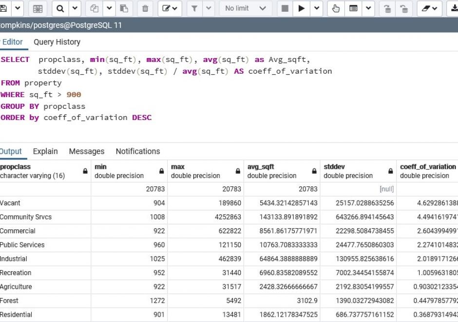
The structured query language (SQL) for database interrogation is presented and illustrated with a few examples using attribute tables one might find in a common GIS database.  A short background is presented on the history and goals that the creators of the SQL language hoped to achieve, followed by a review of SQL utility for data query, editing, and definition.  While the SQL language is rich in content and breadth, this article attempts to build on a simple SQL and then iteratively add additional complexity to highlight the power that SQL affords to the GIS professional who has limited programming capabilities.  The reader is asked to consider how minor modifications to SQL syntax can add complexity and even create more dynamic mathematical models with simple English-like command statements.  Finally, the reader is challenged to consider how terse SQL statements may be used to replace relatively long and laborious command sequences required by a GIS GUI approach.

FC-20 - The power of maps
  • Describe how maps such as topographic maps are produced within certain relations of power and knowledge
  • Discuss how the choices used in the design of a road map will influence the experience visitors may have of the area
  • Explain how legal issues impact the design and content of such special purpose maps as subdivision plans, nautical charts, and cadastral maps
  • Exemplify maps that illustrate the provocative, propagandistic, political, and persuasive nature of maps and geospatial data
  • Demonstrate how different methods of data classification for a single dataset can produce maps that will be interpreted very differently by the user
  • Deconstruct the silences (feature omissions) on a map of a personally well known area
  • Construct two maps about a conflict or war producing one supportive of each side’s viewpoint
FC-27 - Thematic Accuracy Assessment

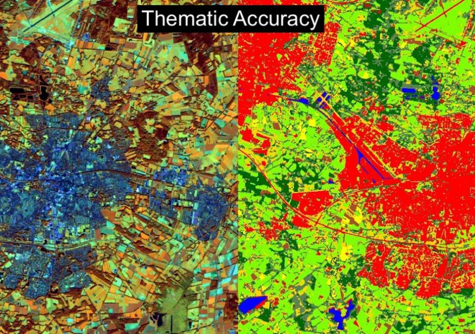
Geographic Information System (GIS) applications often involve various analytical techniques and geographic data to produce thematic maps for gaining a better understanding of geospatial situations to support spatial decisions. Accuracy assessment of a thematic map is necessary for evaluating the quality of the research results and ensuring appropriate use of the geographic data. Thematic accuracy deals with evaluating the accuracy of the attributes or labels of mapped features by comparing them to a reference that is assumed to be true. The fundamental practice presents the remote sensing approach to thematic accuracy assessment as a good guidance. For instance, the accuracy of a remote sensing image can be represented as an error matrix when the map and reference classification are conducted based on categories. This entry introduces basic concepts and techniques used in conducting thematic accuracy with an emphasis on land cover classification based on remote sensing images. The entry first introduces concepts of spatial uncertainty and spatial data quality standards and further gives an example of how spatial data quality affects thematic accuracy. Additionally, the entry illustrates the techniques that can be used to access thematic accuracy as well as using spatial autocorrelation in thematic accuracy sampling design.

FC-08 - Time

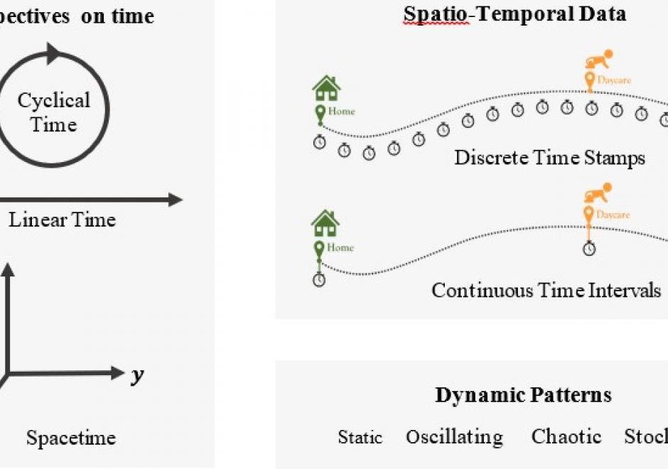
Time is a fundamental concept in geography and many other disciplines. This article introduces time at three levels. At the philosophical level, the article reviews various notions on the nature of time from early mythology to modern science and reveals the dual nature of reality: external (absolute, physical) and internal (perceived, cognitive). At the analytical level, it introduces the measurement of time, the two frames of temporal reference: calendar time and clock time, and the standard time for use globally. The article continues to discuss time in GIS at the practical level. The GISystem was first created as a “static” computer-based system that stores the present status of a dynamic system. Now, GISystems can track and model the dynamics in geographical phenomena and human-environment interactions. Representations of time in dynamic GISystems adopt three perspectives: discrete time, continuous time and Minkowski’s spacetime, and three representations: ordinal, interval, and cyclical. The appropriate perspective and representation depend on the observed temporal patterns, which can be static, oscillating, chaotic, or stochastic. Recent progress in digital technology brings us opportunities and challenges to collect, manage and analyze spatio-temporal data to advance our understanding of dynamical phenomena.

Pages