ontology

GS-13 - Epistemological critiques

As GIS became a firmly established presence in geography and catalysed the emergence of GIScience, it became the target of a series of critiques regarding modes of knowledge production that were perceived as problematic. The first wave of critiques charged GIS with resuscitating logical positivism and its erroneous treatment of social phenomena as indistinguishable from natural/physical phenomena. The second wave of critiques objected to GIS on the basis that it was a representational technology. In the third wave of critiques, rather than objecting to GIS simply because it represented, scholars engaged with the ways in which GIS represents natural and social phenomena, pointing to the masculinist and heteronormative modes of knowledge production that are bound up in some, but not all, uses and applications of geographic information technologies. In response to these critiques, GIScience scholars and theorists positioned GIS as a critically realist technology by virtue of its commitment to the contingency of representation and its non-universal claims to knowledge production in geography. Contemporary engagements of GIS epistemologies emphasize the epistemological flexibility of geospatial technologies.

FC-32 - Semantic Information Elicitation
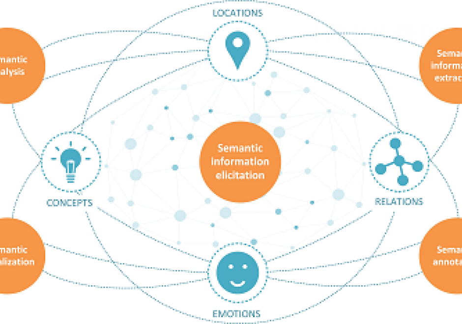
The past few decades have been characterized by an exponential growth of digital information resources. A considerable amount of this information is semi-structured, such as XML files and metadata records and unstructured, such as scientific reports, news articles, and historical archives. These resources include a wealth of latent knowledge in a form mainly intended for human use. Semantic information elicitation refers to a set of related processes: semantic information extraction, linking, and annotation that aim to make this knowledge explicit to help computer systems make sense of the content and support ontology construction, information organization, and knowledge discovery.

In the context of GIScience research, semantic information extraction aims at processing unstructured and semi-structured resources and identifying specific types of information: places, events, topics, geospatial concepts, and relations. These may be further linked to ontologies and knowledge bases to enrich the original unstructured content with well-defined meaning, provide access to information not explicit in the original sources, and support semantic annotation and search. Semantic analysis and visualization techniques are further employed to explore aspects latent in these sources such as the historical evolution of cities, the progression of phenomena and events and people’s perception of places and landscapes.

FC-02 - Epistemology

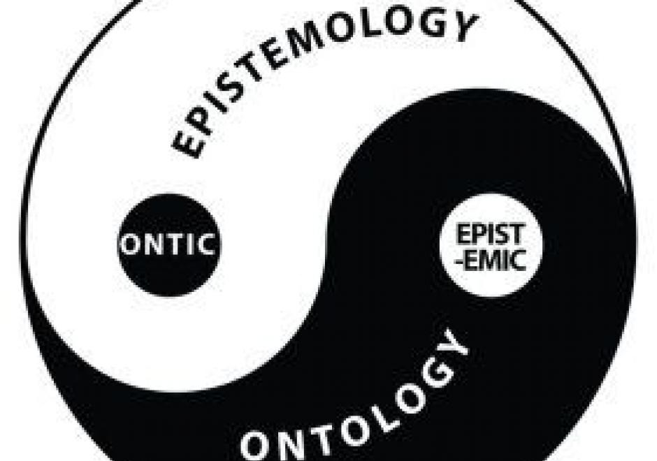
Epistemology is the lens through which we view reality. Different epistemologies interpret the earth and patterns on its surface differently. In effect, epistemology is a belief system about the nature of reality that, in turn, structures our interpretation of the world. Common epistemologies in GIScience include (but are not limited by) positivism and realism. However, many researchers are in effect pragmatists in that they choose the filter that best supports their work and a priori hypotheses. Different epistemologies – or ways of knowing and studying geography – result in different ontologies or classification systems. By understanding the role of epistemology, we can better understand different ways of representing the same phenomena.

FC-03 - Philosophical Perspectives

This entry follows in the footsteps of Anselin’s famous 1989 NCGIA working paper entitled “What is special about spatial?” (a report that is very timely again in an age when non-spatial data scientists are ignorant of the special characteristics of spatial data), where he outlines three unrelated but fundamental characteristics of spatial data. In a similar vein, I am going to discuss some philosophical perspectives that are internally unrelated to each other and could warrant individual entries in this Body of Knowledge. The first one is the notions of space and time and how they have evolved in philosophical discourse over the past three millennia. Related to these are aspects of absolute versus relative conceptions of these two fundamental constructs. The second is a brief introduction to key philosophical approaches and how they impact geospatial science and technology use today. The third is a discussion of which of the promises of the Quantitative Revolution in Geography and neighboring disciplines have been fulfilled by GIScience (and what is still missing). The fourth and final one is an introduction to the role that GIScience may play in what has recently been formalized as theory-guided data science.

DM-80 - Ontology for Geospatial Semantic Interoperability

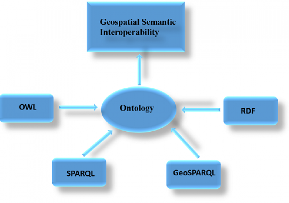
It is difficult to share and reuse geospatial data and retrieve geospatial information because of geospatial data heterogeneity problems. Lack of semantic interoperability is one of the major problems facing GIS (Geographic Information Science/System) systems and applications today. To solve geospatial data heterogeneity problems and support geospatial information retrieval and semantic interoperability over the Web, the use of an ontology is proposed because it is a formal explicit description of concepts or meanings of words in a well-defined and unambiguous manner. Geospatial ontologies represent geospatial concepts and properties for use over the Web. OWL (Ontology Web Language) is an emerging language for defining and instantiating ontologies. OWL builds on RDF (Resource Description Framework) but adds more vocabulary for describing properties and classes. The downside of representing structured geospatial data in OWL and RDF languages is that it can result in inefficient data access. SPARQL (Simple Protocol and RDF Query Language) is recommended for general RDF query while the GeoSPARQL (Geographic Simple Protocol and RDF Query Language) protocol is proposed as an extension of SPARQL for querying geospatial data. However, the runtime cost of GeoSPARQL queries can be high due to the fine-grained nature of RDF data models. There are several challenges to using ontologies for geospatial semantic interoperability but these can be overcome through collaboration.

GS-13 - Epistemological critiques

As GIS became a firmly established presence in geography and catalysed the emergence of GIScience, it became the target of a series of critiques regarding modes of knowledge production that were perceived as problematic. The first wave of critiques charged GIS with resuscitating logical positivism and its erroneous treatment of social phenomena as indistinguishable from natural/physical phenomena. The second wave of critiques objected to GIS on the basis that it was a representational technology. In the third wave of critiques, rather than objecting to GIS simply because it represented, scholars engaged with the ways in which GIS represents natural and social phenomena, pointing to the masculinist and heteronormative modes of knowledge production that are bound up in some, but not all, uses and applications of geographic information technologies. In response to these critiques, GIScience scholars and theorists positioned GIS as a critically realist technology by virtue of its commitment to the contingency of representation and its non-universal claims to knowledge production in geography. Contemporary engagements of GIS epistemologies emphasize the epistemological flexibility of geospatial technologies.

FC-32 - Semantic Information Elicitation

The past few decades have been characterized by an exponential growth of digital information resources. A considerable amount of this information is semi-structured, such as XML files and metadata records and unstructured, such as scientific reports, news articles, and historical archives. These resources include a wealth of latent knowledge in a form mainly intended for human use. Semantic information elicitation refers to a set of related processes: semantic information extraction, linking, and annotation that aim to make this knowledge explicit to help computer systems make sense of the content and support ontology construction, information organization, and knowledge discovery.

In the context of GIScience research, semantic information extraction aims at processing unstructured and semi-structured resources and identifying specific types of information: places, events, topics, geospatial concepts, and relations. These may be further linked to ontologies and knowledge bases to enrich the original unstructured content with well-defined meaning, provide access to information not explicit in the original sources, and support semantic annotation and search. Semantic analysis and visualization techniques are further employed to explore aspects latent in these sources such as the historical evolution of cities, the progression of phenomena and events and people’s perception of places and landscapes.

FC-02 - Epistemology

Epistemology is the lens through which we view reality. Different epistemologies interpret the earth and patterns on its surface differently. In effect, epistemology is a belief system about the nature of reality that, in turn, structures our interpretation of the world. Common epistemologies in GIScience include (but are not limited by) positivism and realism. However, many researchers are in effect pragmatists in that they choose the filter that best supports their work and a priori hypotheses. Different epistemologies – or ways of knowing and studying geography – result in different ontologies or classification systems. By understanding the role of epistemology, we can better understand different ways of representing the same phenomena.

FC-03 - Philosophical Perspectives

This entry follows in the footsteps of Anselin’s famous 1989 NCGIA working paper entitled “What is special about spatial?” (a report that is very timely again in an age when non-spatial data scientists are ignorant of the special characteristics of spatial data), where he outlines three unrelated but fundamental characteristics of spatial data. In a similar vein, I am going to discuss some philosophical perspectives that are internally unrelated to each other and could warrant individual entries in this Body of Knowledge. The first one is the notions of space and time and how they have evolved in philosophical discourse over the past three millennia. Related to these are aspects of absolute versus relative conceptions of these two fundamental constructs. The second is a brief introduction to key philosophical approaches and how they impact geospatial science and technology use today. The third is a discussion of which of the promises of the Quantitative Revolution in Geography and neighboring disciplines have been fulfilled by GIScience (and what is still missing). The fourth and final one is an introduction to the role that GIScience may play in what has recently been formalized as theory-guided data science.

DM-80 - Ontology for Geospatial Semantic Interoperability

It is difficult to share and reuse geospatial data and retrieve geospatial information because of geospatial data heterogeneity problems. Lack of semantic interoperability is one of the major problems facing GIS (Geographic Information Science/System) systems and applications today. To solve geospatial data heterogeneity problems and support geospatial information retrieval and semantic interoperability over the Web, the use of an ontology is proposed because it is a formal explicit description of concepts or meanings of words in a well-defined and unambiguous manner. Geospatial ontologies represent geospatial concepts and properties for use over the Web. OWL (Ontology Web Language) is an emerging language for defining and instantiating ontologies. OWL builds on RDF (Resource Description Framework) but adds more vocabulary for describing properties and classes. The downside of representing structured geospatial data in OWL and RDF languages is that it can result in inefficient data access. SPARQL (Simple Protocol and RDF Query Language) is recommended for general RDF query while the GeoSPARQL (Geographic Simple Protocol and RDF Query Language) protocol is proposed as an extension of SPARQL for querying geospatial data. However, the runtime cost of GeoSPARQL queries can be high due to the fine-grained nature of RDF data models. There are several challenges to using ontologies for geospatial semantic interoperability but these can be overcome through collaboration.

Pages