scale

FC-21 - Resolution

Resolution in the spatial domain refers to the size of the smallest measurement unit observed or recorded for an object, such as pixels in a remote sensing image or line segments used to record a curve. Resolution, also called the measurement scale, is considered one of the four major dimensions of scale, along with the operational scale, observational scale, and cartographic scale. Like the broader concept of scale, resolution is a fundamental consideration in GIScience because it affects the reliability of a study and contributes to the uncertainties of the findings and conclusions. While resolution effects may never be eliminated, techniques such as fractals could be used to reveal the multi-resolution property of a phenomenon and help guide the selection of resolution level for a study.

DA-30 - GIS&T and Landscape Ecology
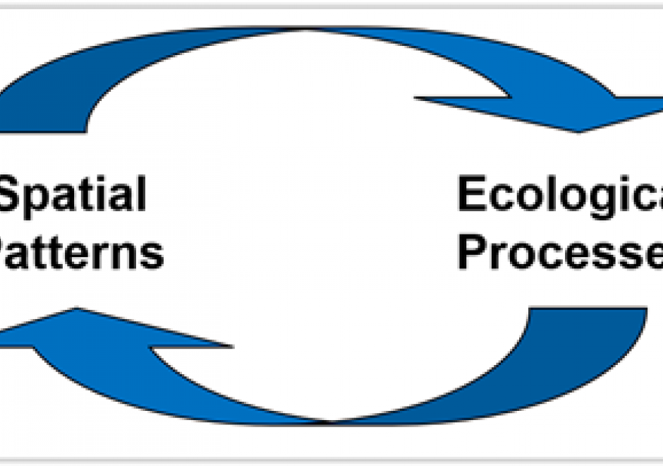
Landscape ecology is a transdisciplinary science dedicated to the study of the interactions among landscape heterogeneity, humans, and natural system. Since its inception in the mid-20th Century, landscape ecology has been strongly intertwined with spatial technologies, from aerial photography to modern space-borne sensors. Satellite-based remote sensing is among the primary data sources for contemporary landscape ecology analysis, while geographic information systems provide tools to analyze the spatial configurations of satellite derived classifications, simulate landscapes and species distributions, quantify landscape change, and elucidate the reciprocal relationship between spatial patterns and ecological processes. Additionally, global navigation satellite systems, such as GPS, Galileo, and GLONASS, augment these datasets and may be used for data collection to aid landscape ecology research. Emerging geospatial technologies, such as unoccupied aerial systems and micro- and nanosatellites, also have a role to play in landscape ecology.

AM-106 - Error-based Uncertainty

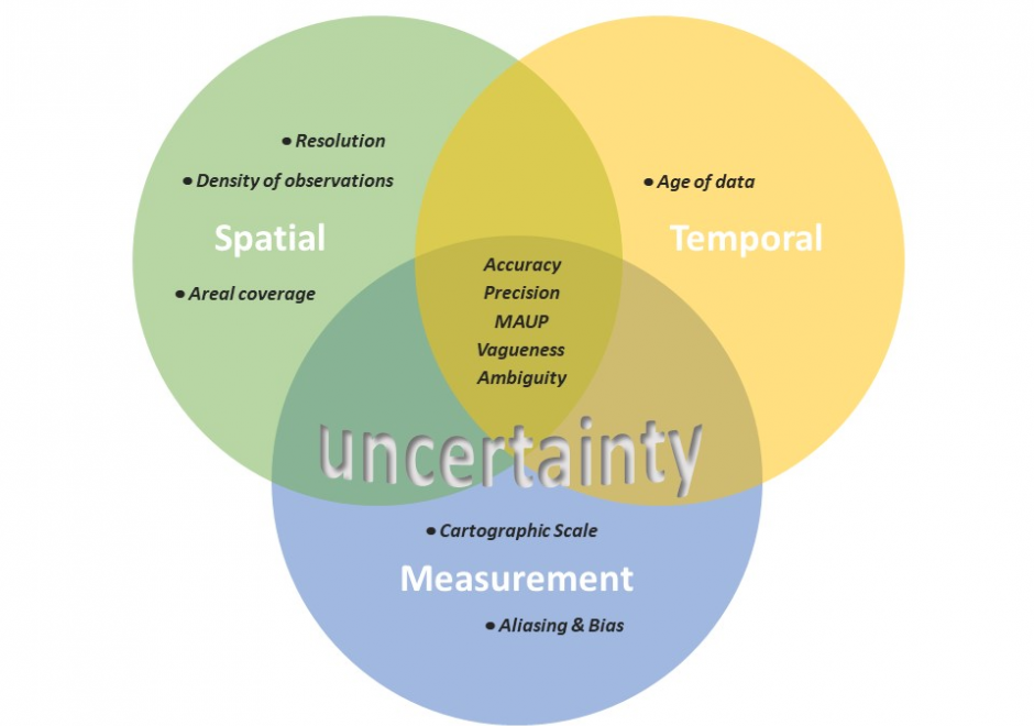
The largest contributing factor to spatial data uncertainty is error. Error is defined as the departure of a measure from its true value. Uncertainty results from: (1) a lack of knowledge of the extent and of the expression of errors and  (2) their propagation through analyses. Understanding error and its sources is key to addressing error-based uncertainty in geospatial practice. This entry presents a sample of issues related to error and error based uncertainty in spatial data. These consist of (1) types of error in spatial data, (2) the special case of scale and its relationship to error and (3) approaches to quantifying error in spatial data.

FC-21 - Resolution

Resolution in the spatial domain refers to the size of the smallest measurement unit observed or recorded for an object, such as pixels in a remote sensing image or line segments used to record a curve. Resolution, also called the measurement scale, is considered one of the four major dimensions of scale, along with the operational scale, observational scale, and cartographic scale. Like the broader concept of scale, resolution is a fundamental consideration in GIScience because it affects the reliability of a study and contributes to the uncertainties of the findings and conclusions. While resolution effects may never be eliminated, techniques such as fractals could be used to reveal the multi-resolution property of a phenomenon and help guide the selection of resolution level for a study.

DA-30 - GIS&T and Landscape Ecology

Landscape ecology is a transdisciplinary science dedicated to the study of the interactions among landscape heterogeneity, humans, and natural system. Since its inception in the mid-20th Century, landscape ecology has been strongly intertwined with spatial technologies, from aerial photography to modern space-borne sensors. Satellite-based remote sensing is among the primary data sources for contemporary landscape ecology analysis, while geographic information systems provide tools to analyze the spatial configurations of satellite derived classifications, simulate landscapes and species distributions, quantify landscape change, and elucidate the reciprocal relationship between spatial patterns and ecological processes. Additionally, global navigation satellite systems, such as GPS, Galileo, and GLONASS, augment these datasets and may be used for data collection to aid landscape ecology research. Emerging geospatial technologies, such as unoccupied aerial systems and micro- and nanosatellites, also have a role to play in landscape ecology.
AM-106 - Error-based Uncertainty

The largest contributing factor to spatial data uncertainty is error. Error is defined as the departure of a measure from its true value. Uncertainty results from: (1) a lack of knowledge of the extent and of the expression of errors and  (2) their propagation through analyses. Understanding error and its sources is key to addressing error-based uncertainty in geospatial practice. This entry presents a sample of issues related to error and error based uncertainty in spatial data. These consist of (1) types of error in spatial data, (2) the special case of scale and its relationship to error and (3) approaches to quantifying error in spatial data.

FC-21 - Resolution

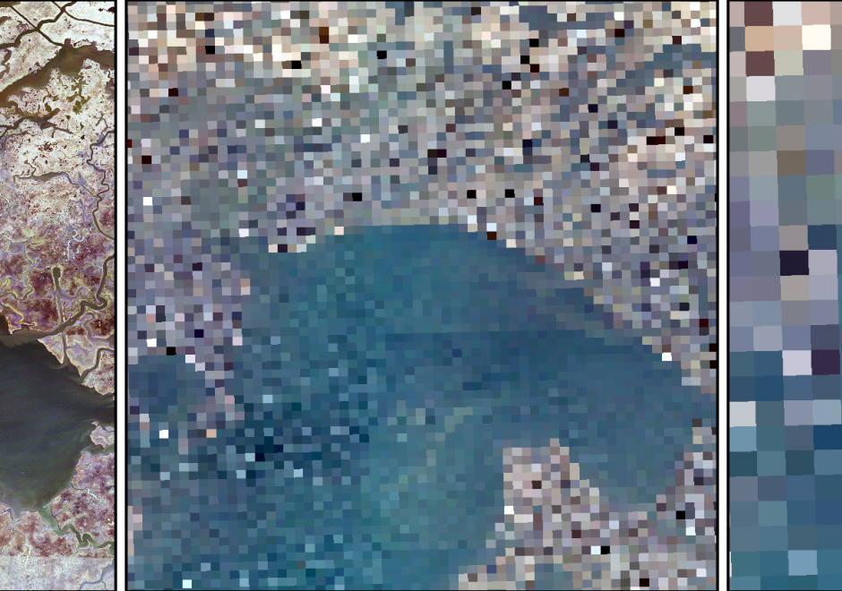
Resolution in the spatial domain refers to the size of the smallest measurement unit observed or recorded for an object, such as pixels in a remote sensing image or line segments used to record a curve. Resolution, also called the measurement scale, is considered one of the four major dimensions of scale, along with the operational scale, observational scale, and cartographic scale. Like the broader concept of scale, resolution is a fundamental consideration in GIScience because it affects the reliability of a study and contributes to the uncertainties of the findings and conclusions. While resolution effects may never be eliminated, techniques such as fractals could be used to reveal the multi-resolution property of a phenomenon and help guide the selection of resolution level for a study.

Pages