All Topics

The Cartography & Visualization section encapsulates competencies related to the design and use of maps and mapping technology. This section covers core topics of reference and thematic maps design, as well as the emerging topics of interaction design, web map design, and mobile map design. This section also covers historical and contemporary influences on cartography and evolving data and critical considerations for map design and use.  

Topics in this Knowledge Area are listed thematically below. Existing topics are in regular font and linked directly to their original entries (published in 2006; these contain only Learning Objectives). Entries that have been updated and expanded are in bold. Forthcoming, future topics are italicized

History & Trends Map Design Techniques Interactive Design Techniques
Cartography & Science Common Thematic Map Types User Interface and User Experience (UI/UX) Design
Cartography & Art Multivariate Mapping Web Mapping
Cartography & Power Spatio-Temporal Representation Virtual & Immersive Environments
  Representing Uncertainty Big Data Visualization
  Terrain Representation Mobile Maps & Responsive Design
Data Considerations Cartograms Usability Engineering & Evaluation
Vector Formats & Sources Map Icon Design Geovisual Analytics
Raster Formats & Sources Narrative & Storytelling Geovisualization
  Flow Maps  
Map Design Fundamentals  Collaborative Cartography  
Scale & Generalization Map Use  
Statistical Mapping (Enumeration, Normalization, Classification) Lesson Design in Cartography Education  
Map Projections Map Reading  
Visual Hierarchy & Layout Map Interpretation  
Symbolization & the Visual Variables Map Analysis  
Color Theory    
Typography    
Design and Aesthetics    
Map Production and Management    


B C D F G L M N R S T U V W
CV-38 - Usability Engineering & Evaluation

In this entry, we introduce tenets of usability engineering (UE) and user-centered design (UCD), interrelated approaches to ensuring that a map or visualization works for the target use. After a general introduction to these concepts and processes, we then discuss treatment of UE and UCD in research on cartography and geographic visualization. Finally, we present a classification of UE evaluation methods, including a general overview of each category of method and their application to cartographic user research.  

CV-13 - User Interface and User Experience (UI/UX) Design
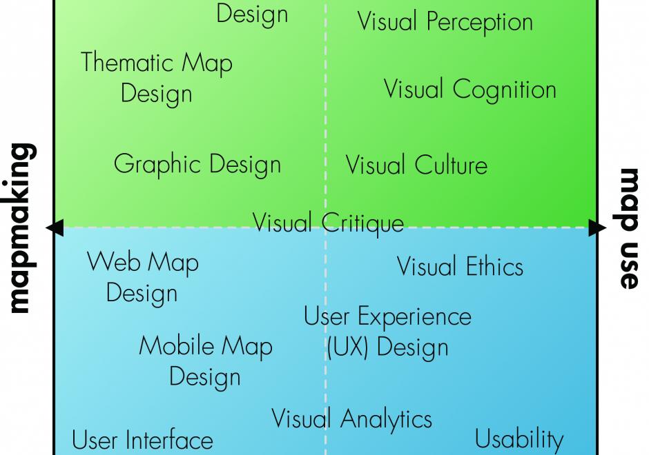
Advances in personal computing and information technologies have fundamentally transformed how maps are produced and consumed, as many maps today are highly interactive and delivered online or through mobile devices. Accordingly, we need to consider interaction as a fundamental complement to representation in cartography and visualization. UI (user interface) / UX (user experience) describes a set of concepts, guidelines, and workflows for critically thinking about the design and use of an interactive product, map or otherwise. This entry introduces core concepts from UI/UX design important to cartography and visualization, focusing on issues related to visual design. First, a fundamental distinction is made between the use of an interface as a tool and the broader experience of an interaction, a distinction that separates UI design and UX design. Norman’s stages of interaction framework then is summarized as a guiding model for understanding the user experience with interactive maps, noting how different UX design solutions can be applied to breakdowns at different stages of the interaction. Finally, three dimensions of UI design are described: the fundamental interaction operators that form the basic building blocks of an interface, interface styles that implement these operator primitives, and recommendations for visual design of an interface.

CV-24 - User-Centered Design and Evaluation
  • Describe the baseline expectations that a particular map makes of its audience
  • Compare and contrast the interpretive dangers (e.g., ecological fallacy, Modifiable Areal Unit Problem) that are inherent to different types of maps or visualizations and their underlying geographic data
  • Identify several uses for which a particular map is or is not effective
  • Identify the particular design choices that make a map more or less effective
  • Evaluate the effectiveness of a map for its audience and purpose
  • Design a testing protocol to evaluate the usability of a simple graphical user interface
  • Perform a rigorous sampled field check of the accuracy of a map
  • Discuss the use limitations of the USGS map accuracy standards for a range of projects demanding different levels of precision (e.g., driving directions vs. excavation planning)