All Topics

A B C D E F G H I J K L M N O P R S T U V W
AM-84 - Simulation Modeling

Advances in computational capacity have enabled dynamic simulation modeling to become increasingly widespread in scientific research. As opposed to conceptual or physical models, simulation models enable numerical experimentation with alternative parametric assumptions for a given model design. Numerous design choices are made in model development that involve continuous or discrete representations of time and space. Simulation modeling approaches include system dynamics, discrete event simulation, agent-based modeling, and multi-method modeling. The model development process involves a shift from qualitative design to quantitative analysis upon implementation of a model in a computer program or software platform. Upon implementation, model analysis is performed through rigorous experimentation to test how model structure produces simulated patterns of behavior over time and space. Validation of a model through correspondence of simulated results with observed behavior facilitates its use as an analytical tool for evaluating strategies and policies that would alter system behavior.

GS-16 - Social critiques
  • Explain the argument that, throughout history, maps have been used to depict social relations
  • Explain the argument that GIS is “socially constructed”
  • Describe the use of GIS from a political ecology point of view (e.g., consider the use of GIS for resource identification, conservation, and allocation by an NGO in Sub-Saharan Africa)
  • Defend or refute the contention that critical studies have an identifiable influence on the development of the information society in general and GIScience in particular
  • Discuss the production, maintenance, and use of geospatial data by a government agency or private firm from the perspectives of a taxpayer, a community organization, and a member of a minority group
  • Explain how a tax assessor’s office adoption of GIS&T may affect power relations within a community
CP-10 - Social Media Analytics

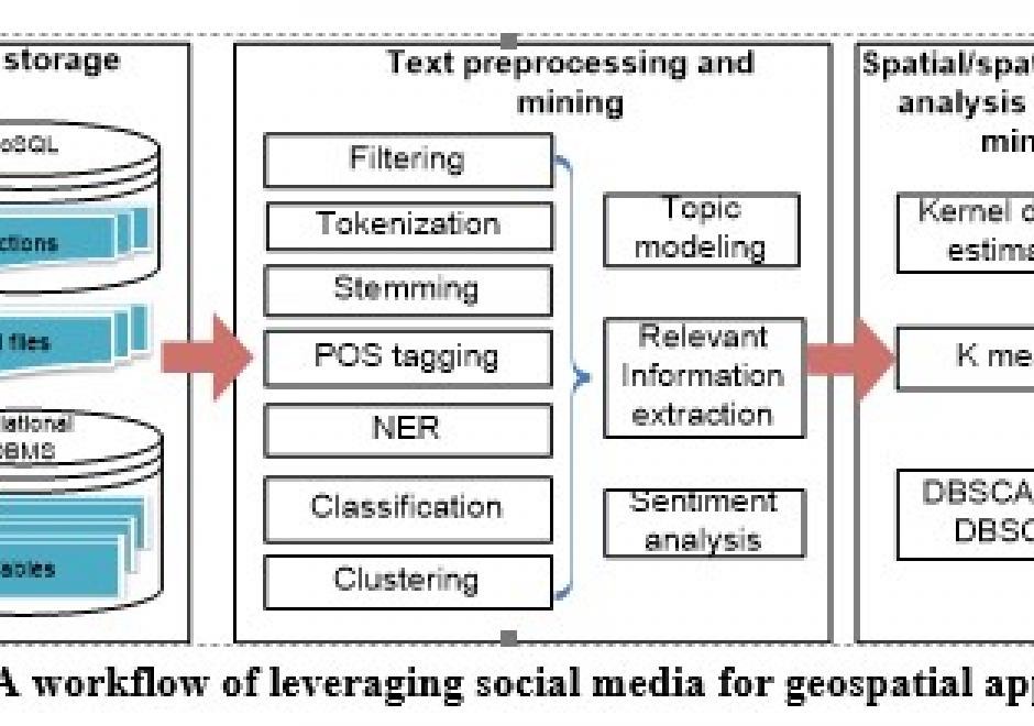
Social media streams have emerged as new sources to support various geospatial applications. However, traditional geospatial tools and systems lack the capacities to process such data streams, which are generated dynamically in extremely large volumes and with versatile contents. Therefore, innovative approaches and frameworks should be developed to detect an emerging event discussed over the social media, understand the extent, consequences of the event, as well as it time-evolving nature, and eventually discover useful patterns. In order to harness social media for geospatial applications, this entry introduces social media analytics technologies for harvesting, managing, mining, analyzing and visualizing the spatial, temporal, text, and network information of social media data.

DC-04 - Social Media Platforms

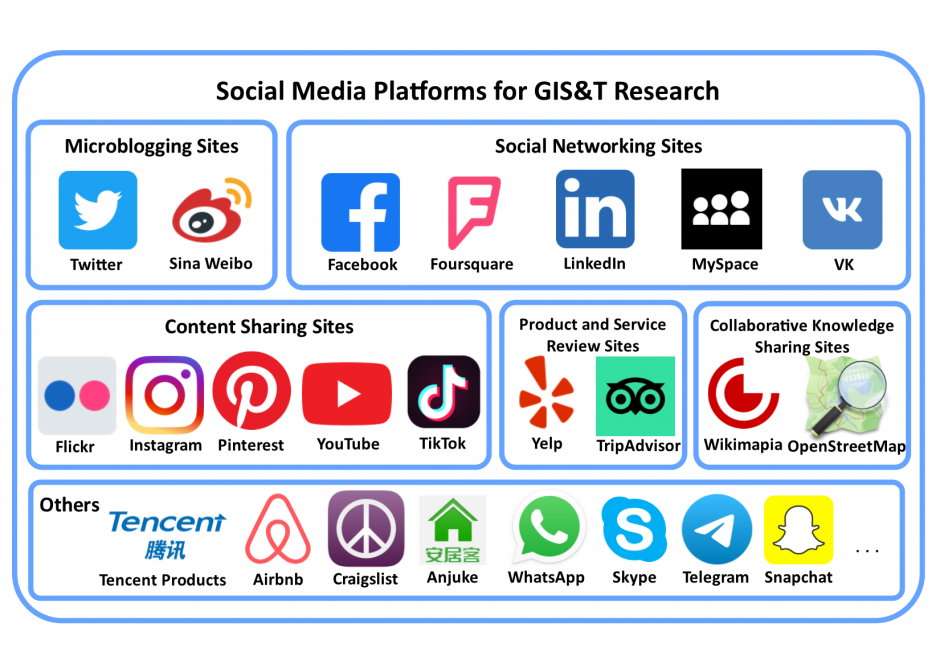
Social media is a group of interactive Web 2.0 Internet-based applications that allow users to create and exchange user-generated content via virtual communities. Social media platforms have a large user population who generate massive amounts of digital footprints, which are valuable data sources for observing and analyzing human activities/behavior. This entry focuses on social media platforms that provide spatial information in different forms for Geographic Information Systems and Technology (GIS&T) research. These social media platforms can be grouped into six categories: microblogging sites, social networking sites, content sharing sites, product and service review sites, collaborative knowledge sharing sites, and others. Four methods are available for capturing data from social media platforms, including Web Application Programming Interfaces (Web APIs), Web scraping, digital participant recruitment, and direct data purchasing. This entry first overviews the history, opportunities, and challenges related to social media platforms. Each category of social media platforms is then introduced in detail, including platform features, well-known platform examples, and data capturing processes.

CP-21 - Social Networks

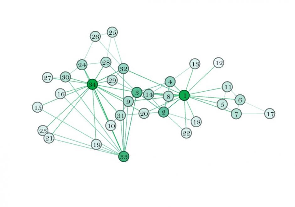
This entry introduces the concept of a social network (SN), its components, and how to weight those components. It also describes some spatial properties of SNs, and how to embed SNs into GIS. SNs are graph structures that consists of nodes and edges that traditionally exist in Sociology and are newer to GIScience. Nodes typically represent individual entities such as people or institutions, and edges represent interpersonal relationships, connections or ties. Many different mathematical metrics exist to characterize nodes, edges and the larger network. When geolocated, SNs are part of a class of spatial networks, more specifically, geographic networks (i.e. road networks, hydrological networks), that require special treatment because edges are non-planar, that is, they do not follow infrastructure or form a vector on the earth’s surface. Future research in this area is likely to take advantage of 21st Century datasets sourced from social media, GPS, wireless signals, and online interactions that each evidence geolocated personal relationships.

CP-01 - Software systems
  • Describe the major geospatial software architectures available currently, including desktop GIS, server-based, Internet, and component-based custom applications
  • Describe non-spatial software that can be used in geospatial applications, such as databases, Web services, and programming environments
  • Compare and contrast the primary sources of geospatial software, including major and minor commercial vendors and open-source options
  • List the major functionality needed from off-the-shelf software based on a requirements report
  • Identify software options that meet functionality needs for a given task or enterprise
  • Evaluate software options that meet functionality needs for a given task or enterprise
FC-07 - Space
  • Differentiate between absolute and relative descriptions of location
  • Define the four basic dimensions or shapes used to describe spatial objects (i.e., points, lines, regions, volumes)
  • Discuss the contributions that different perspectives on the nature of space bring to an understanding of geographic phenomenon
  • Justify the discrepancies between the nature of locations in the real world and representations thereof (e.g., towns as points)
  • Select appropriate spatial metaphors and models of phenomena to be represented in GIS
  • Develop methods for representing non-cartesian models of space in GIS
  • Discuss the advantages and disadvantages of the use of cartesian/metric space as a basis for GIS and related technologies
  • Differentiate between common-sense, Cartesian/metric, relational, relativistic, phenomenological, social constructivist, and other theories of the nature of space
FC-37 - Spatial Autocorrelation

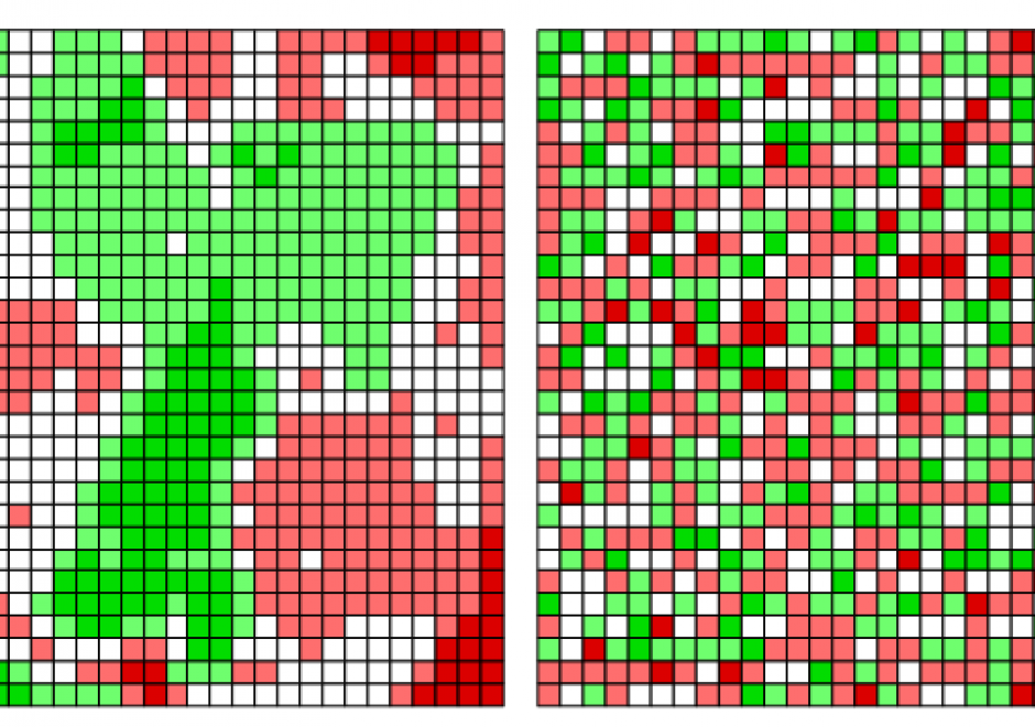
The scientific term spatial autocorrelation describes Tobler’s first law of geography: everything is related to everything else, but nearby things are more related than distant things. Spatial autocorrelation has a:

  • past characterized by scientists’ non-verbal awareness of it, followed by its formalization;
  • present typified by its dissemination across numerous disciplines, its explication, its visualization, and its extension to non-normal data; and
  • an anticipated future in which it becomes a standard in data analytic computer software packages, as well as a routinely considered feature of space-time data and in spatial optimization practice.

Positive spatial autocorrelation constitutes the focal point of its past and present; one expectation is that negative spatial autocorrelation will become a focal point of its future.

AM-32 - Spatial Autoregressive Models

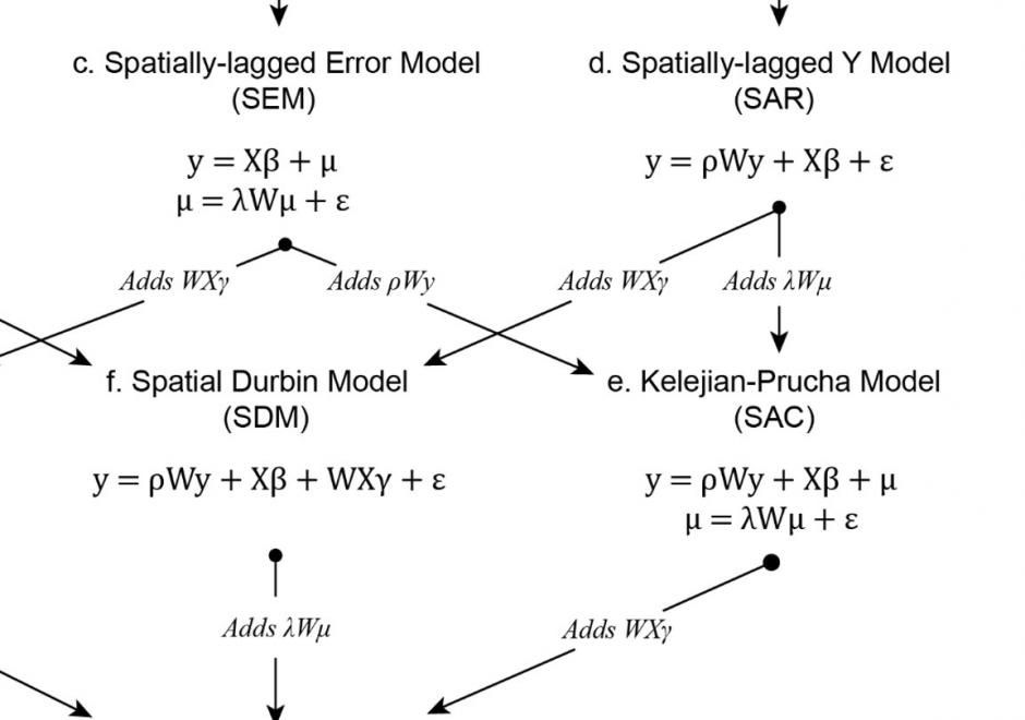
Regression analysis is a statistical technique commonly used in the social and physical sciences to model relationships between variables. To make unbiased, consistent, and efficient inferences about real-world relationships a researcher using regression analysis relies on a set of assumptions about the process generating the data used in the analysis and the errors produced by the model. Several of these assumptions are frequently violated when the real-world process generating the data used in the regression analysis is spatially structured, which creates dependence among the observations and spatial structure in the model errors. To avoid the confounding effects of spatial dependence, spatial autoregression models include spatial structures that specify the relationships between observations and their neighbors. These structures are most commonly specified using a weights matrix that can take many forms and be applied to different components of the spatial autoregressive model. Properly specified, including these structures in the regression analysis can account for the effects of spatial dependence on the estimates of the model and allow researchers to make reliable inferences. While spatial autoregressive models are commonly used in spatial econometric applications, they have wide applicability for modeling spatially dependent data.

CP-08 - Spatial Cloud Computing

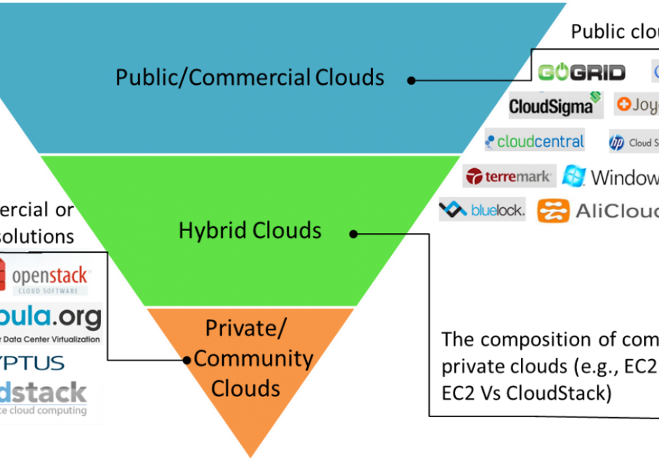
The scientific and engineering advancements in the 21st century pose grand computing challenges in managing big data, using complex algorithms to extract information and knowledge from big data, and simulating complex and dynamic physical and social phenomena. Cloud computing emerged as new computing model with the potential to address these computing challenges. This entry first introduces the concept, features and service models of cloud computing. Next, the ideas of generalized architecture and service models of spatial cloud computing are then elaborated to identify the characteristics, components, development and applications of spatial cloud computing for geospatial sciences. 

Pages