2018 QUARTER 01

A B C D E F G H I K L M N O P R S T U V W
KE-06 - Social, political, and cultural issues
  • Recognize the unique constraints or opportunities of the social or cultural context of a potential application
  • Compare and contrast the needs, constraints, and opportunities of different types of institutions, such as corporations, non-profit organizations, government agencies, and educational institutions
CP-01 - Software systems
  • Describe the major geospatial software architectures available currently, including desktop GIS, server-based, Internet, and component-based custom applications
  • Describe non-spatial software that can be used in geospatial applications, such as databases, Web services, and programming environments
  • Compare and contrast the primary sources of geospatial software, including major and minor commercial vendors and open-source options
  • List the major functionality needed from off-the-shelf software based on a requirements report
  • Identify software options that meet functionality needs for a given task or enterprise
  • Evaluate software options that meet functionality needs for a given task or enterprise
FC-07 - Space
  • Differentiate between absolute and relative descriptions of location
  • Define the four basic dimensions or shapes used to describe spatial objects (i.e., points, lines, regions, volumes)
  • Discuss the contributions that different perspectives on the nature of space bring to an understanding of geographic phenomenon
  • Justify the discrepancies between the nature of locations in the real world and representations thereof (e.g., towns as points)
  • Select appropriate spatial metaphors and models of phenomena to be represented in GIS
  • Develop methods for representing non-cartesian models of space in GIS
  • Discuss the advantages and disadvantages of the use of cartesian/metric space as a basis for GIS and related technologies
  • Differentiate between common-sense, Cartesian/metric, relational, relativistic, phenomenological, social constructivist, and other theories of the nature of space
AM-67 - Space-scale algorithms
  • Describe how space-scale algorithms can, or should, be used
FC-37 - Spatial Autocorrelation

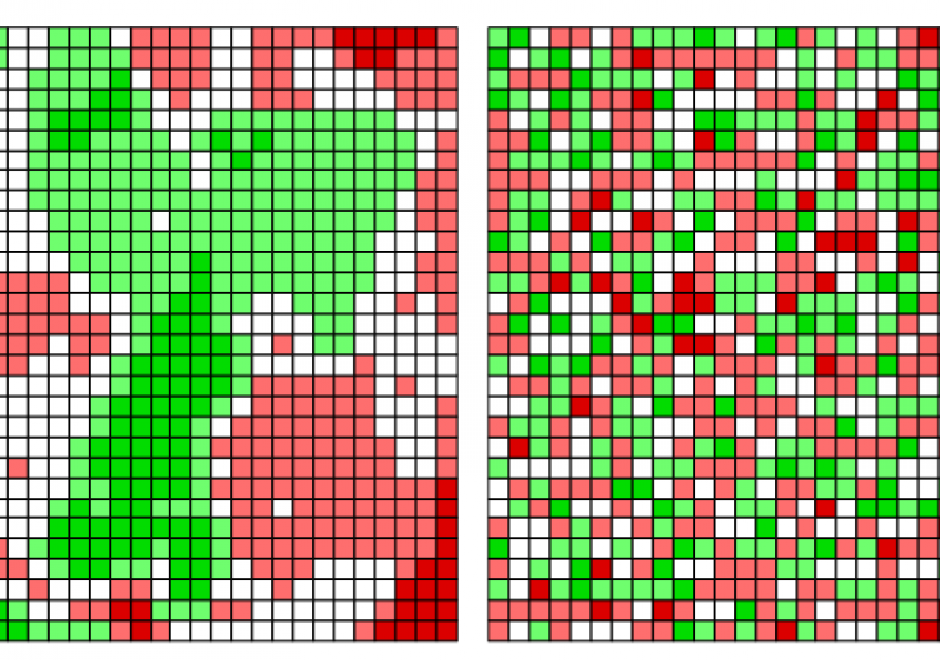
The scientific term spatial autocorrelation describes Tobler’s first law of geography: everything is related to everything else, but nearby things are more related than distant things. Spatial autocorrelation has a:

  • past characterized by scientists’ non-verbal awareness of it, followed by its formalization;
  • present typified by its dissemination across numerous disciplines, its explication, its visualization, and its extension to non-normal data; and
  • an anticipated future in which it becomes a standard in data analytic computer software packages, as well as a routinely considered feature of space-time data and in spatial optimization practice.

Positive spatial autocorrelation constitutes the focal point of its past and present; one expectation is that negative spatial autocorrelation will become a focal point of its future.

DM-60 - Spatial Data Infrastructures

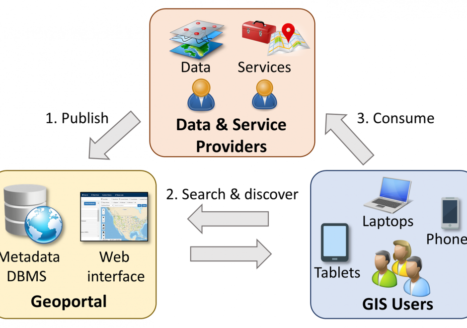
Spatial data infrastructure (SDI) is the infrastructure that facilitates the discovery, access, management, distribution, reuse, and preservation of digital geospatial resources. These resources may include maps, data, geospatial services, and tools. As cyberinfrastructures, SDIs are similar to other infrastructures, such as water supplies and transportation networks, since they play fundamental roles in many aspects of the society. These roles have become even more significant in today’s big data age, when a large volume of geospatial data and Web services are available. From a technological perspective, SDIs mainly consist of data, hardware, and software. However, a truly functional SDI also needs the efforts of people, supports from organizations, government policies, data and software standards, and many others. In this chapter, we will present the concepts and values of SDIs, as well as a brief history of SDI development in the U.S. We will also discuss the components of a typical SDI, and will specifically focus on three key components: geoportals, metadata, and search functions. Examples of the existing SDI implementations will also be discussed.  

DC-21 - Spatial data sharing among organizations
  • Describe the rationale for and against sharing data among organizations
  • Describe the barriers to information sharing
  • Describe methods used by organizations to facilitate data sharing
DM-65 - Spatial Data Uncertainty

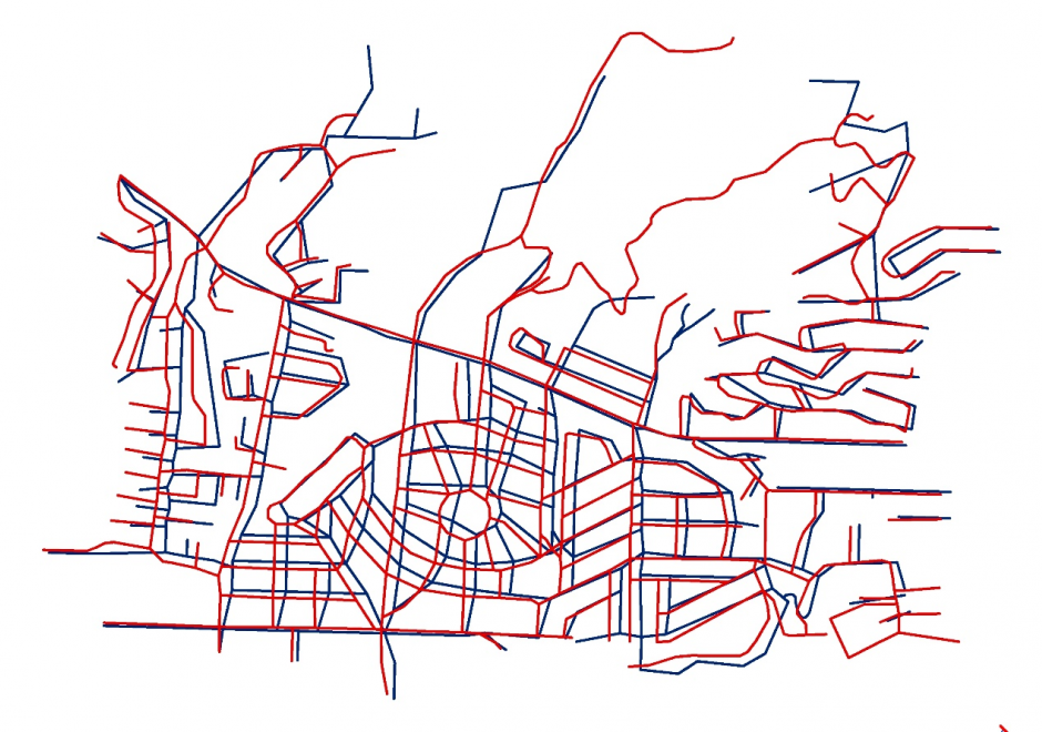
Although spatial data users may not be aware of the inherent uncertainty in all the datasets they use, it is critical to evaluate data quality in order to understand the validity and limitations of any conclusions based on spatial data. Spatial data uncertainty is inevitable as all representations of the real world are imperfect. This topic presents the importance of understanding spatial data uncertainty and discusses major methods and models to communicate, represent, and quantify positional and attribute uncertainty in spatial data, including both analytical and simulation approaches. Geo-semantic uncertainty that involves vague geographic concepts and classes is also addressed from the perspectives of fuzzy-set approaches and cognitive experiments. Potential methods that can be implemented to assess the quality of large volumes of crowd-sourced geographic data are also discussed. Finally, this topic ends with future directions to further research on spatial data quality and uncertainty.

AM-47 - Spatial distribution
  • Find spatial patterns in the distribution of geographic phenomena using geographic visualization and other techniques
  • Hypothesize the causes of a pattern in the spatial distribution of a phenomenon
  • Differentiate among distributions in space, time, and attribute
  • Identify influences of scale on the appearance of distributions
  • Employ techniques for visualizing, describing, and analyzing distributions in space, time, and attribute
  • Discuss the causal relationship between spatial processes and spatial patterns, including the possible problems in determining causality
AM-34 - Spatial expansion and geographically weighted regression
  • Perform an analysis using the geographically weighted regression technique
  • Discuss the appropriateness of GWR under various conditions
  • Describe the characteristics of the spatial expansion method
  • Explain the principles of geographically weighted regression
  • Compare and contrast GWR with universal kriging using moving neighborhoods
  • Explain how allowing the parameters of the model to vary with the spatial location of the sample data can be used to accommodate spatial heterogeneity
  • Analyze the number of degrees of freedom in GWR analyses and discuss any possible difficulties with the method based on your results

Pages