2019 QUARTER 04

A B C D E F G H I K L M N O P R S T U V W
AM-81 - GIS-Based Computational Modeling

GIS-based computational models are explored. While models vary immensely across disciplines and specialties, the focus is on models that simulate and forecast geographical systems and processes in time and space. The degree and means of integration of the many different models with GIS are covered, and the critical phases of modeling: design, implementation, calibration, sensitivity analysis, validation and error analysis are introduced. The use of models in simulations, an important purpose for implementing models within or outside of GIS, is discussed and the context of scenario-based planning explained. To conclude, a survey of model types is presented, with their application methods and some examples, and the goals of modeling are discussed.

AM-22 - Global Measures of Spatial Association

Spatial association broadly describes how the locations and values of samples or observations vary across space. Similarity in both the attribute values and locations of observations can be assessed using measures of spatial association based upon the first law of geography. In this entry, we focus on the measures of spatial autocorrelation that assess the degree of similarity between attribute values of nearby observations across the entire study region. These global measures assess spatial relationships with the combination of spatial proximity as captured in the spatial weights matrix and the attribute similarity as captured by variable covariance (i.e. Moran’s I) or squared difference (i.e. Geary’s C). For categorical data, the join count statistic provides a global measure of spatial association. Two visualization approaches for spatial autocorrelation measures include Moran scatterplots and variograms (also known as semi-variograms).
DC-03 - Global Positioning System
  • Explain how GPS receivers calculate coordinate data
  • Discuss the relationship of GPS to the Global Satellite Navigation System
  • Explain “selective availability,” why it was discontinued in 2000, and what alternatives are available to the U.S. Department of Defense
  • Explain the relationship of the U.S. Global Positioning System with comparable systems sponsored by Russia and the European Union and the Global Navigation Satellite System
  • Discuss the role of GPS in location-based services (LBS)
  • Specify the features of a GPS receiver that is able to achieve geometric accuracies on the order of centimeters without post-processing
  • Explain the relevance of the concept of trilateration to both GPS positioning and control surveying
  • Perform differential correction of GPS data using reference data from a CORS station
  • List, define, and rank the sources of error associated with GPS positioning
  • Distinguish between horizontal and vertical accuracies when using coarse acquisition codes/standard positioning service (C-codes) and precision acquisition codes/precise positioning service (P-codes)
PD-13 - GPU Programming for GIS Applications

Graphics processing units (GPUs) are massively parallel computing environments with applications in graphics and general purpose programming. This entry describes GPU hardware, application domains, and both graphics and general purpose programming languages.

CP-06 - Graphics Processing Units (GPUs)

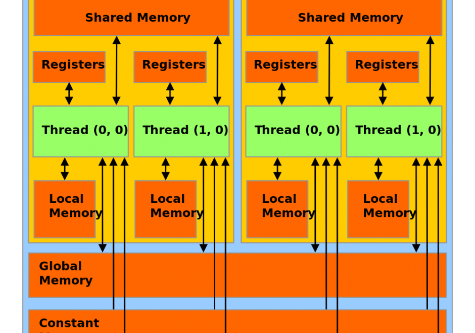
Graphics Processing Units (GPUs) represent a state-of-the-art acceleration technology for general-purpose computation. GPUs are based on many-core architecture that can deliver computing performance much higher than desktop computers based on Central Processing Units (CPUs). A typical GPU device may have hundreds or thousands of processing cores that work together for massively parallel computing. Basic hardware architecture and software standards that support the use of GPUs for general-purpose computation are illustrated by focusing on Nvidia GPUs and its software framework: CUDA. Many-core GPUs can be leveraged for the acceleration of spatial problem-solving.  

DC-19 - Ground verification and accuracy assessment
  • Evaluate the thematic accuracy of a given soils map
  • Explain how U.S. Geological Survey scientists and contractors assess the accuracy of the National Land Cover Dataset

Pages