2020 QUARTER 03

A B C D E F G H I J K L M N O P R S T U V W
AM-04 - Overlay
  • Explain why the process “dissolve and merge” often follows vector overlay operations
  • Outline the possible sources of error in overlay operations
  • Compare and contrast the concept of overlay as it is implemented in raster and vector domains
  • Demonstrate how the geometric operations of intersection and overlay can be implemented in GIS
  • Demonstrate why the georegistration of datasets is critical to the success of any map overlay operation
  • Formalize the operation called map overlay using Boolean logic
  • Explain what is meant by the term “planar enforcement”
  • Exemplify applications in which overlay is useful, such as site suitability analysis
AM-38 - Pattern recognition
  • Differentiate among machine learning, data mining, and pattern recognition
  • Explain the principles of pattern recognition
  • Apply a simple spatial mean filter to an image as a means of recognizing patterns
  • Construct an edge-recognition filter
  • Design a simple spatial mean filter
  • Explain the outcome of an artificial intelligence analysis (e.g., edge recognition), including a discussion of what the human did not see that the computer identified and vice versa
FC-04 - Perception and cognition of geographic phenomena
  • Describe the differences between real phenomena, conceptual models, and GIS data representations thereof
  • Explain the role of metaphors and image schema in our understanding of geographic phenomena and geographic tasks
  • Compare and contrast the symbolic and connectionist theories of human cognition and memory and their ability to model various cases
  • Compare and contrast theories of spatial knowledge acquisition (e.g., Marr on vision, Piaget on childhood, Golledge on wayfinding)
  • Explore the contribution of linguistics to the study of spatial cognition and the role of natural language in the conceptualization of geographic phenomena
FC-03 - Philosophical Perspectives

This entry follows in the footsteps of Anselin’s famous 1989 NCGIA working paper entitled “What is special about spatial?” (a report that is very timely again in an age when non-spatial data scientists are ignorant of the special characteristics of spatial data), where he outlines three unrelated but fundamental characteristics of spatial data. In a similar vein, I am going to discuss some philosophical perspectives that are internally unrelated to each other and could warrant individual entries in this Body of Knowledge. The first one is the notions of space and time and how they have evolved in philosophical discourse over the past three millennia. Related to these are aspects of absolute versus relative conceptions of these two fundamental constructs. The second is a brief introduction to key philosophical approaches and how they impact geospatial science and technology use today. The third is a discussion of which of the promises of the Quantitative Revolution in Geography and neighboring disciplines have been fulfilled by GIScience (and what is still missing). The fourth and final one is an introduction to the role that GIScience may play in what has recently been formalized as theory-guided data science.

DM-36 - Physical Data Models

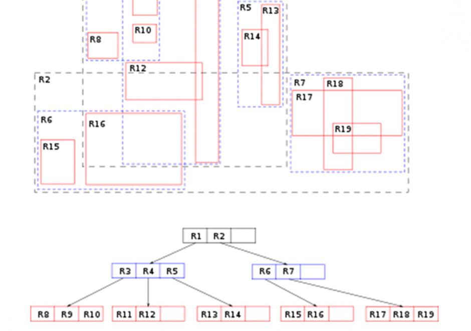
Constructs within a particular implementation of database management software guide the development of a physical data model, which is a product of a physical database design process. A physical data model documents how data are to be stored and accessed on storage media of computer hardware.  A physical data model is dependent on specific data types and indexing mechanisms used within database management system software.  Data types such as integers, reals, character strings, plus many others can lead to different storage structures. Indexing mechanisms such as region-trees and hash functions and others lead to differences in access performance.  Physical data modeling choices about data types and indexing mechanisms related to storage structures refine details of a physical database design. Data types associated with field, record and file storage structures together with the access mechanisms to those structures foster (constrain) performance of a database design. Since all software runs using an operating system, field, record, and file storage structures must be translated into operating system constructs to be implemented.  As such, all storage structures are contingent on the operating system and particular hardware that host data management software. 

FC-06 - Place and landscape
  • Explain how the concept of place encompasses more than just location
  • Evaluate the differences in how various parties think or feel differently about a place being modeled
  • Describe the elements of a sense of place or landscape that are difficult or impossible to adequately represent in GIS
  • Differentiate between space and place
  • Differentiate among elements of the meaning of a place that can or cannot be easily represented using geospatial technologies
  • Select a place or landscape with personal meaning and discuss its importance
  • Define the notions of cultural landscape and physical landscape
DM-48 - Plane coordinate systems
  • Explain why plane coordinates are sometimes preferable to geographic coordinates
  • Identify the map projection(s) upon which UTM coordinate systems are based, and explain the relationship between the projection(s) and the coordinate system grid
  • Discuss the magnitude and cause of error associated with UTM coordinates
  • Differentiate the characteristics and uses of the UTM coordinate system from the Military Grid Reference System (MGRS) and the World Geographic Reference System (GEOREF)
  • Explain what State Plane Coordinates system (SPC) eastings and northings represent
  • Associate SPC coordinates and zone specifications with corresponding positions on a U.S. map or globe
  • Identify the map projection(s) upon which SPC coordinate systems are based, and explain the relationship between the projection(s) and the coordinate system grids
  • Discuss the magnitude and cause of error associated with SPC coordinates
  • Recommend the most appropriate plane coordinate system for applications at different spatial extents and justify the recommendation
  • Critique the U.S. Geological Survey’s choice of UTM as the standard coordinate system for the U.S. National Map
  • Describe the characteristics of the “national grids” of countries other than the U.S.
  • Explain what Universal Transverse Mercator (UTM) eastings and northings represent
  • Associate UTM coordinates and zone specifications with corresponding position on a world map or globe
AM-07 - Point Pattern Analysis

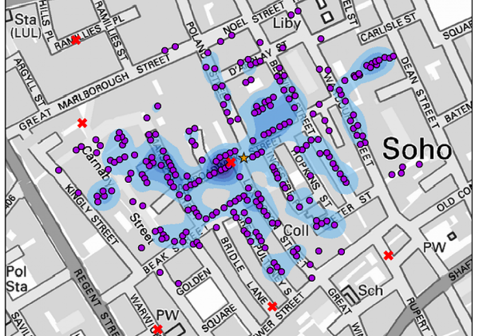
Point pattern analysis (PPA) focuses on the analysis, modeling, visualization, and interpretation of point data. With the increasing availability of big geo-data, such as mobile phone records and social media check-ins, more and more individual-level point data are generated daily. PPA provides an effective approach to analyzing the distribution of such data. This entry provides an overview of commonly used methods in PPA, as well as demonstrates the utility of these methods for scientific investigation based on a classic case study: the 1854 cholera outbreaks in London.

AM-62 - Point, Line, and Area Generalization

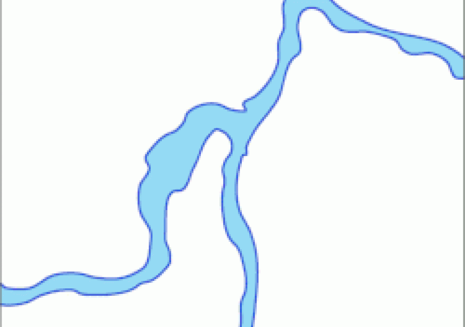
Generalization is an important and unavoidable part of making maps because geographic features cannot be represented on a map without undergoing transformation. Maps abstract and portray features using vector (i.e. points, lines and polygons) and raster (i.e pixels) spatial primitives which are usually labeled. These spatial primitives are subjected to further generalization when map scale is changed. Generalization is a contradictory process. On one hand, it alters the look and feel of a map to improve overall user experience especially regarding map reading and interpretive analysis. On the other hand, generalization has documented quality implications and can sacrifice feature detail, dimensions, positions or topological relationships. A variety of techniques are used in generalization and these include selection, simplification, displacement, exaggeration and classification. The techniques are automated through computer algorithms such as Douglas-Peucker and Visvalingam-Whyatt in order to enhance their operational efficiency and create consistent generalization results. As maps are now created easily and quickly, and used widely by both experts and non-experts owing to major advances in IT, it is increasingly important for virtually everyone to appreciate the circumstances, techniques and outcomes of generalizing maps. This is critical to promoting better map design and production as well as socially appropriate uses.

GS-19 - Political influences
  • Recognize the constraints that political forces place on geospatial applications in public and private sectors
  • Evaluate the influences of political ideologies (e.g., Marxism, Capitalism, conservative/liberal) on the understanding of geographic information
  • Evaluate the influences of political actions, especially the allocation of territory, on human perceptions of space and place

Pages