critical GIS

GS-11 - Professional and Practical Ethics of GIS&T

Geospatial technologies are often and rightly described as “powerful.” With power comes the ability to cause harm – intentionally or unintentionally - as well as to do good. In the context of GIS&T, Practical Ethics is the set of knowledge, skills and abilities needed to make reasoned decisions in light of the risks posed by geospatial technologies and methods in a wide variety of use cases. Ethics have been considered from different viewpoints in the GIS&T field. A practitioner's perspective may be based on a combination of "ordinary morality," institutional ethics policies, and professional ethics codes. By contrast, an academic scholar's perspective may be grounded in social or critical theory. What these perspectives have in common is reliance on reason to respond with integrity to ethical challenges. This entry focuses on the special obligations of GIS professionals, and on a method that educators can use to help students develop moral reasoning skills that GIS professionals need. The important related issues of Critical GIS and Spatial Law and Policy are to be considered elsewhere.  

GS-13 - Epistemological critiques

As GIS became a firmly established presence in geography and catalysed the emergence of GIScience, it became the target of a series of critiques regarding modes of knowledge production that were perceived as problematic. The first wave of critiques charged GIS with resuscitating logical positivism and its erroneous treatment of social phenomena as indistinguishable from natural/physical phenomena. The second wave of critiques objected to GIS on the basis that it was a representational technology. In the third wave of critiques, rather than objecting to GIS simply because it represented, scholars engaged with the ways in which GIS represents natural and social phenomena, pointing to the masculinist and heteronormative modes of knowledge production that are bound up in some, but not all, uses and applications of geographic information technologies. In response to these critiques, GIScience scholars and theorists positioned GIS as a critically realist technology by virtue of its commitment to the contingency of representation and its non-universal claims to knowledge production in geography. Contemporary engagements of GIS epistemologies emphasize the epistemological flexibility of geospatial technologies.

GS-16 - Social critiques
  • Explain the argument that, throughout history, maps have been used to depict social relations
  • Explain the argument that GIS is “socially constructed”
  • Describe the use of GIS from a political ecology point of view (e.g., consider the use of GIS for resource identification, conservation, and allocation by an NGO in Sub-Saharan Africa)
  • Defend or refute the contention that critical studies have an identifiable influence on the development of the information society in general and GIScience in particular
  • Discuss the production, maintenance, and use of geospatial data by a government agency or private firm from the perspectives of a taxpayer, a community organization, and a member of a minority group
  • Explain how a tax assessor’s office adoption of GIS&T may affect power relations within a community
GS-15 - Feminist critiques
  • Defend or refute the contention that the masculinist culture of computer work in general, and GIS work in particular, perpetuates gender inequality in GIS&T education and training and occupational segregation in the GIS&T workforce
  • Discuss the potential role of agency (individual action) in resisting dominant practices and in using GIS&T in ways that are consistent with feminist epistemologies and politics
  • Explain the argument that GIS and remote sensing foster a “disembodied” way of knowing the world
GS-14 - Ethical critiques
  • Defend or refute the argument that GIS&T professionals are culpable for applications that result in civilian casualties in warfare
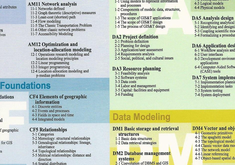
  • Discuss the ethical implications of the use of GIS&T as a surveillance technology
  • Defend or refute the argument that the “digital divide” that characterizes access to GIS&T perpetuates inequities among developed and developing nations, among socio-economic groups, and between individuals, community organizations, and public agencies and private firms
GS-13 - Epistemological critiques
  • Discuss critiques of GIS as “deterministic” technology in relation to debates about the Quantitative Revolution in the discipline of geography
  • Describe the extent to which contemporary GIS&T supports diverse ways of understanding the world
  • Discuss the implications of interoperability on ontology
  • Explain the argument that GIS privileges certain views of the world over others
  • Identify alternatives to the “algorithmic way of thinking” that characterizes GIS
GS-11 - Professional and Practical Ethics of GIS&T

Geospatial technologies are often and rightly described as “powerful.” With power comes the ability to cause harm – intentionally or unintentionally - as well as to do good. In the context of GIS&T, Practical Ethics is the set of knowledge, skills and abilities needed to make reasoned decisions in light of the risks posed by geospatial technologies and methods in a wide variety of use cases. Ethics have been considered from different viewpoints in the GIS&T field. A practitioner's perspective may be based on a combination of "ordinary morality," institutional ethics policies, and professional ethics codes. By contrast, an academic scholar's perspective may be grounded in social or critical theory. What these perspectives have in common is reliance on reason to respond with integrity to ethical challenges. This entry focuses on the special obligations of GIS professionals, and on a method that educators can use to help students develop moral reasoning skills that GIS professionals need. The important related issues of Critical GIS and Spatial Law and Policy are to be considered elsewhere.  

GS-16 - Social critiques
  • Explain the argument that, throughout history, maps have been used to depict social relations
  • Explain the argument that GIS is “socially constructed”
  • Describe the use of GIS from a political ecology point of view (e.g., consider the use of GIS for resource identification, conservation, and allocation by an NGO in Sub-Saharan Africa)
  • Defend or refute the contention that critical studies have an identifiable influence on the development of the information society in general and GIScience in particular
  • Discuss the production, maintenance, and use of geospatial data by a government agency or private firm from the perspectives of a taxpayer, a community organization, and a member of a minority group
  • Explain how a tax assessor’s office adoption of GIS&T may affect power relations within a community
GS-15 - Feminist critiques
  • Defend or refute the contention that the masculinist culture of computer work in general, and GIS work in particular, perpetuates gender inequality in GIS&T education and training and occupational segregation in the GIS&T workforce
  • Discuss the potential role of agency (individual action) in resisting dominant practices and in using GIS&T in ways that are consistent with feminist epistemologies and politics
  • Explain the argument that GIS and remote sensing foster a “disembodied” way of knowing the world
GS-14 - Ethical critiques
  • Defend or refute the argument that GIS&T professionals are culpable for applications that result in civilian casualties in warfare
  • Discuss the ethical implications of the use of GIS&T as a surveillance technology
  • Defend or refute the argument that the “digital divide” that characterizes access to GIS&T perpetuates inequities among developed and developing nations, among socio-economic groups, and between individuals, community organizations, and public agencies and private firms

Pages