decision-making

DA-45 - GIS&T in Business

Geographic Information Systems and Technology are utilized extensively in the business sector and have become a strategic element for competition and partnering.  Although the traditional digital map layers and tables remain at the core of business GIS, the spatial architecture in firms now includes location analytics, location intelligence, AI, machine learning, imagery, social media linkages.  Cloud-based solutions provide platform flexibility, centralized data, and potential to roll out user-friendly webGIS across large segments of business users and customers. GIS is well suited to the digital transformations that are essential for firms, large and small.  With these advances, GIS has become prominent and its function has moved upwards in companies’ organizational hierarchies, with enterprise GIS even being recognized in the C-suite.  UPS is an example in which GIS is now a critical corporate competitive factor. In spite of these successes, a gap remains in the supply of skilled spatial workforce for companies. Business schools can contribute by changing by school leadership “getting it” about spatial, bringing GIS into the mainstream curricula, developing training for business faculty in teaching, conducting research in location analytics, and populating student body and alumni base with knowledge and enthusiasm for spatial thinking and management.

DA-01 - GIS&T and Agriculture
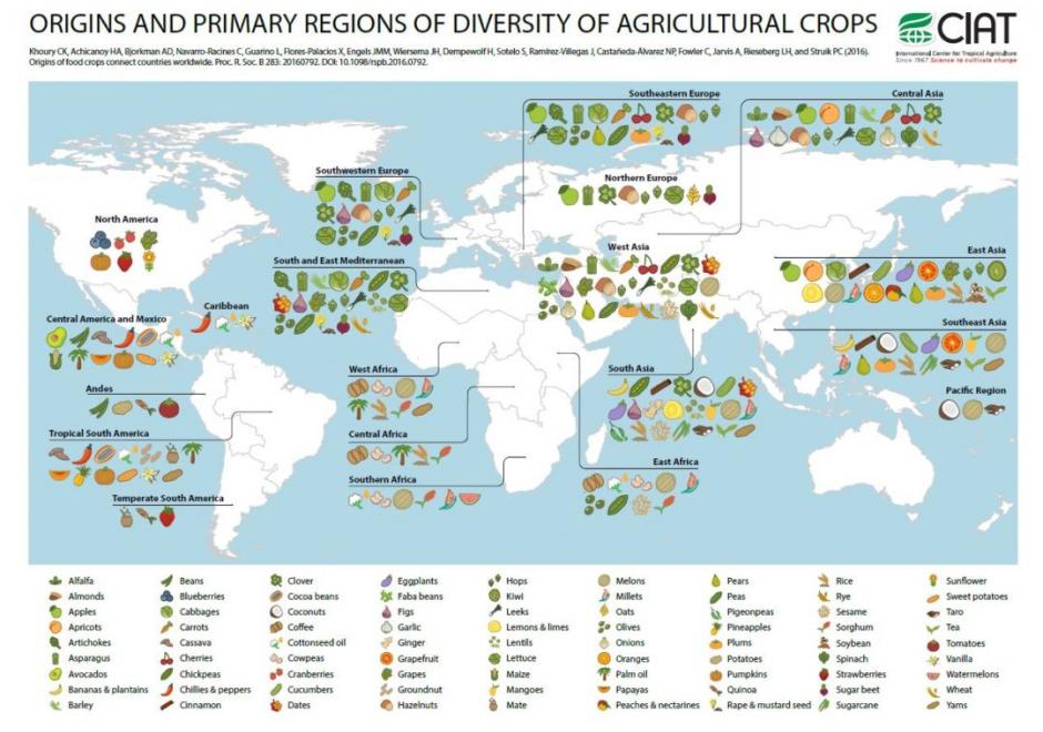
Agriculture, whether in the Corn Belt of the United States, the massive rice producing areas of Southeast Asia, or the bean harvest of a smallholder producer in Central America, is the basis for feeding the world. Agriculture systems are highly complex and heterogeneous in both space and time. The need to contextualize this complexity and to make more informed decisions regarding agriculture has led to GIS&T approaches supporting the agricultural sciences in many different areas. Agriculture represents a rich resource of spatiotemporal data and different problem contexts; current and future GIScientists should look toward agricultural as a potentially rewarding area of investigation and, likewise, one where new approaches have the potential to help improve the food, environmental, and economic security of people around the world.

Pages