CV-34 - Map Icon Design
The use of map icons is an efficient way to condense a map object into a concise expression of geospatial data. Like all cartographic design, map icon design merges artistic and scientific elements into symbolic representations intended to be readily legible to map readers. This entry reviews the types of map icons and elements of icon design, including the ways in which the visual variables are used in map icon communication. As communicative devices, icons are imbued with cultural meanings and can oftentimes lead to the preservation of stereotypes. This review concludes with an examination of icons’ perpetuation of – and challenge to – cultural stereotypes.


DA-09 - GIS&T and Geodesign
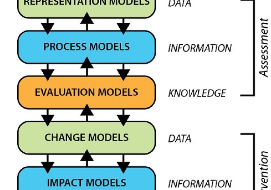
Geodesign leverages GIS&T to allow collaborations that result in geographically specific, adaptive and resilient solutions to complex problems across scales of the built and natural environment. Geodesign is rooted in decades of research and practice. Building on that history, is a contemporary approach that embraces the latest in GIS&T, visualization, and social science, all of which is organized around a unique framework process involving six models. More than just technology or GIS, Geodesign is a way of thinking when faced with complicated spatial issues that need systematic, creative, and integrative solutions. Geodesign holds great promise for addressing the complexity of interrelated issues associated with growth and landscape change. Geodesign empowers through design combined with data and analytics to shape our environments and create desired futures.