error

DM-65 - Spatial Data Uncertainty

Although spatial data users may not be aware of the inherent uncertainty in all the datasets they use, it is critical to evaluate data quality in order to understand the validity and limitations of any conclusions based on spatial data. Spatial data uncertainty is inevitable as all representations of the real world are imperfect. This topic presents the importance of understanding spatial data uncertainty and discusses major methods and models to communicate, represent, and quantify positional and attribute uncertainty in spatial data, including both analytical and simulation approaches. Geo-semantic uncertainty that involves vague geographic concepts and classes is also addressed from the perspectives of fuzzy-set approaches and cognitive experiments. Potential methods that can be implemented to assess the quality of large volumes of crowd-sourced geographic data are also discussed. Finally, this topic ends with future directions to further research on spatial data quality and uncertainty.

DC-19 - Ground Verification and Accuracy Assessment
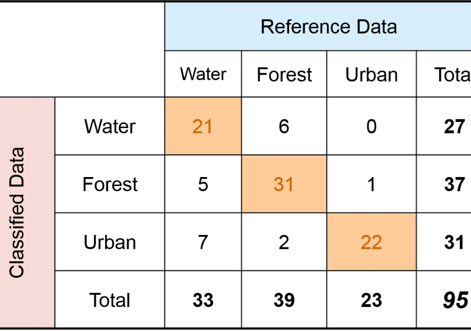
Spatial products such as maps of land cover, soil type, wildfire, glaciers, and surface water have become increasingly available and used in science and policy decisions.  These maps are not without error, and it is critical that a description of quality accompany each product.  In the case of a thematic map, one aspect of quality is obtained by conducting a spatially explicit accuracy assessment in which the map class and reference class are compared on a per spatial unit basis (e.g., per 30m x 30m pixel).  The outcome of an accuracy assessment is a description of quality of the end-product map, in contrast to conducting an evaluation of map quality as part of the map production process.  The accuracy results can be used to decide if the map is of adequate quality for an intended application, as input to uncertainty analyses, and as information to improve future map products.
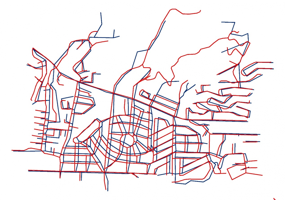

DM-65 - Spatial Data Uncertainty

Although spatial data users may not be aware of the inherent uncertainty in all the datasets they use, it is critical to evaluate data quality in order to understand the validity and limitations of any conclusions based on spatial data. Spatial data uncertainty is inevitable as all representations of the real world are imperfect. This topic presents the importance of understanding spatial data uncertainty and discusses major methods and models to communicate, represent, and quantify positional and attribute uncertainty in spatial data, including both analytical and simulation approaches. Geo-semantic uncertainty that involves vague geographic concepts and classes is also addressed from the perspectives of fuzzy-set approaches and cognitive experiments. Potential methods that can be implemented to assess the quality of large volumes of crowd-sourced geographic data are also discussed. Finally, this topic ends with future directions to further research on spatial data quality and uncertainty.

Pages