geoprocessing

PD-11 - Python for GIS

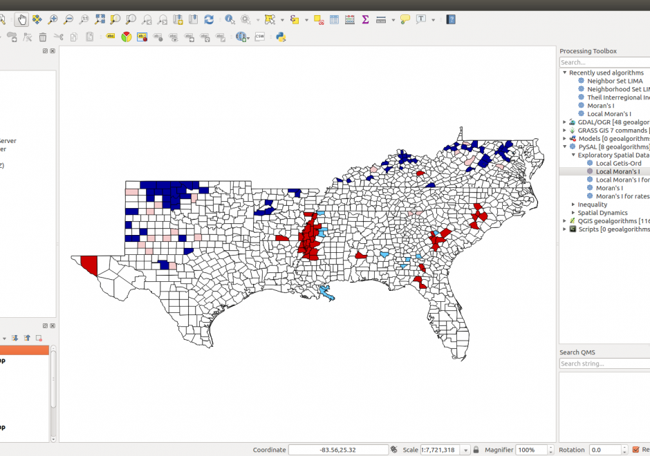
Figure 1. PySAL within QGIS Processing Toolbox: Hot-spot analysis of Homicide Rates in Southern US Counties.


Python is a popular language for geospatial programming and application development. This entry provides an overview of the different development modes that can be adopted for GIS programming with Python and discusses the history of Python adoption in the GIS community. The different layers of the geospatial development stack in Python are examined giving the reader an understanding of the breadth that Python offers to the GIS developer. Future developments and broader issues related to interoperability and programming ecosystems are identified.

DM-66 - Spatial Indexing
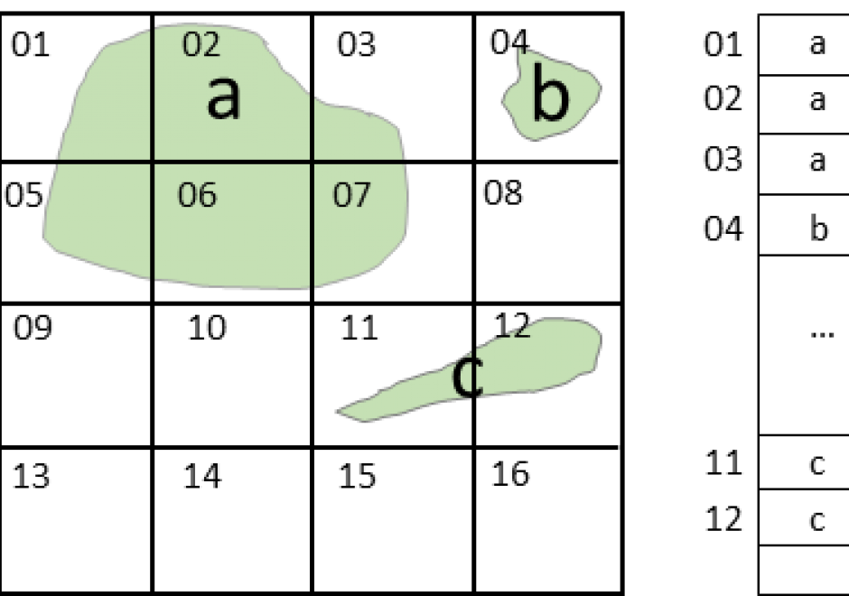
A spatial index is a data structure that allows for accessing a spatial object efficiently. It is a common technique used by spatial databases.  Without indexing, any search for a feature would require a "sequential scan" of every record in the database, resulting in much longer processing time. In a spatial index construction process, the minimum bounding rectangle serves as an object approximation. Various types of spatial indices across commercial and open-source databases yield measurable performance differences. Spatial indexing techniques are playing a central role in time-critical applications and the manipulation of spatial big data.

PD-11 - Python for GIS

Figure 1. PySAL within QGIS Processing Toolbox: Hot-spot analysis of Homicide Rates in Southern US Counties.


Python is a popular language for geospatial programming and application development. This entry provides an overview of the different development modes that can be adopted for GIS programming with Python and discusses the history of Python adoption in the GIS community. The different layers of the geospatial development stack in Python are examined giving the reader an understanding of the breadth that Python offers to the GIS developer. Future developments and broader issues related to interoperability and programming ecosystems are identified.

DM-66 - Spatial Index

A spatial index is a data structure that allows for accessing a spatial object efficiently. It is a common technique used by spatial databases.  Without indexing, any search for a feature would require a "sequential scan" of every record in the database, resulting in much longer processing time. In a spatial index construction process, the minimum bounding rectangle serves as an object approximation. Various types of spatial indices across commercial and open-source databases yield measurable performance differences. Spatial indexing techniques are playing a central role in time-critical applications and the manipulation of spatial big data.

DM-66 - Spatial Indexing

A spatial index is a data structure that allows for accessing a spatial object efficiently. It is a common technique used by spatial databases.  Without indexing, any search for a feature would require a "sequential scan" of every record in the database, resulting in much longer processing time. In a spatial index construction process, the minimum bounding rectangle serves as an object approximation. Various types of spatial indices across commercial and open-source databases yield measurable performance differences. Spatial indexing techniques are playing a central role in time-critical applications and the manipulation of spatial big data.

PD-11 - Python for GIS

Figure 1. PySAL within QGIS Processing Toolbox: Hot-spot analysis of Homicide Rates in Southern US Counties.


Python is a popular language for geospatial programming and application development. This entry provides an overview of the different development modes that can be adopted for GIS programming with Python and discusses the history of Python adoption in the GIS community. The different layers of the geospatial development stack in Python are examined giving the reader an understanding of the breadth that Python offers to the GIS developer. Future developments and broader issues related to interoperability and programming ecosystems are identified.

Pages