GS-20 - Aggregation of Spatial Entities and Legislative Redistricting

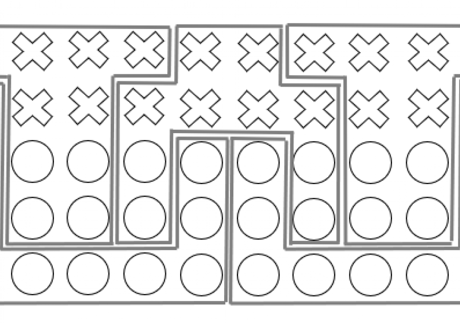
The partitioning of space is an essential consideration for the efficient allocation of resources. In the United States and many other countries, this parcelization of sub-regions for political and legislative purposes results in what is referred to as districts. A district is an aggregation of smaller, spatially bound units, along with their statistical properties, into larger spatially-bound units. When a district has the primary purpose of representation, individuals who reside within that district make up a constituency. Redistricting is often required as populations of constituents shift over time or resources that service areas change. Administrative challenges with creating districts have been greatly aided by increasing utilization of GIS. However, with these advances in geospatial methods, political disputes with the way in which districts increasingly snare the process in legal battles often centered on the topic of gerrymandering. This chapter focuses on the redistricting process within the United States and how the aggregation of representative spatial entities presents a mix of political, technical and legal challenges.


AM-97 - An Introduction to Spatial Data Mining
The goal of spatial data mining is to discover potentially useful, interesting, and non-trivial patterns from spatial data-sets (e.g., GPS trajectory of smartphones). Spatial data mining is societally important having applications in public health, public safety, climate science, etc. For example, in epidemiology, spatial data mining helps to nd areas with a high concentration of disease incidents to manage disease outbreaks. Computational methods are needed to discover spatial patterns since the volume and velocity of spatial data exceed the ability of human experts to analyze it. Spatial data has unique characteristics like spatial autocorrelation and spatial heterogeneity which violate the i.i.d (Independent and Identically Distributed) assumption of traditional statistic and data mining methods. Therefore, using traditional methods may miss patterns or may yield spurious patterns, which are costly in societal applications. Further, there are additional challenges such as MAUP (Modiable Areal Unit Problem) as illustrated by a recent court case debating gerrymandering in elections. In this article, we discuss tools and computational methods of spatial data mining, focusing on the primary spatial pattern families: hotspot detection, collocation detection, spatial prediction, and spatial outlier detection. Hotspot detection methods use domain information to accurately model more active and high-density areas. Collocation detection methods find objects whose instances are in proximity to each other in a location. Spatial prediction approaches explicitly model the neighborhood relationship of locations to predict target variables from input features. Finally, spatial outlier detection methods find data that differ from their neighbors. Lastly, we describe future research and trends in spatial data mining.