DM-79 - U.S. National Spatial Data Infrastructure

Spatial data infrastructures may be thought of as socio-technical frameworks for coordinating the development, management, sharing and use of geospatial data across multiple organizational jurisdictions and varying geographic extents. The United States was an early adopter of the SDI concept and the U.S. National Spatial Data Infrastructure (NSDI) is an example of a country-wide SDI implementation facilitated by coordination at the federal-government level. At the time of its establishment in the early 1990s, a unique characteristic of the NSDI was a mandate for federal agencies to establish partnerships with state- and local-level government. This entry summarizes the origins of the NSDI’s establishment, its original core components and how they’ve evolved over the last 25 years, the role of the Federal Geographic Data Committee (FGDC), and the anticipated impact of passage of the Geospatial Data Act of 2018. For broader technical information about SDIs, readers are referred to GIST BoK Entry DM-60: Spatial Data Infrastructures (Hu and Li 2017). For additional details on the history of the NSDI, readers are referred to Rhind (1999). For the latest information on recent and emerging NSDI initiatives, please visit the FGDC web site (www.fgdc.gov).


DM-60 - Spatial Data Infrastructures
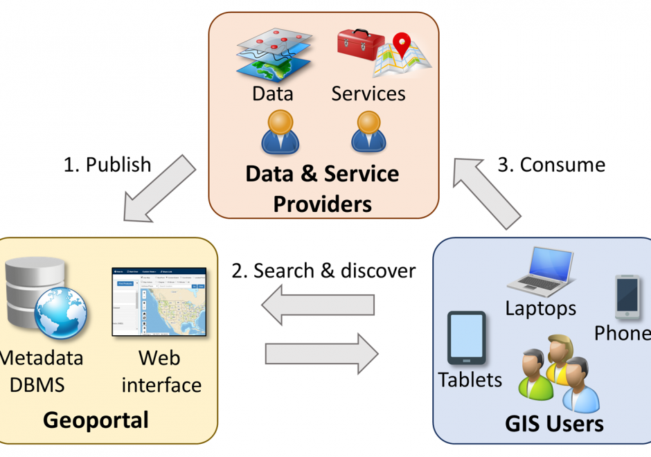
Spatial data infrastructure (SDI) is the infrastructure that facilitates the discovery, access, management, distribution, reuse, and preservation of digital geospatial resources. These resources may include maps, data, geospatial services, and tools. As cyberinfrastructures, SDIs are similar to other infrastructures, such as water supplies and transportation networks, since they play fundamental roles in many aspects of the society. These roles have become even more significant in today’s big data age, when a large volume of geospatial data and Web services are available. From a technological perspective, SDIs mainly consist of data, hardware, and software. However, a truly functional SDI also needs the efforts of people, supports from organizations, government policies, data and software standards, and many others. In this chapter, we will present the concepts and values of SDIs, as well as a brief history of SDI development in the U.S. We will also discuss the components of a typical SDI, and will specifically focus on three key components: geoportals, metadata, and search functions. Examples of the existing SDI implementations will also be discussed.