ontology

FC-02 - Epistemology
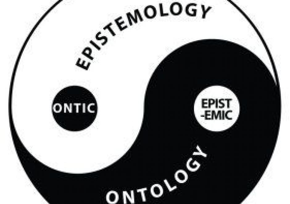
Epistemology is the lens through which we view reality. Different epistemologies interpret the earth and patterns on its surface differently. In effect, epistemology is a belief system about the nature of reality that, in turn, structures our interpretation of the world. Common epistemologies in GIScience include (but are not limited by) positivism and realism. However, many researchers are in effect pragmatists in that they choose the filter that best supports their work and a priori hypotheses. Different epistemologies – or ways of knowing and studying geography – result in different ontologies or classification systems. By understanding the role of epistemology, we can better understand different ways of representing the same phenomena.
GS-13 - Epistemological critiques

As GIS became a firmly established presence in geography and catalysed the emergence of GIScience, it became the target of a series of critiques regarding modes of knowledge production that were perceived as problematic. The first wave of critiques charged GIS with resuscitating logical positivism and its erroneous treatment of social phenomena as indistinguishable from natural/physical phenomena. The second wave of critiques objected to GIS on the basis that it was a representational technology. In the third wave of critiques, rather than objecting to GIS simply because it represented, scholars engaged with the ways in which GIS represents natural and social phenomena, pointing to the masculinist and heteronormative modes of knowledge production that are bound up in some, but not all, uses and applications of geographic information technologies. In response to these critiques, GIScience scholars and theorists positioned GIS as a critically realist technology by virtue of its commitment to the contingency of representation and its non-universal claims to knowledge production in geography. Contemporary engagements of GIS epistemologies emphasize the epistemological flexibility of geospatial technologies.

DM-80 - Ontology for Geospatial Semantic Interoperability

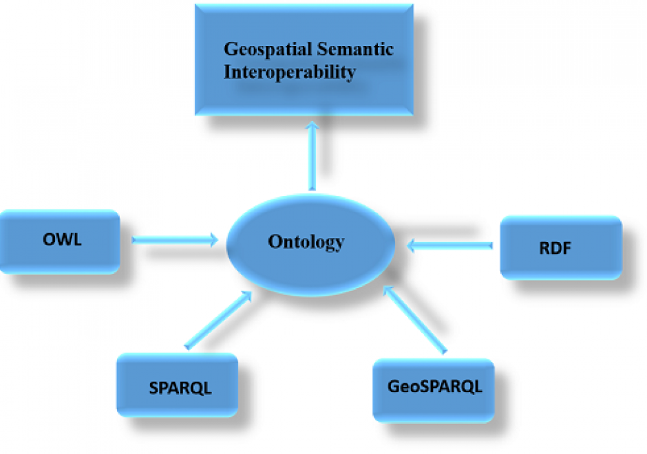
It is difficult to share and reuse geospatial data and retrieve geospatial information because of geospatial data heterogeneity problems. Lack of semantic interoperability is one of the major problems facing GIS (Geographic Information Science/System) systems and applications today. To solve geospatial data heterogeneity problems and support geospatial information retrieval and semantic interoperability over the Web, the use of an ontology is proposed because it is a formal explicit description of concepts or meanings of words in a well-defined and unambiguous manner. Geospatial ontologies represent geospatial concepts and properties for use over the Web. OWL (Ontology Web Language) is an emerging language for defining and instantiating ontologies. OWL builds on RDF (Resource Description Framework) but adds more vocabulary for describing properties and classes. The downside of representing structured geospatial data in OWL and RDF languages is that it can result in inefficient data access. SPARQL (Simple Protocol and RDF Query Language) is recommended for general RDF query while the GeoSPARQL (Geographic Simple Protocol and RDF Query Language) protocol is proposed as an extension of SPARQL for querying geospatial data. However, the runtime cost of GeoSPARQL queries can be high due to the fine-grained nature of RDF data models. There are several challenges to using ontologies for geospatial semantic interoperability but these can be overcome through collaboration.

GS-13 - Epistemological critiques

As GIS became a firmly established presence in geography and catalysed the emergence of GIScience, it became the target of a series of critiques regarding modes of knowledge production that were perceived as problematic. The first wave of critiques charged GIS with resuscitating logical positivism and its erroneous treatment of social phenomena as indistinguishable from natural/physical phenomena. The second wave of critiques objected to GIS on the basis that it was a representational technology. In the third wave of critiques, rather than objecting to GIS simply because it represented, scholars engaged with the ways in which GIS represents natural and social phenomena, pointing to the masculinist and heteronormative modes of knowledge production that are bound up in some, but not all, uses and applications of geographic information technologies. In response to these critiques, GIScience scholars and theorists positioned GIS as a critically realist technology by virtue of its commitment to the contingency of representation and its non-universal claims to knowledge production in geography. Contemporary engagements of GIS epistemologies emphasize the epistemological flexibility of geospatial technologies.

Pages