photogrammetry

DC-24 - Unmanned Aerial Systems (UAS)

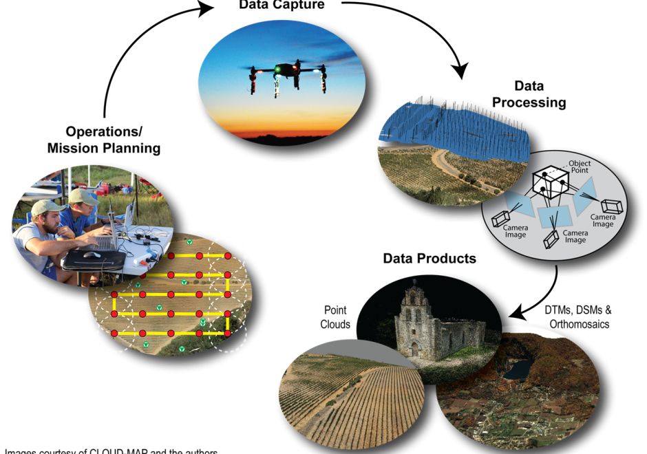
Unmanned Aerial Systems (UAS) are revolutionizing how GIS&T researchers and practitioners model and analyze our world. Compared to traditional remote sensing approaches, UAS provide a largely inexpensive, flexible, and relatively easy-to-use platform to capture high spatial and temporal resolution geospatial data. Developments in computer vision, specifically Structure from Motion (SfM), enable processing of UAS-captured aerial images to produce three-dimensional point clouds and orthophotos. However, many challenges persist, including restrictive legal environments for UAS flight, extensive data processing times, and the need for further basic research. Despite its transformative potential, UAS adoption still faces some societal hesitance due to privacy concerns and liability issues.

DC-10 - Aerial Photography: History and Georeferencing
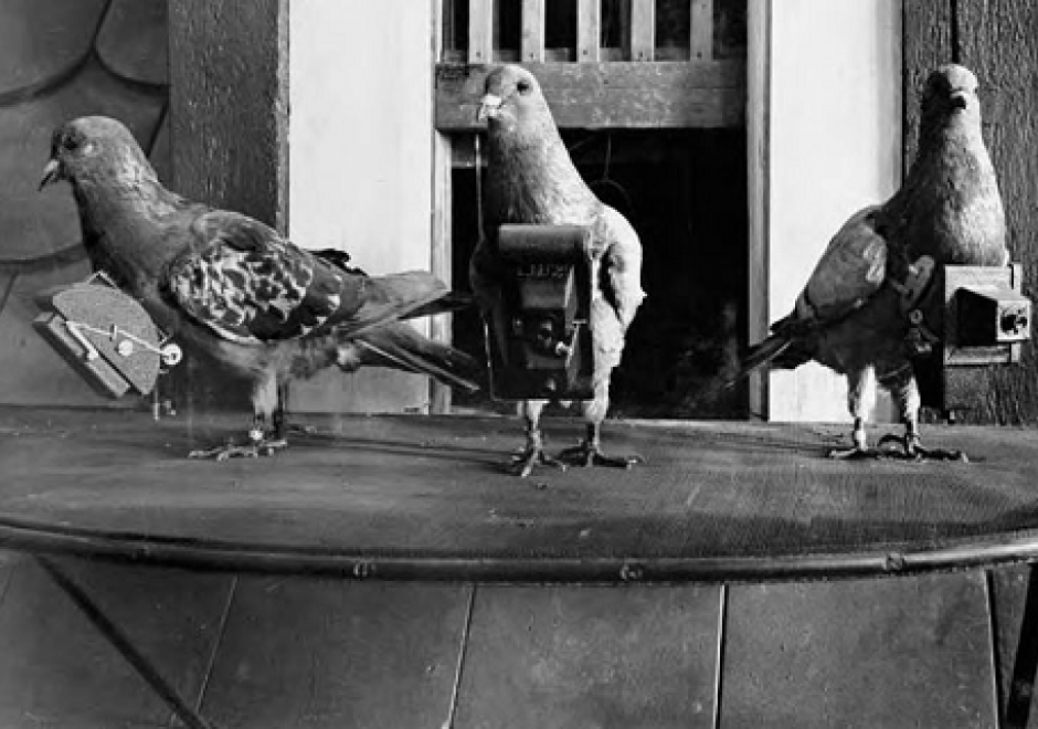
In 1903, Julius Neubranner, a photography enthusiast, designed and patented a breast-mounted aerial camera for carrier pigeons. Weighing only 70 grams, the camera took automatic exposures at 30-second intervals along the flight line flown by the bird. Although faster than balloons, they were not always reliable in following their flight paths. Today the pigeon corps has been replaced by unmanned aerial vehicles, but aerial photography continues to be an important source of data for use in a wide range of geospatial applications. Processing of the imagery to remove various types of distortion is a necessary step before the images can be georeferenced and used for mapping purposes. 

Pages