S-100

DM-90 - Hydrographic Geospatial Data Standards

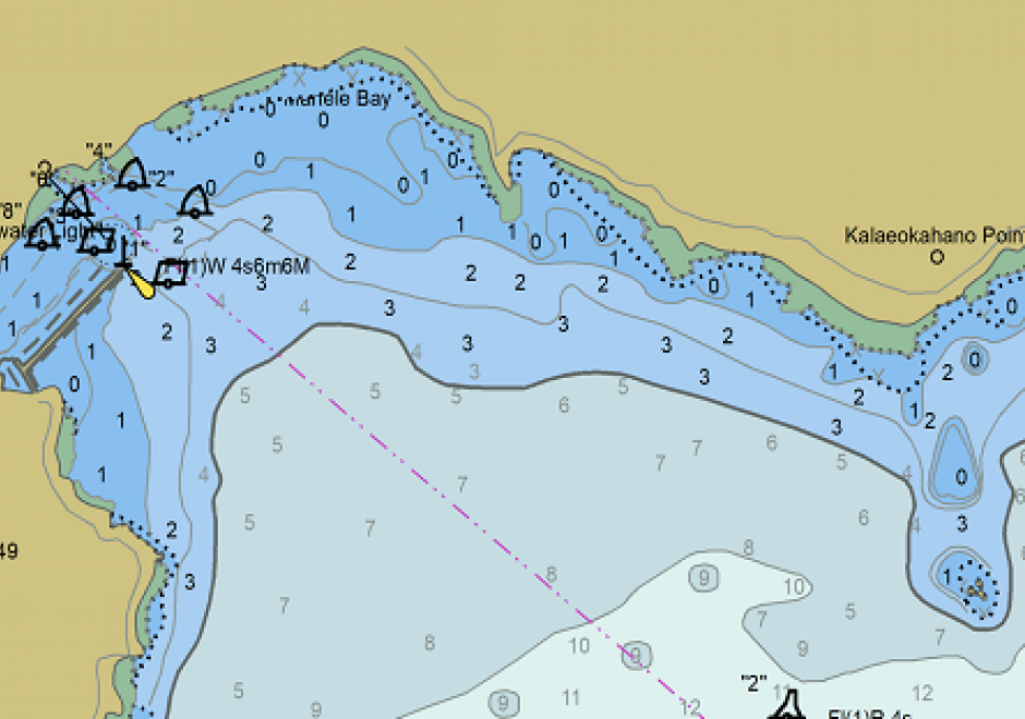
Coastal nations, through their dedicated Hydrographic Offices (HOs), have the obligation to provide nautical charts for the waters of national jurisdiction in support of safe maritime navigation. Accurate and reliable charts are essential to seafarers whether for commerce, defense, fishing, or recreation. Since navigation can be an international activity, mariners often use charts published from different national HOs. Standardization of data collection and processing, chart feature generalization methods, text, symbology, and output validation becomes essential in providing mariners with consistent and uniform products regardless of the region or the producing nation. Besides navigation, nautical charts contain information about the seabed and the coastal environment useful in other domains such as dredging, oceanography, geology, coastal modelling, defense, and coastal zone management. The standardization of hydrographic and nautical charting activities is achieved through various publications issued by the International Hydrographic Organization (IHO). This chapter discusses the purpose and importance of nautical charts, the establishment and role of the IHO in coordinating HOs globally, the existing hydrographic geospatial data standards, as well as those under development based on the new S-100 Universal Hydrographic Data Model.

DM-91 - Marine Spatial Data Infrastructure
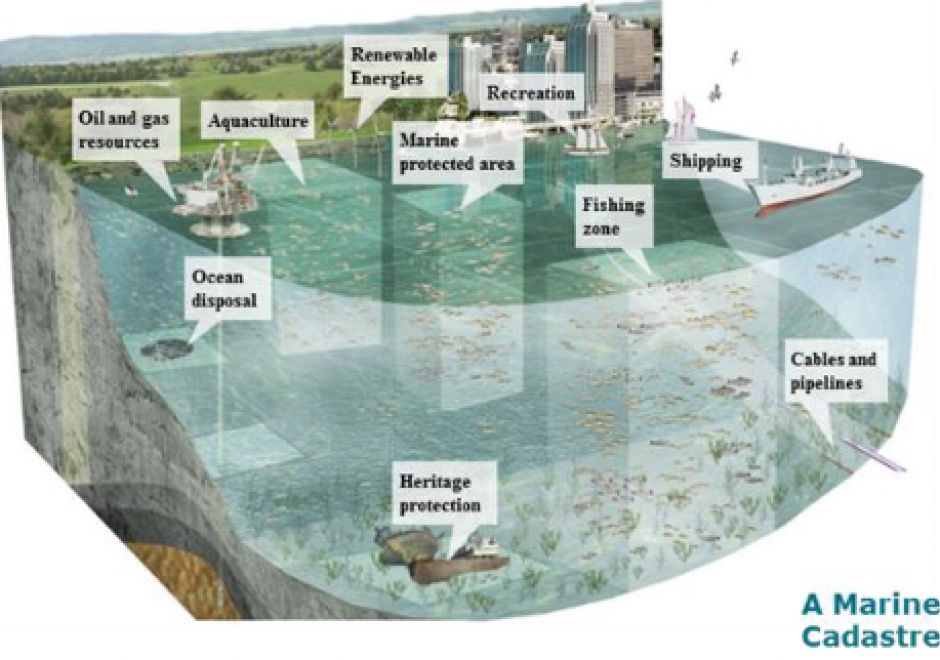
Marine Spatial Data Infrastructure (MSDI), the extension of terrestrial Spatial Data Infrastructure to the marine environment, is a type of cyberinfrastructure that facilitates the discovery, access, management, distribution, reuse, and preservation of hydrospatial data. MSDIs provide timely access to data from public and private organizations of marine related disciplines such as hydrography, oceanography, meteorology and maritime economic sectors, to be used for applications such as the safety of navigation, aquatic and marine activities, economic development, security and defence, scientific research, and marine ecosystems sustainability. This chapter discusses the main pillars of a MSDI, its importance for facilitating public processes such as Marine Spatial Planning and Coastal Zone Management, the wide range of stakeholders, implementation challenges, and future developments, such as the FAIR design principles, new data sources and services.

DM-90 - Hydrographic Geospatial Data Standards

Coastal nations, through their dedicated Hydrographic Offices (HOs), have the obligation to provide nautical charts for the waters of national jurisdiction in support of safe maritime navigation. Accurate and reliable charts are essential to seafarers whether for commerce, defense, fishing, or recreation. Since navigation can be an international activity, mariners often use charts published from different national HOs. Standardization of data collection and processing, chart feature generalization methods, text, symbology, and output validation becomes essential in providing mariners with consistent and uniform products regardless of the region or the producing nation. Besides navigation, nautical charts contain information about the seabed and the coastal environment useful in other domains such as dredging, oceanography, geology, coastal modelling, defense, and coastal zone management. The standardization of hydrographic and nautical charting activities is achieved through various publications issued by the International Hydrographic Organization (IHO). This chapter discusses the purpose and importance of nautical charts, the establishment and role of the IHO in coordinating HOs globally, the existing hydrographic geospatial data standards, as well as those under development based on the new S-100 Universal Hydrographic Data Model.

DM-91 - Marine Spatial Data Infrastructure

Marine Spatial Data Infrastructure (MSDI), the extension of terrestrial Spatial Data Infrastructure to the marine environment, is a type of cyberinfrastructure that facilitates the discovery, access, management, distribution, reuse, and preservation of hydrospatial data. MSDIs provide timely access to data from public and private organizations of marine related disciplines such as hydrography, oceanography, meteorology and maritime economic sectors, to be used for applications such as the safety of navigation, aquatic and marine activities, economic development, security and defence, scientific research, and marine ecosystems sustainability. This chapter discusses the main pillars of a MSDI, its importance for facilitating public processes such as Marine Spatial Planning and Coastal Zone Management, the wide range of stakeholders, implementation challenges, and future developments, such as the FAIR design principles, new data sources and services.

DM-90 - Hydrographic Geospatial Data Standards

Coastal nations, through their dedicated Hydrographic Offices (HOs), have the obligation to provide nautical charts for the waters of national jurisdiction in support of safe maritime navigation. Accurate and reliable charts are essential to seafarers whether for commerce, defense, fishing, or recreation. Since navigation can be an international activity, mariners often use charts published from different national HOs. Standardization of data collection and processing, chart feature generalization methods, text, symbology, and output validation becomes essential in providing mariners with consistent and uniform products regardless of the region or the producing nation. Besides navigation, nautical charts contain information about the seabed and the coastal environment useful in other domains such as dredging, oceanography, geology, coastal modelling, defense, and coastal zone management. The standardization of hydrographic and nautical charting activities is achieved through various publications issued by the International Hydrographic Organization (IHO). This chapter discusses the purpose and importance of nautical charts, the establishment and role of the IHO in coordinating HOs globally, the existing hydrographic geospatial data standards, as well as those under development based on the new S-100 Universal Hydrographic Data Model.

DM-91 - Marine Spatial Data Infrastructure

Marine Spatial Data Infrastructure (MSDI), the extension of terrestrial Spatial Data Infrastructure to the marine environment, is a type of cyberinfrastructure that facilitates the discovery, access, management, distribution, reuse, and preservation of hydrospatial data. MSDIs provide timely access to data from public and private organizations of marine related disciplines such as hydrography, oceanography, meteorology and maritime economic sectors, to be used for applications such as the safety of navigation, aquatic and marine activities, economic development, security and defence, scientific research, and marine ecosystems sustainability. This chapter discusses the main pillars of a MSDI, its importance for facilitating public processes such as Marine Spatial Planning and Coastal Zone Management, the wide range of stakeholders, implementation challenges, and future developments, such as the FAIR design principles, new data sources and services.

Pages