security

DM-62 - Database Administration

Organizations with a responsibility for maintaining large-scale, multi-user spatial databases often turn to server-based relational database management systems to achieve their goals.  The administration of such databases has many dimensions.  Industry standards in the areas of data storage and services should be researched and applied to ensure a sound, comprehensive database design as well as to promote interoperability with external entities.  Data validation tools should be implemented to improve the accuracy and efficiency of data maintenance activities.  Metadata should be maintained according to industry standards to protect the organization’s investment in data and to increase the likelihood of the data being located by clearinghouse and portal search tools.  Database security strategies can prevent unauthorized access to data and lessen the chances of data loss due to accidental data corruption.  Database performance should be monitored and strategies implemented to ensure that data can be retrieved from the system with acceptable response times.  Finally, trends in the field such as the increasing need to manage large volumes of data call for spatial database managers to be knowledgeable of non-relational data models as well, such as NoSQL data models.

DC-29 - Volunteered Geographic Information
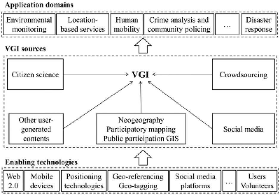
Volunteered geographic information (VGI) refers to geo-referenced data created by citizen volunteers. VGI has proliferated in recent years due to the advancement of technologies that enable the public to contribute geographic data. VGI is not only an innovative mechanism for geographic data production and sharing, but also may greatly influence GIScience and geography and its relationship to society. Despite the advantages of VGI, VGI data quality is under constant scrutiny as quality assessment is the basis for users to evaluate its fitness for using it in applications. Several general approaches have been proposed to assure VGI data quality but only a few methods have been developed to tackle VGI biases. Analytical methods that can accommodate the imperfect representativeness and biases in VGI are much needed for inferential use where the underlying phenomena of interest are inferred from a sample of VGI observations. VGI use for inference and modeling adds much value to VGI. Therefore, addressing the issue of representativeness and VGI biases is important to fulfill VGI’s potential. Privacy and security are also important issues. Although VGI has been used in many domains, more research is desirable to address the fundamental intellectual and scholarly needs that persist in the field.

Pages