spatial analytics

CV-06 - Map Projections

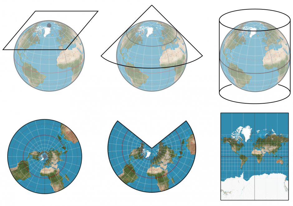
Map projection is the process of transforming angular (spherical / elliptical) coordinates into planar coordinates. All map projections introduce distortion (e.g., to areas, angles, distances) in the resulting planar coordinates. Understanding what, where, and how much distortion is introduced is an important consideration for spatial computations and visual interpretation of spatial patterns, as well as for general aesthetics of any map.

CP-10 - Social Media Analytics
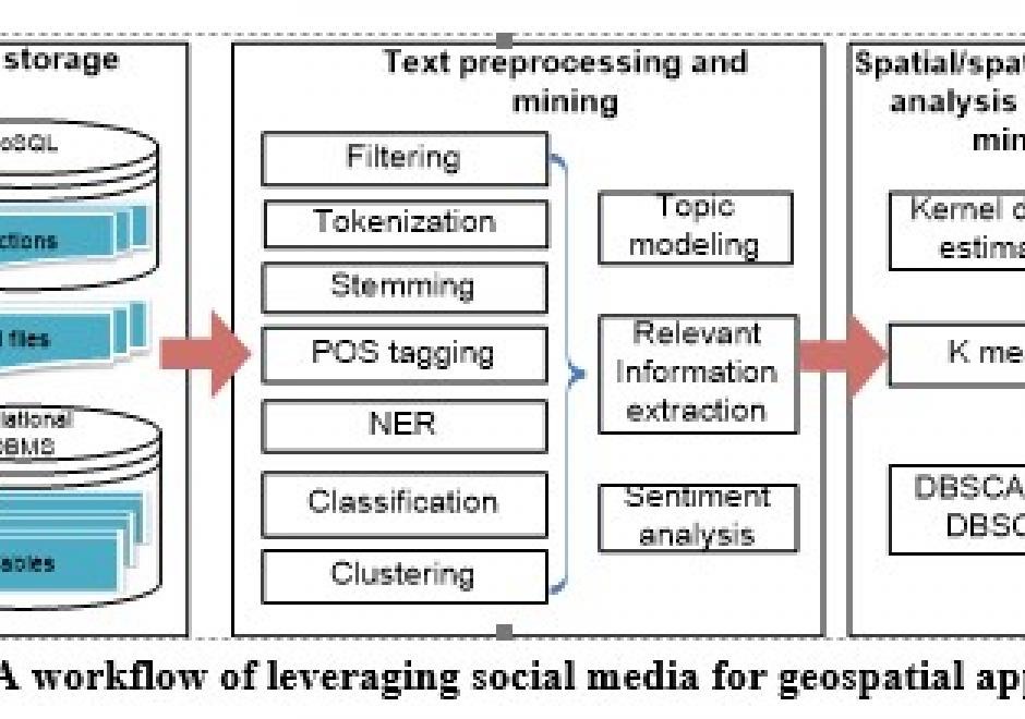
Social media streams have emerged as new sources to support various geospatial applications. However, traditional geospatial tools and systems lack the capacities to process such data streams, which are generated dynamically in extremely large volumes and with versatile contents. Therefore, innovative approaches and frameworks should be developed to detect an emerging event discussed over the social media, understand the extent, consequences of the event, as well as it time-evolving nature, and eventually discover useful patterns. In order to harness social media for geospatial applications, this entry introduces social media analytics technologies for harvesting, managing, mining, analyzing and visualizing the spatial, temporal, text, and network information of social media data.

DA-38 - GIS&T and Retail Business

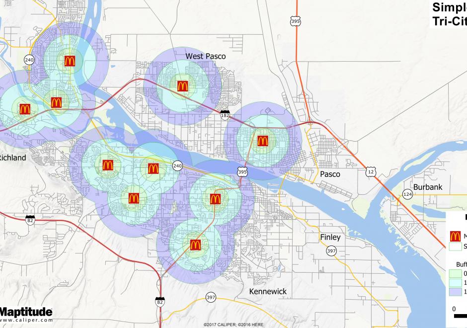
Where should a retail business occur or locate within a region?  What would that trade area look like?  Should a retail expansion occur and how would that affect sales of other nearby existing locations?  Would a new retail location have the right demographic or socio-economic customer base to be profitable?  These are important questions for retailers to consider.  Within the evolving landscape of GIS, there is more geospatial data than ever before about the potential customer.  In retail, the application of maps and mapping technology is growing to include commercial real estate, logistics, and marketing to name a few.  There has been an increased momentum across commercial applications for geospatial technologies delivered in an easy to comprehend format for a variety of end users.  

DA-46 - Computational Geography

Computational Geography emerged in the 1980s in response to the reductionist limitations of early GIS software, which inhibited deep analyses of rich geographic data. Today, Computational Geography continues to integrate a wide range of domains to facilitate spatial analyses that require computational resources or ontological paradigms beyond that made available in traditional GIS software packages. These include novel approaches for the mass creation of geospatial data, large-scale database design for the effective storage and querying of spatial identifiers (i.e., distributed spatial databases), and methodologies which enable simulations and/or analysis in the context of large-scale, frequently near-real-time, spatially-explicit sources of information. The topics studied within Computational Geography directly enable many of the world’s largest public databases, including Google Maps and Open Street Map (OSM), as well as many modern analytic pipelines designed to study human behavior with the integration of large volumes of location information (e.g., mobile phone data) with other geospatial sources (e.g., satellite imagery).

CV-06 - Map Projections

Map projection is the process of transforming angular (spherical / elliptical) coordinates into planar coordinates. All map projections introduce distortion (e.g., to areas, angles, distances) in the resulting planar coordinates. Understanding what, where, and how much distortion is introduced is an important consideration for spatial computations and visual interpretation of spatial patterns, as well as for general aesthetics of any map.

CP-10 - Social Media Analytics

Social media streams have emerged as new sources to support various geospatial applications. However, traditional geospatial tools and systems lack the capacities to process such data streams, which are generated dynamically in extremely large volumes and with versatile contents. Therefore, innovative approaches and frameworks should be developed to detect an emerging event discussed over the social media, understand the extent, consequences of the event, as well as it time-evolving nature, and eventually discover useful patterns. In order to harness social media for geospatial applications, this entry introduces social media analytics technologies for harvesting, managing, mining, analyzing and visualizing the spatial, temporal, text, and network information of social media data.
DA-46 - Computational Geography

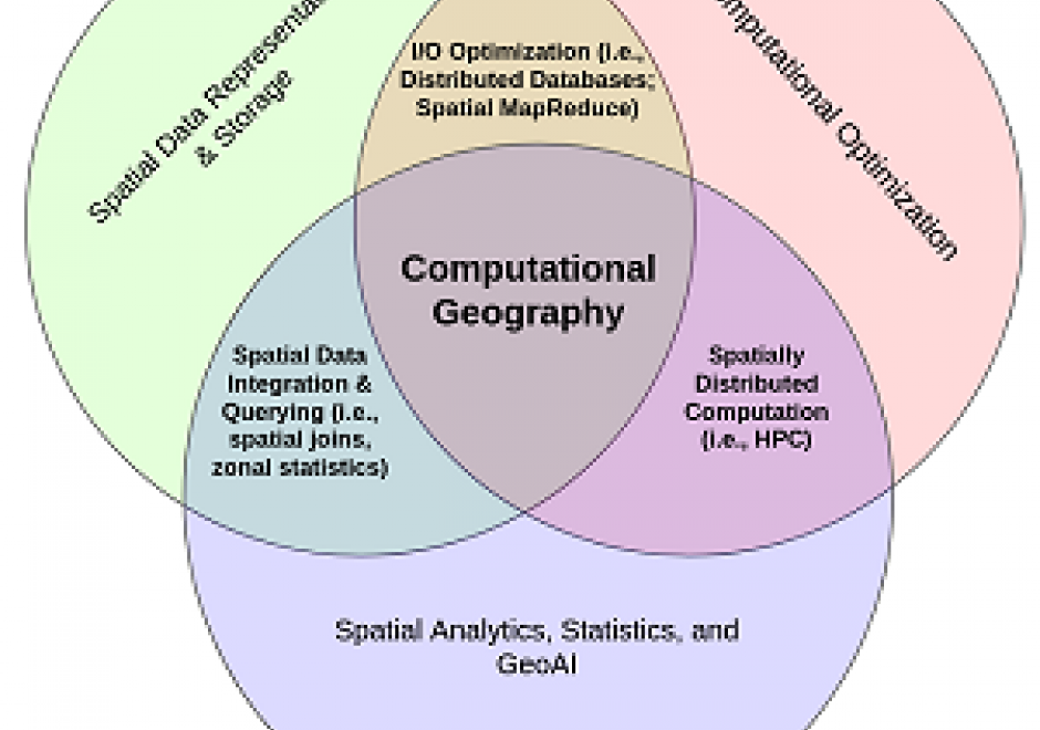
Computational Geography emerged in the 1980s in response to the reductionist limitations of early GIS software, which inhibited deep analyses of rich geographic data. Today, Computational Geography continues to integrate a wide range of domains to facilitate spatial analyses that require computational resources or ontological paradigms beyond that made available in traditional GIS software packages. These include novel approaches for the mass creation of geospatial data, large-scale database design for the effective storage and querying of spatial identifiers (i.e., distributed spatial databases), and methodologies which enable simulations and/or analysis in the context of large-scale, frequently near-real-time, spatially-explicit sources of information. The topics studied within Computational Geography directly enable many of the world’s largest public databases, including Google Maps and Open Street Map (OSM), as well as many modern analytic pipelines designed to study human behavior with the integration of large volumes of location information (e.g., mobile phone data) with other geospatial sources (e.g., satellite imagery).

DA-38 - GIS&T and Retail Business

Where should a retail business occur or locate within a region?  What would that trade area look like?  Should a retail expansion occur and how would that affect sales of other nearby existing locations?  Would a new retail location have the right demographic or socio-economic customer base to be profitable?  These are important questions for retailers to consider.  Within the evolving landscape of GIS, there is more geospatial data than ever before about the potential customer.  In retail, the application of maps and mapping technology is growing to include commercial real estate, logistics, and marketing to name a few.  There has been an increased momentum across commercial applications for geospatial technologies delivered in an easy to comprehend format for a variety of end users.  

CV-06 - Map Projections

Map projection is the process of transforming angular (spherical / elliptical) coordinates into planar coordinates. All map projections introduce distortion (e.g., to areas, angles, distances) in the resulting planar coordinates. Understanding what, where, and how much distortion is introduced is an important consideration for spatial computations and visual interpretation of spatial patterns, as well as for general aesthetics of any map.

CP-10 - Social Media Analytics

Social media streams have emerged as new sources to support various geospatial applications. However, traditional geospatial tools and systems lack the capacities to process such data streams, which are generated dynamically in extremely large volumes and with versatile contents. Therefore, innovative approaches and frameworks should be developed to detect an emerging event discussed over the social media, understand the extent, consequences of the event, as well as it time-evolving nature, and eventually discover useful patterns. In order to harness social media for geospatial applications, this entry introduces social media analytics technologies for harvesting, managing, mining, analyzing and visualizing the spatial, temporal, text, and network information of social media data.
Pages