CV-31 - Flow Maps

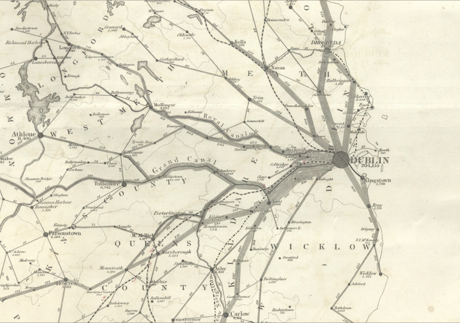
Flow mapping is a cartographic method of representing movement of phenomena. Maps of this type often depict the vector movement of entities (imports and exports, people, information) between geographic areas, but the general method also encompasses a range of graphics illustrating networks (e.g., transit and communications grids) and dynamic systems (e.g., wind and water currents). Most flow maps typically use line symbols of varying widths, lengths, shapes, colors, or speeds (in the case of animated flow maps) to show the quality, direction, and magnitude of movements. Aesthetic considerations for flow maps are numerous and their production is often done manually without significant automation. Flow maps frequently use distorted underlying geography to accommodate the placement of flow paths, which are often dramatically smoothed/abstracted into visually pleasing curves or simply straight lines. In the extreme, such maps lack a geographic coordinate space and are more diagrammatic, as in Sankey diagrams, alluvial diagrams, slope graphs, and circle migration plots. Whatever their form, good flow maps should effectively visualize the relative magnitude and direction of movement or potential movement between a one or more origins and destinations.


FC-03 - Philosophical Perspectives
This entry follows in the footsteps of Anselin’s famous 1989 NCGIA working paper entitled “What is special about spatial?” (a report that is very timely again in an age when non-spatial data scientists are ignorant of the special characteristics of spatial data), where he outlines three unrelated but fundamental characteristics of spatial data. In a similar vein, I am going to discuss some philosophical perspectives that are internally unrelated to each other and could warrant individual entries in this Body of Knowledge. The first one is the notions of space and time and how they have evolved in philosophical discourse over the past three millennia. Related to these are aspects of absolute versus relative conceptions of these two fundamental constructs. The second is a brief introduction to key philosophical approaches and how they impact geospatial science and technology use today. The third is a discussion of which of the promises of the Quantitative Revolution in Geography and neighboring disciplines have been fulfilled by GIScience (and what is still missing). The fourth and final one is an introduction to the role that GIScience may play in what has recently been formalized as theory-guided data science.