2017 QUARTER 04

A B C D E F G H I K L M N O P R S T U V W
CV-17 - Mapping Time
  • Describe how the adding time-series data reveals or does not reveal patterns not evident in a cross-sectional data
  • Describe how an animated map reveals patterns not evident without animation
  • Demonstrate how Bertin’s “graphic variables” can be extended to include animation effects
  • Create a temporal sequence representing a dynamic geospatial process
CV-18 - Mapping Uncertainty
  • Describe a technique that can be used to represent the value of each of the components of data quality (positional and attribute accuracy, logical consistency, and completeness)
  • Apply multivariate and dynamic visualization methods to display uncertainty in data
  • Sketch a map with a reliability overlay using symbols suited to reliability representations
  • Develop graphic techniques that clearly show different forms of inexactness (e.g., existence uncertainty, boundary location uncertainty, attribute ambiguity, transitional boundary) of a given feature (e.g., a culture region)
DA-23 - Marine Science

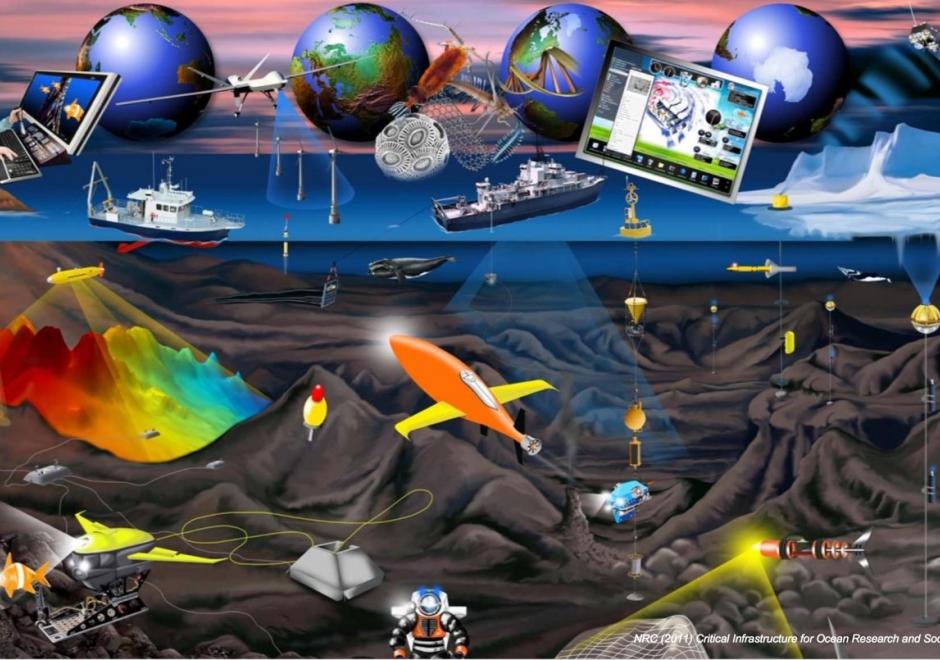
Image courtesy of the National Academy of Sciences Ocean Studies Board


GIS&T has traditionally provided effective technological solutions to the integration, visualization, and analysis of heterogeneous, georeferenced data on land. In recent years, our ability to measure change in the ocean is increasing, not only because of improved measuring devices and scientific techniques, but also because new GIS&T is aiding us in better understanding this dynamic environment. The domain has progressed from applications that merely collect and display data to complex simulation, modeling, and the development of new research methods and concepts.

AM-45 - Mathematical modeling
  • Explain how optimization models can be used to generate models of alternate options for presentation to decision makers
  • Explain, using the concept of combinatorial complexity, why some location problems are very hard to solve
  • Compare and contrast the concepts of discrete location problems and continuous location problems
  • Explain the concept of solution space
  • Explain the principles of operations research modeling and location modeling
AM-48 - Mathematical models of uncertainty: probability and statistics
  • Devise simple ways to represent probability information in GIS
  • Describe the basic principles of randomness and probability
  • Compute descriptive statistics and geostatistics of geographic data
  • Interpret descriptive statistics and geostatistics of geographic data
  • Recognize the assumptions underlying probability and geostatistics and the situations in which they are useful analytical tools
DM-31 - Mathematical models of vagueness: Fuzzy sets and rough sets
  • Compare and contrast the relative merits of fuzzy sets, rough sets, and other models
  • Differentiate between fuzzy set membership and probabilistic set membership
  • Explain the problems inherent in fuzzy sets
  • Create appropriate membership functions to model vague phenomena
KE-17 - Measuring costs
  • Explain how the saying “developing data is the largest single cost of implementing GIS” could be true for an organization that is already collecting data as part of its regular operations
  • Describe some non-fiduciary barriers to GIS implementation
  • Summarize what the literature suggests as means for overcoming some of the non-fiduciary barriers to GIS implementation
  • Outline sources of additional costs associated with development of an enterprise GIS
  • Outline the categories of costs that an organization should anticipate as it plans to design and implement a GIS
GS-08 - Mechanisms of control of geospatial information
  • Distinguish among the various intellectual property rights, including copyright, patent, trademark, business methods, and other rights
  • Explain how databases may be protected under U.S. copyright law
  • Describe advantages and disadvantages of “open” alternatives to copyright protection, such as the Creative Commons
  • Outline the intellectual property protection clause of a contract that a local government uses to license geospatial data to a community group
  • Explain how maps may be protected under U.S. copyright law
  • Differentiate geospatial information from other works protected under copyright law
DM-26 - Mereology: structural relationships
  • Describe particular geographic phenomena in terms of their place in mereonomic hierarchies (parts and composites)
  • Explain the contributions of formal mathematical methods such as graph theory to the study and application of geographic structures
  • Represent structural relationships in GIS data
  • Explain the effects of spatial or temporal scale on the perception of structure
  • Explain the modeling of structural relationships in standard GIS data models, such as stored topology
  • Identify phenomena that are best understood as networks
DM-57 - Metadata
  • Define “metadata” in the context of the geospatial data set
  • Use a metadata utility to create a geospatial metadata document for a digital database you created
  • Formulate metadata for a graphic output that would be distributed to the general public
  • Formulate metadata for a geostatistical analysis that would be released to an experienced audience
  • Compose data integrity statements for a geostatistical or spatial analysis to be included in graphic output
  • Identify software tools available to support metadata creation
  • Interpret the elements of an existing metadata document
  • Explain why metadata production should be integrated into the data production and database development workflows, rather than treated as an ancillary activity
  • Outline the elements of the U.S. geospatial metadata standard
  • Explain the ways in which metadata increases the value of geospatial data

Pages