AM-21 - The Evolution of Geospatial Reasoning, Analytics, and Modeling

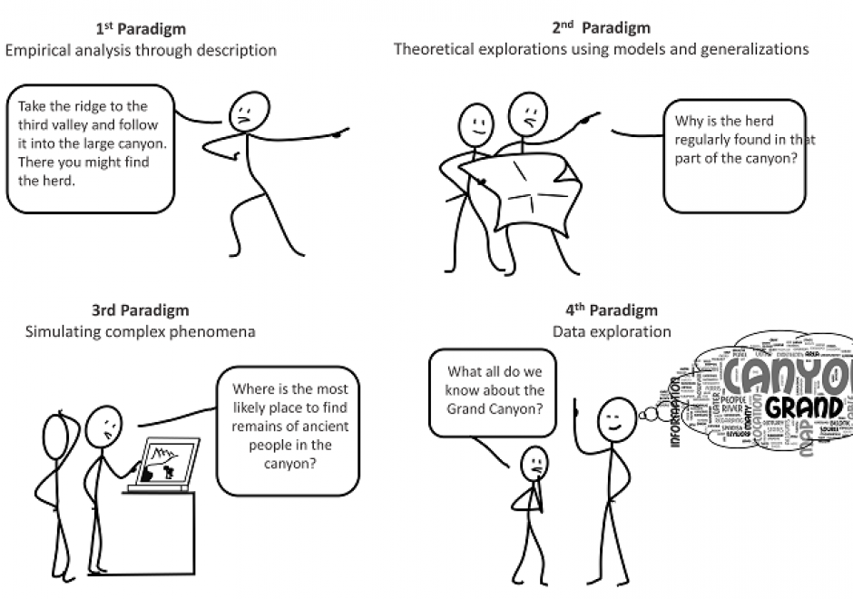
The field of geospatial analytics and modeling has a long history coinciding with the physical and cultural evolution of humans. This history is analyzed relative to the four scientific paradigms: (1) empirical analysis through description, (2) theoretical explorations using models and generalizations, (3) simulating complex phenomena and (4) data exploration. Correlations among developments in general science and those of the geospatial sciences are explored. Trends identify areas ripe for growth and improvement in the fourth and current paradigm that has been spawned by the big data explosion, such as exposing the ‘black box’ of GeoAI training and generating big geospatial training datasets. Future research should focus on integrating both theory- and data-driven knowledge discovery.


DM-85 - Point, Line, and Area Generalization
Generalization is an important and unavoidable part of making maps because geographic features cannot be represented on a map without undergoing transformation. Maps abstract and portray features using vector (i.e. points, lines and polygons) and raster (i.e pixels) spatial primitives which are usually labeled. These spatial primitives are subjected to further generalization when map scale is changed. Generalization is a contradictory process. On one hand, it alters the look and feel of a map to improve overall user experience especially regarding map reading and interpretive analysis. On the other hand, generalization has documented quality implications and can sacrifice feature detail, dimensions, positions or topological relationships. A variety of techniques are used in generalization and these include selection, simplification, displacement, exaggeration and classification. The techniques are automated through computer algorithms such as Douglas-Peucker and Visvalingam-Whyatt in order to enhance their operational efficiency and create consistent generalization results. As maps are now created easily and quickly, and used widely by both experts and non-experts owing to major advances in IT, it is increasingly important for virtually everyone to appreciate the circumstances, techniques and outcomes of generalizing maps. This is critical to promoting better map design and production as well as socially appropriate uses.