CP-04 - Artificial Intelligence Tools and Platforms for GIS

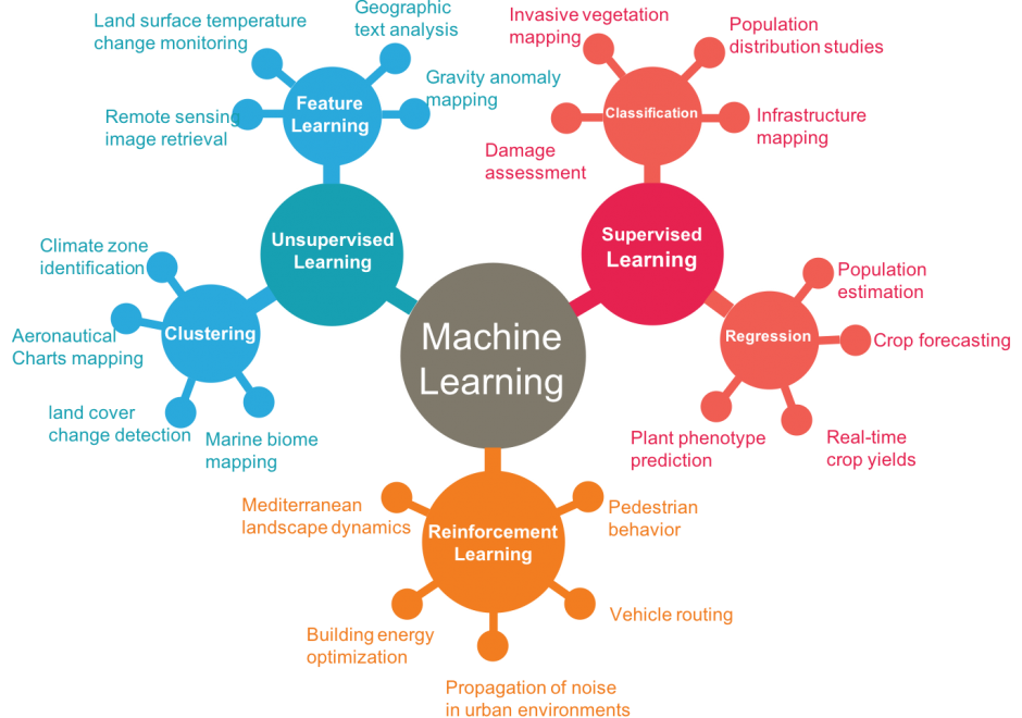
Artificial intelligence is the study of intelligence agents as demonstrated by machines. It is an interdisciplinary field involving computer science as well as, various kinds of engineering and science, for example, robotics, bio-medical engineering, that accentuates automation of human acts and intelligence through machines. AI represents state-of-the-art use of machines to bring about algorithmic computation and understanding of tasks that include learning, problem solving, mapping, perception, and reasoning. Given the data and a description of its properties and relations between objects of interest, AI methods can perform the aforementioned tasks. Widely applied AI capabilities, e.g. learning, are now achievable at large scale through machine learning (ML), large volumes of data and specialized computational machines. ML encompasses learning without any kind of supervision (unsupervised learning) and learning with full supervision (supervised learning). Widely applied supervised learning techniques include deep learning and other machine learning methods that require less data than deep learning e.g. support vector machines, random forests. Unsupervised learning examples include dictionary learning, independent component analysis, and autoencoders. For application tasks with less labeled data, both supervised and unsupervised techniques can be adapted in a semi-supervised manner to produce accurate models and to increase the size of the labeled training data.


CV-05 - Statistical Mapping (Enumeration, Normalization, Classification)
Proper communication of spatial distributions, trends, and patterns in data is an important component of a cartographers work. Geospatial data is often large and complex, and due to inherent limitations of size, scalability, and sensitivity, cartographers are often required to work with data that is abstracted, aggregated, or simplified from its original form. Working with data in this manner serves to clarify cartographic messages, expedite design decisions, and assist in developing narratives, but it also introduces a degree of abstraction and subjectivity in the map that can make it easy to infer false messages from the data and ultimately can mislead map readers. This entry introduces the core topics of statistical mapping around cartography. First, we define enumeration and the aggregation of data to units of enumeration. Next, we introduce the importance of data normalization (or standardization) to more truthfully communicate cartographically and, lastly, discuss common methods of data classification and how cartographers bin data into groups that simplify communication.