Search Page

Showing 1 - 7 of 7
AM-94 - Machine Learning Approaches

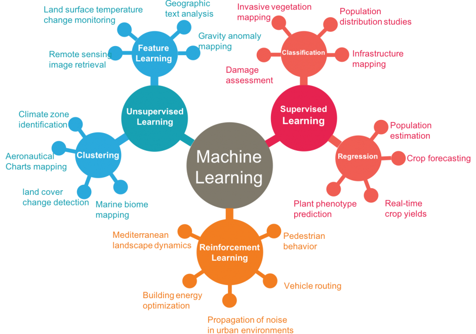
Machine learning approaches are increasingly used across numerous applications in order to learn from data and generate new knowledge discoveries, advance scientific studies and support automated decision making. In this knowledge entry, the fundamentals of Machine Learning (ML) are introduced, focusing on how feature spaces, models and algorithms are being developed and applied in geospatial studies. An example of a ML workflow for supervised/unsupervised learning is also introduced. The main challenges in ML approaches and our vision for future work are discussed at the end.

AM-97 - An Introduction to Spatial Data Mining
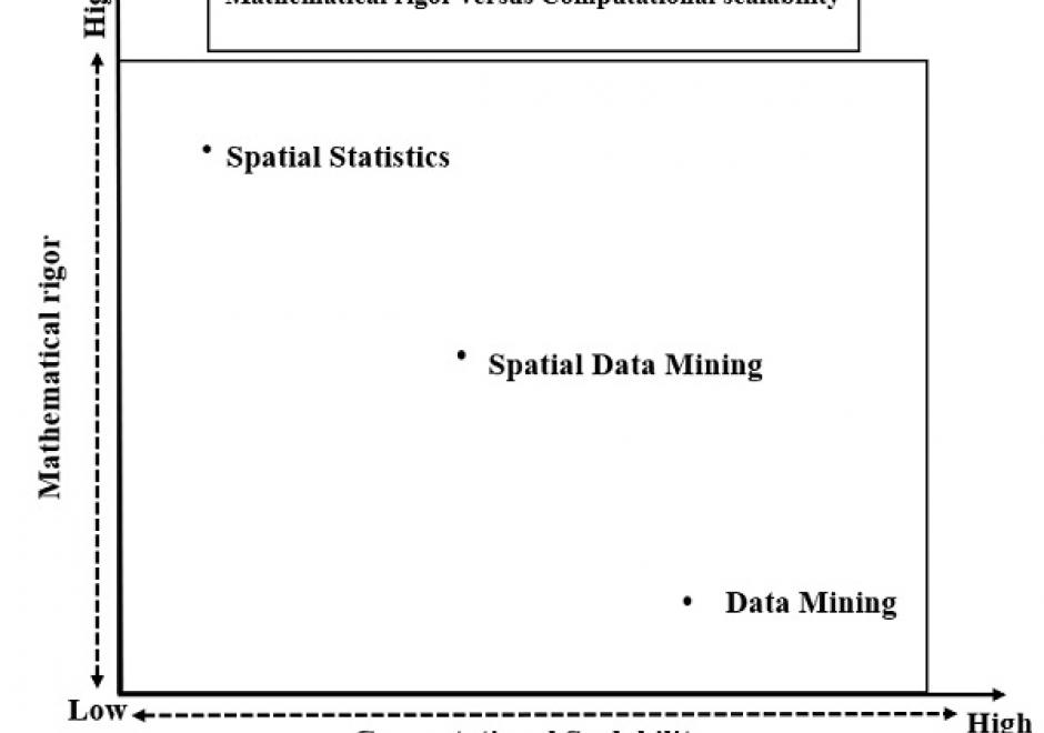
The goal of spatial data mining is to discover potentially useful, interesting, and non-trivial patterns from spatial data-sets (e.g., GPS trajectory of smartphones). Spatial data mining is societally important having applications in public health, public safety, climate science, etc. For example, in epidemiology, spatial data mining helps to nd areas with a high concentration of disease incidents to manage disease outbreaks. Computational methods are needed to discover spatial patterns since the volume and velocity of spatial data exceed the ability of human experts to analyze it. Spatial data has unique characteristics like spatial autocorrelation and spatial heterogeneity which violate the i.i.d (Independent and Identically Distributed) assumption of traditional statistic and data mining methods. Therefore, using traditional methods may miss patterns or may yield spurious patterns, which are costly in societal applications. Further, there are additional challenges such as MAUP (Modiable Areal Unit Problem) as illustrated by a recent court case debating gerrymandering in elections. In this article, we discuss tools and computational methods of spatial data mining, focusing on the primary spatial pattern families: hotspot detection, collocation detection, spatial prediction, and spatial outlier detection. Hotspot detection methods use domain information to accurately model more active and high-density areas. Collocation detection methods find objects whose instances are in proximity to each other in a location. Spatial prediction approaches explicitly model the neighborhood relationship of locations to predict target variables from input features. Finally, spatial outlier detection methods find data that differ from their neighbors. Lastly, we describe future research and trends in spatial data mining.

CV-05 - Statistical Mapping (Enumeration, Normalization, Classification)

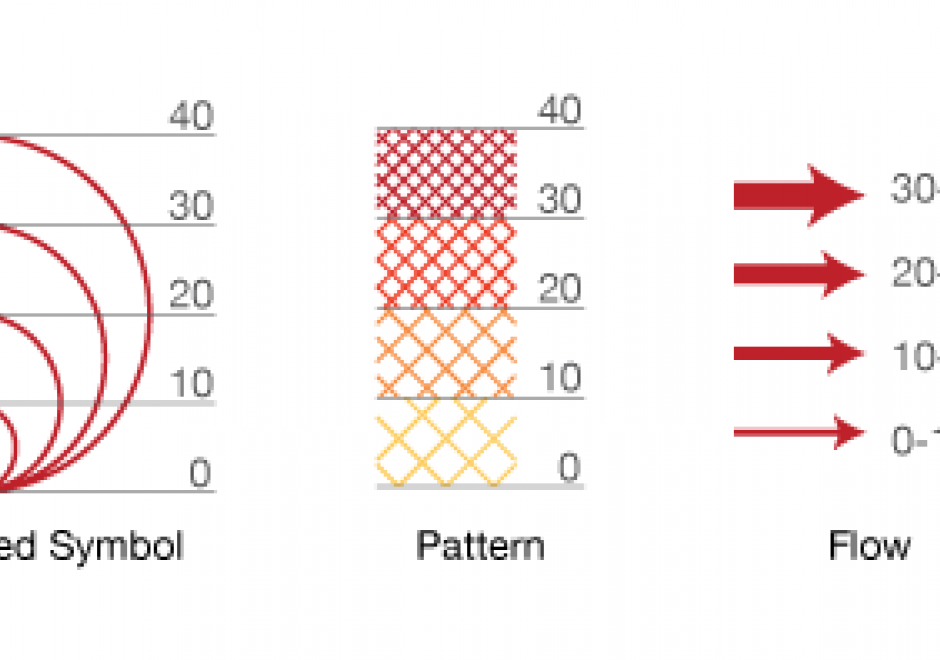
Proper communication of spatial distributions, trends, and patterns in data is an important component of a cartographers work. Geospatial data is often large and complex, and due to inherent limitations of size, scalability, and sensitivity, cartographers are often required to work with data that is abstracted, aggregated, or simplified from its original form. Working with data in this manner serves to clarify cartographic messages, expedite design decisions, and assist in developing narratives, but it also introduces a degree of abstraction and subjectivity in the map that can make it easy to infer false messages from the data and ultimately can mislead map readers. This entry introduces the core topics of statistical mapping around cartography. First, we define enumeration and the aggregation of data to units of enumeration. Next, we introduce the importance of data normalization (or standardization) to more truthfully communicate cartographically and, lastly, discuss common methods of data classification and how cartographers bin data into groups that simplify communication.

AM-107 - Spatial Data Uncertainty

Although spatial data users may not be aware of the inherent uncertainty in all the datasets they use, it is critical to evaluate data quality in order to understand the validity and limitations of any conclusions based on spatial data. Spatial data uncertainty is inevitable as all representations of the real world are imperfect. This topic presents the importance of understanding spatial data uncertainty and discusses major methods and models to communicate, represent, and quantify positional and attribute uncertainty in spatial data, including both analytical and simulation approaches. Geo-semantic uncertainty that involves vague geographic concepts and classes is also addressed from the perspectives of fuzzy-set approaches and cognitive experiments. Potential methods that can be implemented to assess the quality of large volumes of crowd-sourced geographic data are also discussed. Finally, this topic ends with future directions to further research on spatial data quality and uncertainty.

CP-04 - Artificial Intelligence Tools and Platforms for GIS

Artificial intelligence is the study of intelligence agents as demonstrated by machines. It is an interdisciplinary field involving computer science as well as, various kinds of engineering and science, for example, robotics, bio-medical engineering, that accentuates automation of human acts and intelligence through machines. AI represents state-of-the-art use of machines to bring about algorithmic computation and understanding of tasks that include learning, problem solving, mapping, perception, and reasoning. Given the data and a description of its properties and relations between objects of interest, AI methods can perform the aforementioned tasks. Widely applied AI capabilities, e.g. learning, are now achievable at large scale through machine learning (ML), large volumes of data and specialized computational machines. ML encompasses learning without any kind of supervision (unsupervised learning) and learning with full supervision (supervised learning). Widely applied supervised learning techniques include deep learning and other machine learning methods that require less data than deep learning e.g. support vector machines, random forests. Unsupervised learning examples include dictionary learning, independent component analysis, and autoencoders. For application tasks with less labeled data, both supervised and unsupervised techniques can be adapted in a semi-supervised manner to produce accurate models and to increase the size of the labeled training data.

CV-34 - Map Icon Design

The use of map icons is an efficient way to condense a map object into a concise expression of geospatial data. Like all cartographic design, map icon design merges artistic and scientific elements into symbolic representations intended to be readily legible to map readers. This entry reviews the types of map icons and elements of icon design, including the ways in which the visual variables are used in map icon communication. As communicative devices, icons are imbued with cultural meanings and can oftentimes lead to the preservation of stereotypes. This review concludes with an examination of icons’ perpetuation of – and challenge to – cultural stereotypes.

CV-28 - Lesson Design in Cartography Education

This entry describes six general variables of lesson design in cartography education and offers some practical advice for the development of materials for teaching cartography. First, a lesson’s scope concerns the set of ideas included in a lesson and helps identify different types of lessons based on the kinds of knowledge that they contain. Second, learning objectives concern the things that students should be able to do following a lesson and relate to different cognitive processes of learning. Third, a lesson’s scheme deals with the organizational framework for delivering content. Fourth, a lesson’s guidance concerns the amount and quality of supportive information provided. Fifth, a lesson’s sequence may involve one or more strategies for ordering content. Sixth, a lesson’s activity concerns what students do during a lesson and is often associated with different learning outcomes. These six variables help differentiate traditions for teaching cartography, elucidate some of the recurring challenges in cartography education, and offer strategies for designing lessons to foster meaningful learning outcomes.