2017 QUARTER 03

A B C D E F G H I K L M N O P R S T U V W
KE-15 - Models of benefits
  • Describe recent models of the benefits of GIS&T applications
  • Explain how profit considerations have shaped the evolution of GIS&T
  • Outline the elements of a business case that justifies an organization’s investment in an enterprise geospatial information infrastructure
  • Discuss the extent to which external costs and benefits enhance the economic case for GIS
AM-13 - Multi-criteria evaluation
  • Describe the implementation of an ordered weighting scheme in a multiple-criteria aggregation
  • Compare and contrast the terms multi-criteria evaluation, weighted linear combination, and site suitability analysis
  • Differentiate between contributing factors and constraints in a multi-criteria application
  • Explain the legacy of multi-criteria evaluation in relation to cartographic modeling
  • Determine which method to use to combine criteria (e.g., linear, multiplication)
  • Create initial weights using the analytical hierarchy process (AHP)
  • Calibrate a linear combination model by adjusting weights using a test data set
DC-16 - Nature of multispectral image data

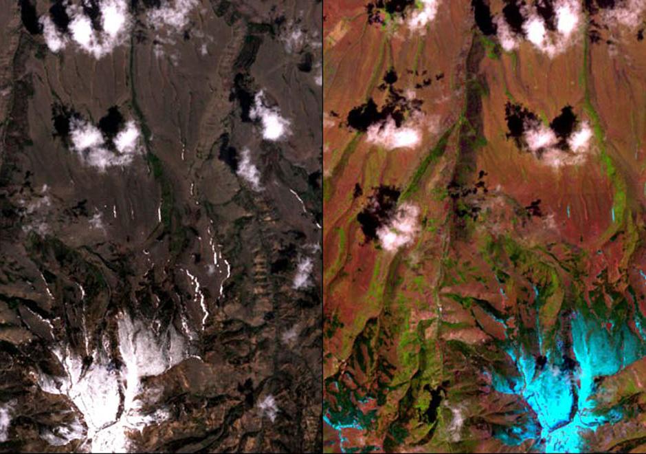
A multispectral image comprises a set of co-registered images, each of which captures the spatially varying brightness of a scene in a specific spectral band, or electromagnetic wavelength region. An image is structured as a raster, or grid, of pixels. Multispectral images are used as a visual backdrop for other GIS layers, to provide information that is manually interpreted from images, or to generate automatically-derived thematic layers, for example through classification. The scale of multispectral images has spatial, spectral, radiometric and temporal components. Each component of scale has two aspects, extent (or coverage), and grain (or resolution). The brightness variations of an image are determined by factors that include (1) illumination variations and effects of the atmosphere, (2) spectral properties of materials in the scene (particularly reflectance, but also, depending on the wavelength, emittance), (3) spectral bands of the sensor, and (4) display options, such as the contrast stretch, which affect the visualization of the image. This topic review focuses primarily on optical remote sensing in the visible, near infrared and shortwave infrared parts of the electromagnetic spectrum, with an emphasis on satellite imagery.  

AM-05 - Neighborhoods
  • Discuss the role of Voronoi polygons as the dual graph of the Delaunay triangulation
  • Explain how Voronoi polygons can be used to define neighborhoods around a set of points
  • Outline methods that can be used to establish non-overlapping neighborhoods of similarity in raster datasets
  • Create proximity polygons (Thiessen/Voronoi polygons) in point datasets
  • Write algorithms to calculate neighborhood statistics (minimum, maximum, focal flow) using a moving window in raster datasets
  • Explain how the range of map algebra operations (local, focal, zonal, and global) relate to the concept of neighborhoods
FC-19 - Networks defined
  • Define different interpretations of “cost” in various routing applications
  • Describe networks that apply to specific applications or industries
  • Create a data set with network attributes and topology
  • Define the following terms pertaining to a network: Loops, multiple edges, the degree of a vertex, walk, trail, path, cycle, fundamental cycle
AM-63 - Non-linearity relationships and non-Gaussian distributions
  • Understand how some machine learning methods might be more adept at modeling or representing such distributions
  • Define non-linear and non-Gaussian distributions in a geospatial data environment
  • Exemplify non-linear and non-Gaussian distributions in a geospatial data environment
DM-17 - Object-based spatial databases
  • Discuss the merits of storing geometric data in the same location as attribute data
  • Evaluate the advantages and disadvantages of the object-based data model compared to the layer-based vector data model (topological or spaghetti)
  • Describe the architectures of various object-relational spatial data models, including spatial extensions of DBMS, proprietary object-based data models from GIS vendors, and open-source and standards-based efforts
  • Differentiate between the topological vector data model and spaghetti object data with topological rulebases
  • Write a script (in a GIS, database, or Web environment) to read and write data in an objectbased spatial database
  • Transfer geospatial data from an XML schema to a database
  • Discuss the degree to which various object-relational spatial data models approximate a true object-oriented paradigm, and whether they should
DM-04 - Object-oriented DBMS
  • Describe the basic elements of the object-oriented paradigm, such as inheritance, encapsulation, methods, and composition
  • Evaluate the degree to which the object-oriented paradigm does or does not approximate cognitive structures
  • Explain how the principle of inheritance can be implemented using an object-oriented programming approach
  • Defend or refute the notion that the Extensible Markup Language (XML) is a form of object-oriented database
  • Explain how the properties of object orientation allows for combining and generalizing objects
  • Evaluate the advantages and disadvantages of object-oriented databases compared to relational databases, focusing on representational power, data entry, storage efficiency, and query performance
  • Implement a GIS database design in an off-the-shelf, object-oriented database
  • Differentiate between object-oriented programming and object-oriented databases
DM-61 - Ongoing GIS revision
  • Describe a method that allows users within an organization to access data, including methods of data sharing, version control, and maintenance
  • Describe how spatial data and GIS&T can be integrated into a work flow process
  • Develop a plan for user feedback and self-evaluation procedures
  • Evaluate how external spatial data sources can be incorporated into the business process
  • Evaluate internal spatial databases for continuing adequacy
  • Evaluate the efficiency and effectiveness of an existing enterprise GIS
  • Evaluate the needs for spatial data sources including currency, accuracy and access, specifically addressing issues related to financial costs, sharing arrangements, online/realtime, and transactional processes across an organization
  • Illustrate how a business process analysis can be used to periodically review system requirements
  • List improvements that may be made to the design of an existing GIS
  • Describe how internal spatial data sources can be handled during an implementation process
FC-35 - Openness
  • Assess the status of openness in the GIS&T field
  • In the role of a consultant or chief information officer, respond to a client’s or colleague’s question about the future prospects of open standards and systems in GIS&T
  • Discuss the advantages and disadvantages of adopting open systems in the context of a local government
  • Differentiate “open standards,” “open source,” and “open systems”

Pages