Search Page

Showing 1 - 7 of 7
GS-14 - GIS and Critical Ethics

This entry discusses and defines ethical critiques and GIS. It complements other GIS&T Body of Knowledge entries on Professional and Practical Ethics and Codes of Ethics for GIS Professionals. Critical ethics is presented as the attempt to provide a better understanding of data politics. Knowledge is never abstract or non-material. Spatial data, as a form of knowledge, may mask, conceal, disallow or disavow, even as it speaks, permits and claims. A critical ethics of GIS investigates this situated power-knowledge. Two concepts from educational pedagogy are suggested: threshold and troublesome knowledge. As we use and continue to learn GIS, these concepts may enrich our experience by usefully leading us astray. This points finally to how ethical critique is practical, empirical and political, rather than abstract or theoretical.

GS-04 - Location Privacy

How effective is this fence at keeping people, objects, or sensitive information inside or outside? Location Privacy is concerned with the claim of individuals to determine when, how, and to what extent information about themselves and their location is communicated to others. Privacy implications for spatial data are growing in importance with growing awareness of the value of geo-information and the advent of the Internet of Things, Cloud-Based GIS, and Location Based Services.  

In the rapidly changing landscape of GIS and public domain spatial data, issues of location privacy are more important now than ever before. Technological trailblazing tends to precede legal safeguards. The development of GIS tools and the work of the GIS&T research and user community have typically occurred at a much faster rate than the establishment of legislative frameworks governing the use of spatial data, including privacy concerns. Yet even in a collaborative environment that characterizes the GIS&T community, and despite progress made, the issue of location privacy is a particularly thorny one, occurring as it does at the intersection of geotechnology and society.

CV-19 - Big Data Visualization

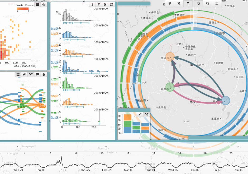
As new information and communication technologies have altered so many aspects of our daily lives over the past decades, they have simultaneously stimulated a shift in the types of data that we collect, produce, and analyze. Together, this changing data landscape is often referred to as "big data." Big data is distinguished from "small data" not only by its high volume but also by the velocity, variety, exhaustivity, resolution, relationality, and flexibility of the datasets. This entry discusses the visualization of big spatial datasets. As many such datasets contain geographic attributes or are situated and produced within geographic space, cartography takes on a pivotal role in big data visualization. Visualization of big data is frequently and effectively used to communicate and present information, but it is in making sense of big data – generating new insights and knowledge – that visualization is becoming an indispensable tool, making cartography vital to understanding geographic big data. Although visualization of big data presents several challenges, human experts can use visualization in general, and cartography in particular, aided by interfaces and software designed for this purpose, to effectively explore and analyze big data.

KE-31 - Professional Certification

Professional Certification has been a part of the GIS enterprise for over two decades. There are several different certification programs and related activities now in operation within GIS, though there has been much debate over its merits, how it should be done and by whom. 

KE-32 - Competence in GIS&T Knowledge Work

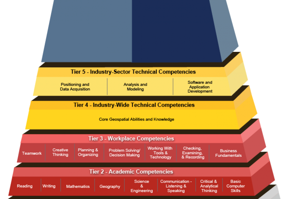
“Competence” is a word that rolls off the tongues of instructional designers, education administrators, and HR people. Others find it hard to swallow. For some GIS&T educators, competence connotes an emphasis on vocational instruction that’s unworthy of the academy. This entry challenges skeptical educators to rethink competence not just as readiness for an occupation, but first and foremost as the readiness to live life to the fullest, and to contribute to a sustainable future. The entry considers the OECD’s “Key Competencies for a Successful Life and Well-Functioning Society,” as well as the specialized GIS&T competencies specified in the U.S. Department of Labor’s Geospatial Technology Competency Model. It presents findings of a survey in which 226 self-selected members of Esri’s Young Professionals Network observe that competencies related to the GTCM’s Software and App Development Segment were under-developed in their university studies. Looking ahead, in the context of an uncertain future in which, some say, many workers are at risk of “technological unemployment,” the entry considers which GIS&T competencies are likely to be of lasting value.

AM-90 - Computational Movement Analysis

Figure 1. Group movement patterns as illustrated in this coordinated escape behavior of a group of mountain goat (Rubicapra rubicapra) evading approaching hikers on the Fuorcla Trupchun near the Italian/Swiss border are at the core of computational movement analysis. Once the trajectories of moving objects are collected and made accessible for computational processing, CMA aims at a better understanding of the characteristics of movement processes of animals, people or things in geographic space.


Computational Movement Analysis (CMA) develops and applies analytical computational tools aiming at a better understanding of movement data. CMA copes with the rapidly growing data streams capturing the mobility of people, animals, and things roaming geographic spaces. CMA studies how movement can be represented, modeled, and analyzed in GIS&T. The CMA toolbox includes a wide variety of approaches, ranging from database research, over computational geometry to data mining and visual analytics.

CV-26 - Cartography and Power

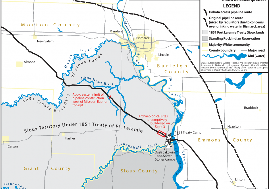
Over twenty five years ago, Brian Harley (1989, p. 2) implored cartographers to “search for the social forces that have structured cartography and to locate the presence of power – and its effects – in all map knowledge.” In the intervening years, while Harley has become a bit of a touchstone for citational practices acknowledging critical cartography (Edney, 2015), both theoretical understandings of power as well as the tools and technologies that go into cartographic production have changed drastically. This entry charts some of the many ways that power may be understood to manifest within and through maps and mapmaking practices. To do so, after briefly situating work on cartography and power historically, it presents six critiques of cartography and power in the form of dialectics. First, building from Harley’s earlier work, it defines a deconstructivist approach to mapping and places it in contrast to hermeneutic phenomenological approaches. Second, it places state-sanctioned practices of mapping against participatory and counter-mapping ones. Third, epistemological understanding of maps and their affects are explored through the dialectic of the map as a static object versus more processual, ontogenetic understandings of maps. Finally, the chapter concludes by suggesting the incomplete, heuristic nature of both the approaches and ideas explored here as well as the practices of critical cartography itself. Additional resources for cartographers and GIScientists seeking to further explore critical approaches to maps are provided.