Search Page

Showing 11 - 20 of 20
CP-26 - eScience, the Evolution of Science

Science—and research more broadly—face many challenges as its practitioners struggle to accommodate new challenges around reproducibility and openness.  The current practice of science limits access to knowledge, information and infrastructure, which in turn leads to inefficiencies, frustrations and a lack of rigor.  Many useful research outcomes are never used because they are too difficult to find, or to access, or to understand.

New computational methods and infrastructure provide opportunities to reconceptualize how science is conducted, how it is shared, how it is evaluated and how it is reused.  And new data sources changed what can be known, and how well, and how frequently.  This article describes some of the major themes of eScience/eResearch aimed at improving the process of doing science.

KE-32 - Competence in GIS&T Knowledge Work
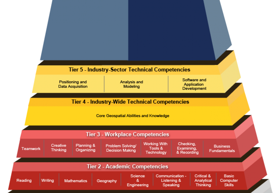
“Competence” is a word that rolls off the tongues of instructional designers, education administrators, and HR people. Others find it hard to swallow. For some GIS&T educators, competence connotes an emphasis on vocational instruction that’s unworthy of the academy. This entry challenges skeptical educators to rethink competence not just as readiness for an occupation, but first and foremost as the readiness to live life to the fullest, and to contribute to a sustainable future. The entry considers the OECD’s “Key Competencies for a Successful Life and Well-Functioning Society,” as well as the specialized GIS&T competencies specified in the U.S. Department of Labor’s Geospatial Technology Competency Model. It presents findings of a survey in which 226 self-selected members of Esri’s Young Professionals Network observe that competencies related to the GTCM’s Software and App Development Segment were under-developed in their university studies. Looking ahead, in the context of an uncertain future in which, some say, many workers are at risk of “technological unemployment,” the entry considers which GIS&T competencies are likely to be of lasting value.


AM-90 - Computational Movement Analysis

Figure 1. Group movement patterns as illustrated in this coordinated escape behavior of a group of mountain goat (Rubicapra rubicapra) evading approaching hikers on the Fuorcla Trupchun near the Italian/Swiss border are at the core of computational movement analysis. Once the trajectories of moving objects are collected and made accessible for computational processing, CMA aims at a better understanding of the characteristics of movement processes of animals, people or things in geographic space.


Computational Movement Analysis (CMA) develops and applies analytical computational tools aiming at a better understanding of movement data. CMA copes with the rapidly growing data streams capturing the mobility of people, animals, and things roaming geographic spaces. CMA studies how movement can be represented, modeled, and analyzed in GIS&T. The CMA toolbox includes a wide variety of approaches, ranging from database research, over computational geometry to data mining and visual analytics.

CP-15 - Mobile Devices

Mobile devices refer to a computing system intended to be used by hand, such as smartphones or tablet computers. Mobile devices more broadly refer to mobile sensors and other hardware that has been made for relatively easy transportability, including wearable fitness trackers. Mobile devices are particularly relevant to Geographic Information Systems and Technology (GIS&T) in that they house multiple locational sensors that were until recently very expensive and only accessible to highly trained professionals. Now, mobile devices serve an important role in computing platform infrastructure and are key tools for collecting information and disseminating information to, from, and among heterogeneous and spatially dispersed audiences and devices. Due to the miniaturization and the decrease in the cost of computing capabilities, there has been widespread social uptake of mobile devices, making them ubiquitous. Mobile devices are embedded in Geographic Information Science (GIScience) meaning GIScience is increasingly permeating lived experiences and influencing social norms through the use of mobile devices. In this entry, locational sensors are described, with computational considerations specifically for mobile computing. Mobile app development is described in terms of key considerations for native versus cross-platform development. Finally, mobile devices are contextualized within computational infrastructure, addressing backend and frontend considerations.

GS-15 - Feminist Critiques of GIS

Feminist interactions with GIS started in the 1990s in the form of strong critiques against GIS inspired by feminist and postpositivist theories. Those critiques mainly highlighted a supposed epistemological dissonance between GIS and feminist scholarship. GIS was accused of being shaped by positivist and masculinist epistemologies, especially due to its emphasis on vision as the principal way of knowing. In addition, feminist critiques claimed that GIS was largely incompatible with positionality and reflexivity, two core concepts of feminist theory. Feminist critiques of GIS also discussed power issues embedded in GIS practices, including the predominance of men in the early days of the GIS industry and the development of GIS practices for the military and surveillance purposes.

At the beginning of the 21st century, feminist geographers reexamined those critiques and argued against an inherent epistemological incompatibility between GIS methods and feminist scholarship. They advocated for a reappropriation of GIS by feminist scholars in the form of critical feminist GIS practices. The critical GIS perspective promotes an unorthodox, reconstructed, and emancipatory set of GIS practices by critiquing dominant approaches of knowledge production, implementing GIS in critically informed progressive social research, and developing postpositivist techniques of GIS. Inspired by those debates, feminist scholars did reclaim GIS and effectively developed feminist GIS practices.

CV-01 - Cartography and Science

"Science" is used both to describe a general, systematic approach to understanding the world and to refer to that approach as it is applied to a specific phenomenon of interest, for example, "geographic information science." The scientific method is used to develop theories that explain phenomena and processes. It consists of an iterative cycle of several steps: proposing a hypothesis, devising a way to make empirical observations that test that hypothesis, and finally, refining the hypothesis based on the empirical observations. "Scientific cartography" became a dominant mode of cartographic research and inquiry after World War II, when there was increased focus on the efficacy of particular design decisions and how particular maps were understood by end users. This entry begins with a brief history of the development of scientific cartographic approaches, including how they are deployed in map design research today. Next it discusses how maps have been used by scientists to support scientific thinking. Finally, it concludes with a discussion of how maps are used to communicate the results of scientific thinking.

CV-26 - Cartography and Power

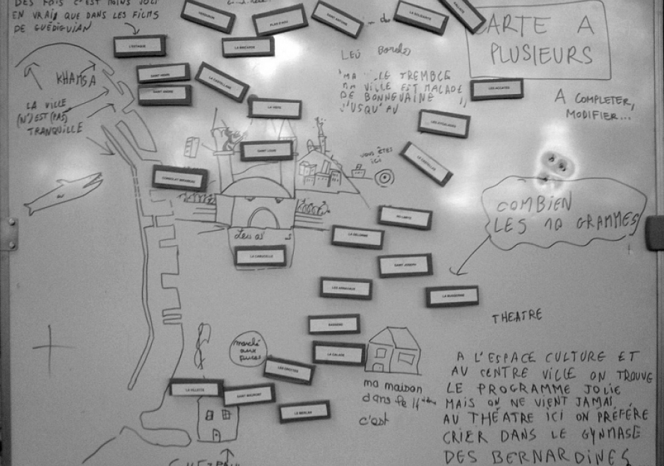
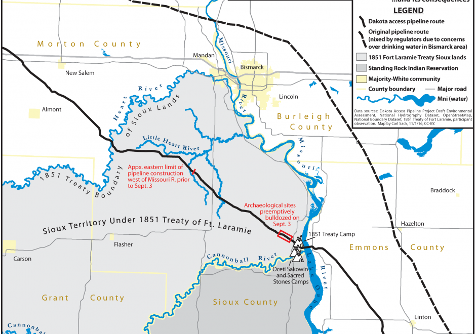
Over twenty five years ago, Brian Harley (1989, p. 2) implored cartographers to “search for the social forces that have structured cartography and to locate the presence of power – and its effects – in all map knowledge.” In the intervening years, while Harley has become a bit of a touchstone for citational practices acknowledging critical cartography (Edney, 2015), both theoretical understandings of power as well as the tools and technologies that go into cartographic production have changed drastically. This entry charts some of the many ways that power may be understood to manifest within and through maps and mapmaking practices. To do so, after briefly situating work on cartography and power historically, it presents six critiques of cartography and power in the form of dialectics. First, building from Harley’s earlier work, it defines a deconstructivist approach to mapping and places it in contrast to hermeneutic phenomenological approaches. Second, it places state-sanctioned practices of mapping against participatory and counter-mapping ones. Third, epistemological understanding of maps and their affects are explored through the dialectic of the map as a static object versus more processual, ontogenetic understandings of maps. Finally, the chapter concludes by suggesting the incomplete, heuristic nature of both the approaches and ideas explored here as well as the practices of critical cartography itself. Additional resources for cartographers and GIScientists seeking to further explore critical approaches to maps are provided.

DA-45 - GIS&T in Business

Geographic Information Systems and Technology are utilized extensively in the business sector and have become a strategic element for competition and partnering.  Although the traditional digital map layers and tables remain at the core of business GIS, the spatial architecture in firms now includes location analytics, location intelligence, AI, machine learning, imagery, social media linkages.  Cloud-based solutions provide platform flexibility, centralized data, and potential to roll out user-friendly webGIS across large segments of business users and customers. GIS is well suited to the digital transformations that are essential for firms, large and small.  With these advances, GIS has become prominent and its function has moved upwards in companies’ organizational hierarchies, with enterprise GIS even being recognized in the C-suite.  UPS is an example in which GIS is now a critical corporate competitive factor. In spite of these successes, a gap remains in the supply of skilled spatial workforce for companies. Business schools can contribute by changing by school leadership “getting it” about spatial, bringing GIS into the mainstream curricula, developing training for business faculty in teaching, conducting research in location analytics, and populating student body and alumni base with knowledge and enthusiasm for spatial thinking and management.

FC-03 - Philosophical Perspectives

This entry follows in the footsteps of Anselin’s famous 1989 NCGIA working paper entitled “What is special about spatial?” (a report that is very timely again in an age when non-spatial data scientists are ignorant of the special characteristics of spatial data), where he outlines three unrelated but fundamental characteristics of spatial data. In a similar vein, I am going to discuss some philosophical perspectives that are internally unrelated to each other and could warrant individual entries in this Body of Knowledge. The first one is the notions of space and time and how they have evolved in philosophical discourse over the past three millennia. Related to these are aspects of absolute versus relative conceptions of these two fundamental constructs. The second is a brief introduction to key philosophical approaches and how they impact geospatial science and technology use today. The third is a discussion of which of the promises of the Quantitative Revolution in Geography and neighboring disciplines have been fulfilled by GIScience (and what is still missing). The fourth and final one is an introduction to the role that GIScience may play in what has recently been formalized as theory-guided data science.

KE-33 - Organizational Models for GIS Management

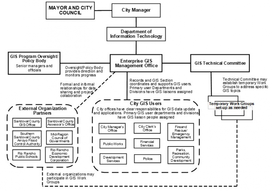
Organizational structures and management practices for GIS programs are numerous and complex. This topic begins with an explanation of organizational and management concepts and context that are particularly relevant to GIS program and project management, including strategic planning and stakeholders. Specific types of organizations that typically use GIS technology are described and organizational structure types are explained. For GIS Program management, organizational placement, organizational components, and management control and policies are covered in depth. Multi-organizational GIS Programs are also discussed. Additional topics include management roles and technology trends that affect organizational structure. It concludes with a general description of GIS Project management. 

Pages