DC-24 - Unmanned Aerial Systems (UAS)

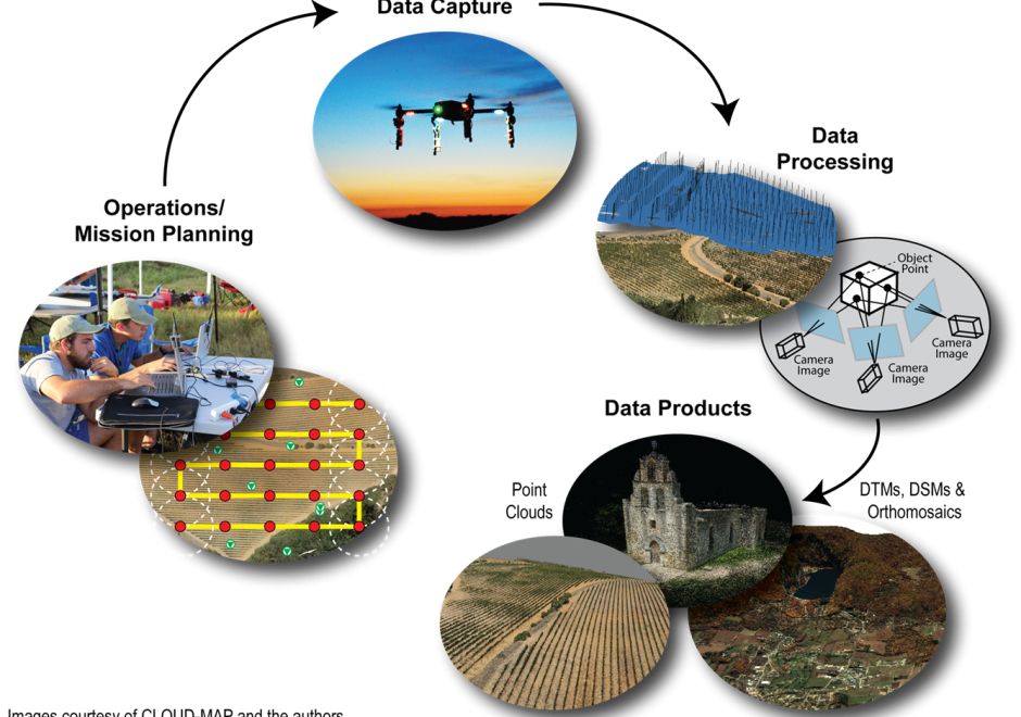
Unmanned Aerial Systems (UAS) are revolutionizing how GIS&T researchers and practitioners model and analyze our world. Compared to traditional remote sensing approaches, UAS provide a largely inexpensive, flexible, and relatively easy-to-use platform to capture high spatial and temporal resolution geospatial data. Developments in computer vision, specifically Structure from Motion (SfM), enable processing of UAS-captured aerial images to produce three-dimensional point clouds and orthophotos. However, many challenges persist, including restrictive legal environments for UAS flight, extensive data processing times, and the need for further basic research. Despite its transformative potential, UAS adoption still faces some societal hesitance due to privacy concerns and liability issues.


DC-28 - United States Census Data
The Census Bureau collects extensive numeric data on the residents of the United States as well ast the national economy. This is accomplished both through a decennial census as well as numerous other more frequent surveys. The decennial census is a fundamental basis of American democracy, mandated by the U.S. Constitution and essential for the equal representation in a democratic government. Numeric census data are maintained in vast collections of tables and organized at many different levels of geographies. From the Census website, the geographic and tabular data can be downloaded and then joined for display and analysis within a GIS. Because of the nature of individual data aggregated over areas and other matters, care must be taken to avoid statistical errors when undertaking spatial analyses.