2021 QUARTER 02

A B C D E F G H I J K L M N O P R S T U V W
PD-05 - Design, Development, Testing, and Deployment of GIS Applications

A systems development life cycle (SDLC) denes and guides the activities and milestones in the design, development, testing, and de ployment of software applications & information systems. Various choices of SDLC are available for different types of software applications & information systems and compositions of development teams and stakeholders. While the choice of an SDLC for building geographic information system (GIS) applications is similar to that of other types of software applications, critical decisions in each phase of the GIS development life cycle (GiSDLC) should take into account essential questions concern ing the storage, access, and analysis of (geo)spatial data for the target application. This article aims to introduce various considerations in the GiSDLC, from the perspectives of handling (geo)spatial data. The article rst introduces several (geo)spatial processes and types as well as various modalities of GIS applications. Then the article gives a brief introduction to an SDLC, including explaining the role of (geo)spatial data in the SDLC. Finally, the article uses two existing real-world applications as an example to highlight critical considerations in the GiSDLC.

DM-20 - Discrete entities
  • Discuss the human predilection to conceptualize geographic phenomena in terms of discrete entities
  • Compare and contrast differing epistemological and metaphysical viewpoints on the “reality” of geographic entities
  • Identify the types of features that need to be modeled in a particular GIS application or procedure
  • Identify phenomena that are difficult or impossible to conceptualize in terms of entities
  • Describe the difficulties in modeling entities with ill-defined edges
  • Describe the difficulties inherent in extending the “tabletop” metaphor of objects to the geographic environment
  • Evaluate the effectiveness of GIS data models for representing the identity, existence, and lifespan of entities
  • Justify or refute the conception of fields (e.g., temperature, density) as spatially-intensive attributes of (sometimes amorphous and anonymous) entities
  • Model “gray area” phenomena, such as categorical coverages (a.k.a. discrete fields), in terms of objects
  • Evaluate the influence of scale on the conceptualization of entities
  • Describe the perceptual processes (e.g., edge detection) that aid cognitive objectification
  • Describe particular entities in terms of space, time, and properties
FC-42 - Distance Operations

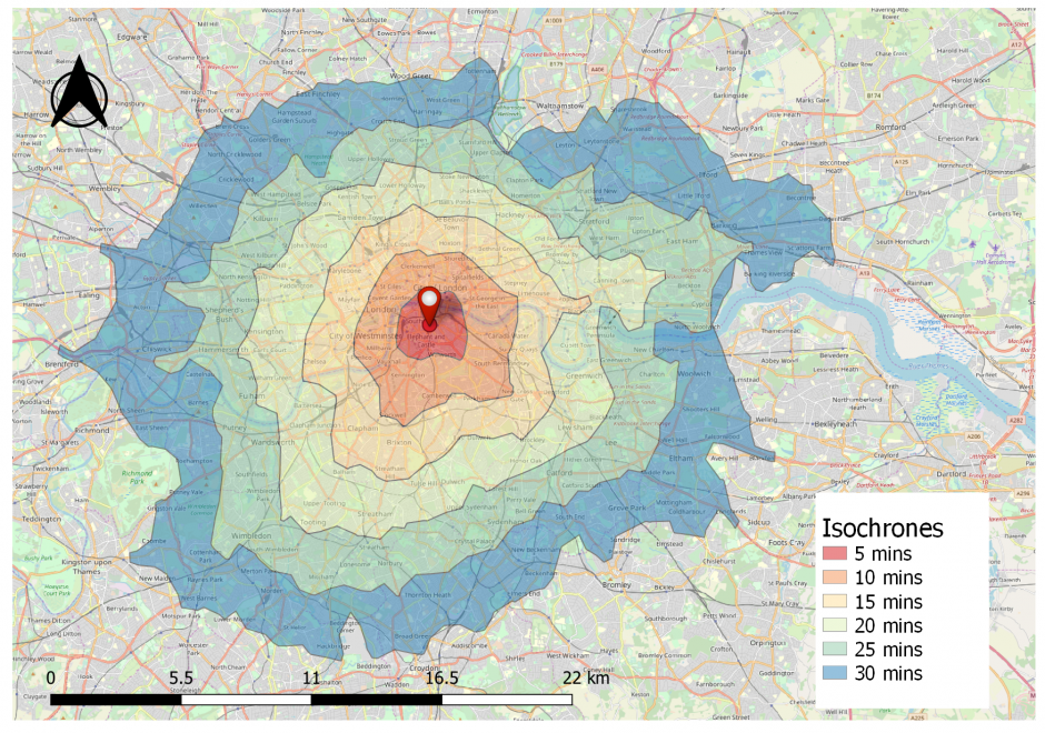
Distance is a central concept in geography, and consequently, there are various types of operations that leverage the concept of distance. This short article introduces common distance measures, the purpose of distance operations, different types of operations and considerations, as well as sample applications in the physical and social domains. Distance operations can be performed on both vector or raster data, but the operations and results may differ. While performing distance operations, it is important to remember how distance is conceptualized while performing the operation.

FC-14 - Distance, Length, and Direction
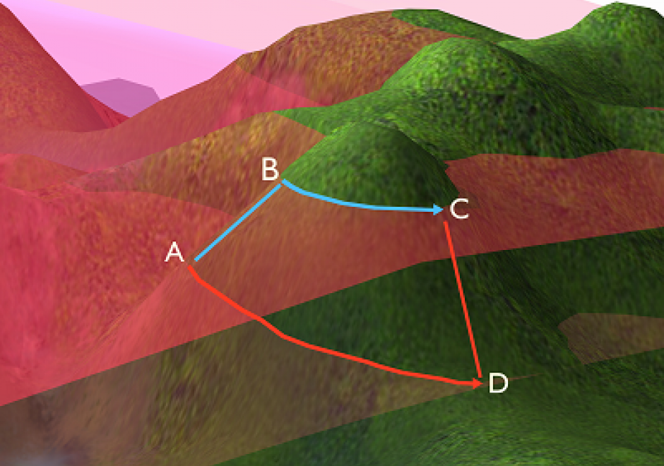
  • Describe several different measures of distance between two points (e.g., Euclidean, Manhattan, network distance, spherical)
  • Explain how different measures of distance can be used to calculate the spatial weights matrix
  • Explain why estimating the fractal dimension of a sinuous line has important implications for the measurement of its length
  • Explain how fractal dimension can be used in practical applications of GIS
  • Explain the differences in the calculated distance between the same two places when data used are in different projections
  • Outline the implications of differences in distance calculations on real world applications of GIS, such as routing and determining boundary lengths and service areas
  • Estimate the fractal dimension of a sinuous line
  • Describe operations that can be performed on qualitative representations of direction
  • Explain any differences in the measured direction between two places when the data are presented in a GIS in different projections
  • Compute the mean of directional data
  • Compare and contrast how direction is determined and stated in raster and vector data
  • Define “direction” and its measurement in different angular measures
DM-44 - Earth's Shape, Sea Level, and the Geoid

C. F. Gauss set the modern definition of the shape of the Earth, being described as the shape the oceans would adopt if they were entirely unperturbed and, thus, placid—a surface now called the geoid.  This surface cannot be observed directly because the oceans have waves, tides, currents, and other perturbations. Nonetheless, the geoid is the ideal datum for heights, and the science of determining the location of the geoid for practical purposes is the topic of physical geodesy. The geoid is the central concept that ties together what the various kinds of height mean, how they are measured, and how they are inter-related.

GS-09 - Enforcing control
  • Explain the concept of “fair use” with regard to geospatial information
  • Describe defenses against various claims of copyright infringement
  • Discuss ways in which copyright infringements may be remedied
  • Identify types of copyright infringement
CP-29 - Enterprise GIS

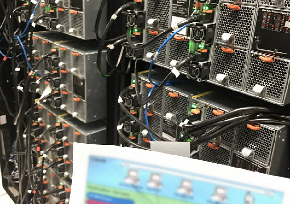
Enterprise GIS is the implementation of GIS infrastructure, processes and tools at scale within the context of an organization, shaped by the prevailing information technology patterns of the day. It can be framed as an infrastructure enabling a set of capabilities, and a process for establishing and maintaining that infrastructure. Enterprise GIS facilitates the storage, sharing and dissemination of geospatial information products (data, maps, apps) within an organization and beyond. Enterprise GIS is integrated into, and shaped by the business processes, culture and context of an organization. Enterprise GIS implementations require general-purpose IT knowledge in the areas of performance tuning, information security, maintenance, interoperability, and data governance. The specific enabling technologies of Enterprise GIS will change with time, but currently the prevailing pattern is a multi-tiered services-oriented architecture supporting delivery of GIS capabilities on the web, democratizing access to and use of geospatial information products.

GS-13 - Epistemological critiques

As GIS became a firmly established presence in geography and catalysed the emergence of GIScience, it became the target of a series of critiques regarding modes of knowledge production that were perceived as problematic. The first wave of critiques charged GIS with resuscitating logical positivism and its erroneous treatment of social phenomena as indistinguishable from natural/physical phenomena. The second wave of critiques objected to GIS on the basis that it was a representational technology. In the third wave of critiques, rather than objecting to GIS simply because it represented, scholars engaged with the ways in which GIS represents natural and social phenomena, pointing to the masculinist and heteronormative modes of knowledge production that are bound up in some, but not all, uses and applications of geographic information technologies. In response to these critiques, GIScience scholars and theorists positioned GIS as a critically realist technology by virtue of its commitment to the contingency of representation and its non-universal claims to knowledge production in geography. Contemporary engagements of GIS epistemologies emphasize the epistemological flexibility of geospatial technologies.

FC-02 - Epistemology

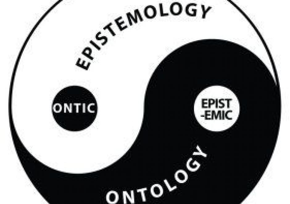
Epistemology is the lens through which we view reality. Different epistemologies interpret the earth and patterns on its surface differently. In effect, epistemology is a belief system about the nature of reality that, in turn, structures our interpretation of the world. Common epistemologies in GIScience include (but are not limited by) positivism and realism. However, many researchers are in effect pragmatists in that they choose the filter that best supports their work and a priori hypotheses. Different epistemologies – or ways of knowing and studying geography – result in different ontologies or classification systems. By understanding the role of epistemology, we can better understand different ways of representing the same phenomena.

FC-25 - Error
  • Compare and contrast how systematic errors and random errors affect measurement of distance
  • Describe the causes of at least five different types of errors (e.g., positional, attribute, temporal, logical inconsistency, and incompleteness)

Pages