All Topics

Computing Platforms provide the computational capabilities to apply methods and models to geographic data. Computing Platforms vary in capability, price, and availability from mobile devices to advanced supercomputers and from standalone computers to complex networked infrastructures to address different user needs and data-processing workloads.

Topics in this Knowledge Area are listed thematically below. Existing topics are in regular font and linked directly to their original entries (published in 2006; these contain only Learning Objectives). Entries that have been updated and expanded are in bold. Forthcoming, future topics are italicized

Computing Infrastructures Software Systems 
Graphics Processing Units Spatial Database Management Systems (DBMS)
Spatial Cloud Computing Spatial MapReduce
Mobile Devices Artificial Intelligence Tools and Platforms for GIS
Cyberinfrastructure Geospatial Technology Transfer
eScience, the Evolution of Science Web GIS
Computing Approaches Enterprise GIS
Origins of Computing & GIS&T: a Computer Systems Perspective   
Origins of Computing & GIS&T: a Perspective on the Role of Peripheral Devices Examples and Applications 
High Throughput Computing and GIS Google Earth Engine
High Performance Computing and GIS ArcGIS Online
Science Gateways GIS&T and Computational Notebooks
  OSGeo Live
  Apache Spark
Social Media and Location-based Services  
Location-based Services  
GIS& the Internet of Things  
Social Media Analytics  
Social Networks  
GIS&T Web Services  


A C E G H L M O S W
CP-10 - Social Media Analytics

Social media streams have emerged as new sources to support various geospatial applications. However, traditional geospatial tools and systems lack the capacities to process such data streams, which are generated dynamically in extremely large volumes and with versatile contents. Therefore, innovative approaches and frameworks should be developed to detect an emerging event discussed over the social media, understand the extent, consequences of the event, as well as it time-evolving nature, and eventually discover useful patterns. In order to harness social media for geospatial applications, this entry introduces social media analytics technologies for harvesting, managing, mining, analyzing and visualizing the spatial, temporal, text, and network information of social media data.

CP-21 - Social Networks
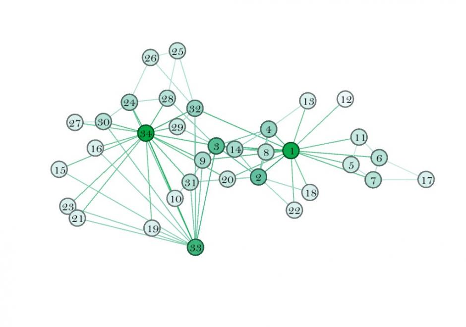
This entry introduces the concept of a social network (SN), its components, and how to weight those components. It also describes some spatial properties of SNs, and how to embed SNs into GIS. SNs are graph structures that consists of nodes and edges that traditionally exist in Sociology and are newer to GIScience. Nodes typically represent individual entities such as people or institutions, and edges represent interpersonal relationships, connections or ties. Many different mathematical metrics exist to characterize nodes, edges and the larger network. When geolocated, SNs are part of a class of spatial networks, more specifically, geographic networks (i.e. road networks, hydrological networks), that require special treatment because edges are non-planar, that is, they do not follow infrastructure or form a vector on the earth’s surface. Future research in this area is likely to take advantage of 21st Century datasets sourced from social media, GPS, wireless signals, and online interactions that each evidence geolocated personal relationships.

CP-01 - Software systems
  • Describe the major geospatial software architectures available currently, including desktop GIS, server-based, Internet, and component-based custom applications
  • Describe non-spatial software that can be used in geospatial applications, such as databases, Web services, and programming environments
  • Compare and contrast the primary sources of geospatial software, including major and minor commercial vendors and open-source options
  • List the major functionality needed from off-the-shelf software based on a requirements report
  • Identify software options that meet functionality needs for a given task or enterprise
  • Evaluate software options that meet functionality needs for a given task or enterprise
CP-08 - Spatial Cloud Computing

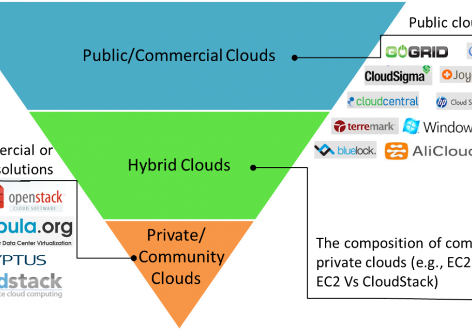
The scientific and engineering advancements in the 21st century pose grand computing challenges in managing big data, using complex algorithms to extract information and knowledge from big data, and simulating complex and dynamic physical and social phenomena. Cloud computing emerged as new computing model with the potential to address these computing challenges. This entry first introduces the concept, features and service models of cloud computing. Next, the ideas of generalized architecture and service models of spatial cloud computing are then elaborated to identify the characteristics, components, development and applications of spatial cloud computing for geospatial sciences. 

CP-07 - Spatial MapReduce

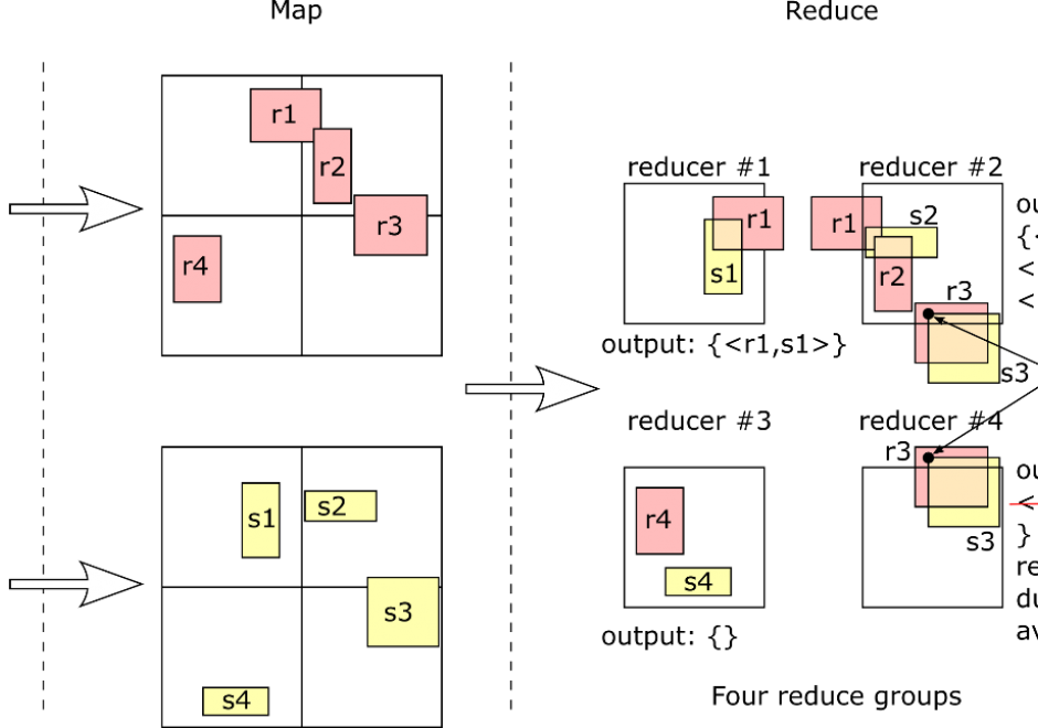
MapReduce has become a popular programming paradigm for distributed processing platforms. It exposes an abstraction of two functions, map and reduce, which users can define to implement a myriad of operations. Once the two functions are defined, a MapReduce framework will automatically apply them in parallel to billions of records and over hundreds of machines. Users in different domains are adopting MapReduce as a simple solution for big data processing due to its flexibility and efficiency. This article explains the MapReduce programming paradigm, focusing on its applications in processing big spatial data. First, it gives a background on MapReduce as a programming paradigm and describes how a MapReduce framework executes it efficiently at scale. Then, it details the implementation of two fundamental spatial operations, namely, spatial range query and spatial join. Finally, it gives an overview of spatial indexing in MapReduce systems and how they can be combined with MapReduce processing.