Data Capture

The capture of massive quantities of spatial data, able to be distributed and shared in real time, provide for an ever-increasing range of environmental and societal applications. Data capture includes the principles, methods, technologies, applications, and institutional/programmatic aspects of spatial data acquisition. Sources of data include global navigation satellite systems, satellite and aerial sensing, field surveys, land records, socioeconomic data (e.g., census), volunteered geographic information, wireless sensor networks, and unmanned aerial systems.

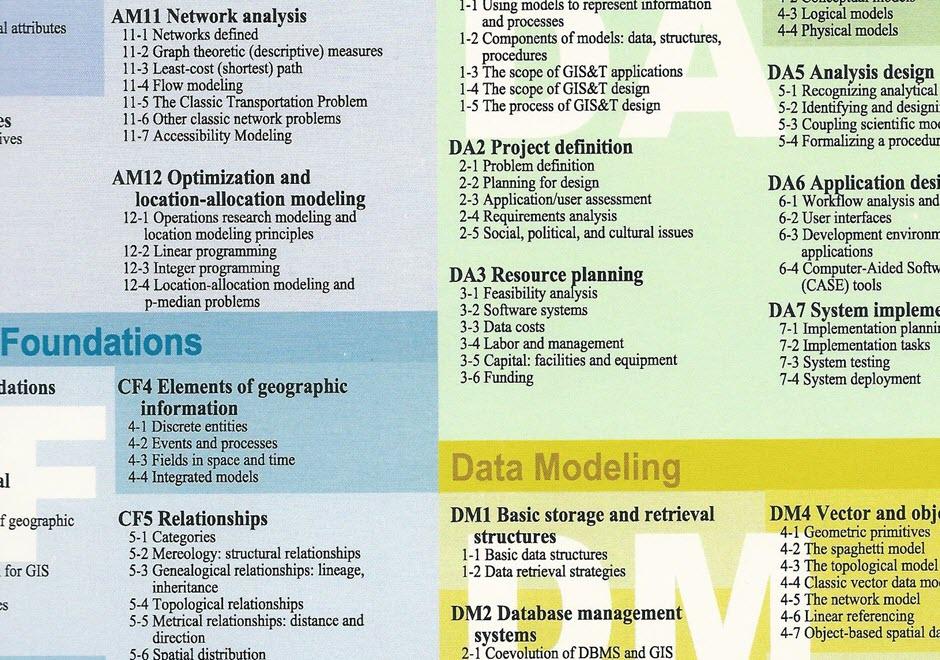
Topics in this Knowledge Area are listed thematically below. Existing topics are in regular font and linked directly to their original entries (published in 2006; these contain only Learning Objectives). Entries that have been updated and expanded are in bold. Forthcoming, future topics are italicized


History & Trends Processing Remotely-Sensed Data
Changes in Data Capture Methods Over Time, Part 1: Technological Developments Image Interpretation: Aerial Photography & Satellites
Changes in Data Capture Over Time, Part 2: Implications and Case Studies Feature Extraction in Satellite Imagery
Georeferencing and Georectification Structure from Motion Photogrammetry
Digital Data Sources & Capture Methods Ground Verification and Accuracy Assessment
Historical (Paper) Maps Spectral Properties of Terrestrial Surfaces
Global Navigation Satellite Systems  
Mobile Applications GIS and Surveying
Aerial Photography: History & Georeferencing Professional Land Surveying
Ground or Street-Level Imagery Land records
Social Media Platforms Ocean Surveying
Texts  
Volunteered Geographic Information (VGI) Field Data Collection
Remote Sensing Platforms & Sensors Sampling: Size Selection, Sample Types, Intervals
Remote Sensing Platforms overview Field Data Capture Technologies
Nature of multispectral image data U.S. Census Data
Unmanned Aerial Systems (UAS) Data Coordinating Organizations
Landsat Multi-Organizational GIS Coordination
Light Detection and Ranging (LiDAR) Federal Agencies & National Organizations and Programs
Indoor LiDAR Scanning International Organizations & Programs
Thermal Imagery  
Radar, Sonar, and Echolocation  
Hyperspectral Imagery  
Airborne LiDAR Bathymetry  


DC-25 - Changes in Geospatial Data Capture Over Time: Part 1, Technological Developments

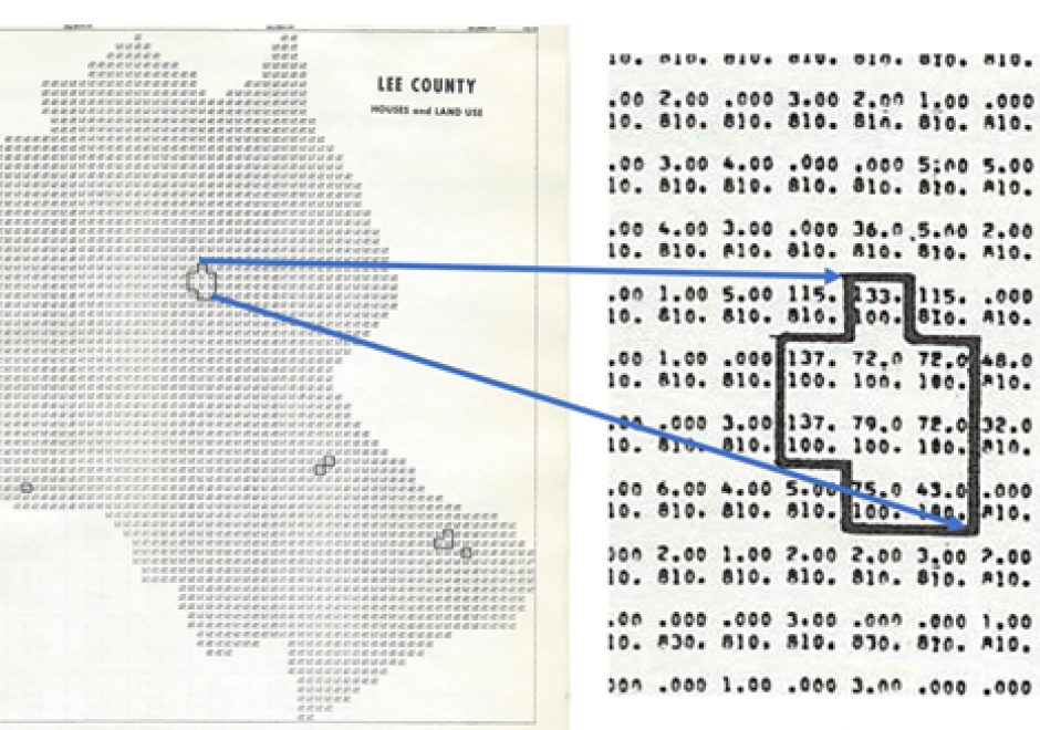
Geographic Information Systems (GIS) are fueled by geospatial data.  This comprehensive article reviews the evolution of procedures and technologies used to create the data that fostered the explosion of GIS applications. It discusses the need to geographically reference different types of information to establish an integrated computing environment that can address a wide range of questions. This includes the conversion of existing maps and aerial photos into georeferenced digital data.  It covers the advancements in manual digitizing procedures and direct digital data capture. This includes the evolution of software tools used to build accurate data bases. It also discusses the role of satellite based multispectral scanners for Earth observation and how LiDAR has changed the way that we measure and represent the terrain and structures. Other sections deal with building GIS data directly from street addresses and the construction of parcels to support land record systems. It highlights the way Global Positioning Systems (GPS) technology coupled with wireless networks and cloud-based applications have spatially empowered millions of users. This combination of technology has dramatically affected the way individuals search and navigate in their daily lives while enabling citizen scientists to be active participants in the capture of spatial data. For further information on changes to data capture, see Part 2: Implications and Case Studies. 

DC-12 - Aerial photography image interpretation
  • Use photo interpretation keys to interpret features on aerial photographs
  • Calculate the nominal scale of a vertical aerial image
  • Calculate heights and areas of objects and distances between objects shown in a vertical aerial image
  • Produce a map of land use/land cover classes using a vertical aerial image
  • Describe the elements of image interpretation
DC-10 - Aerial Photography: History and Georeferencing

In 1903, Julius Neubranner, a photography enthusiast, designed and patented a breast-mounted aerial camera for carrier pigeons. Weighing only 70 grams, the camera took automatic exposures at 30-second intervals along the flight line flown by the bird. Although faster than balloons, they were not always reliable in following their flight paths. Today the pigeon corps has been replaced by unmanned aerial vehicles, but aerial photography continues to be an important source of data for use in a wide range of geospatial applications. Processing of the imagery to remove various types of distortion is a necessary step before the images can be georeferenced and used for mapping purposes. 

DC-42 - Changes in Geospatial Data Capture Over Time: Part 2, Implications and Case Studies

Advances in technological approaches and tools to capture geospatial data have contributed to a vast collection of applications and enabled capacity for new programs, functions, products, workflows, and whole national-level spatial data infrastructure. In this entry, such outcomes and implications are described, focusing on developmental changes in specific application areas such as land use & land cover inventory, land parcel administration, and business, as well as examples from federal agencies, including the US Geological Survey, the Census Bureau, US Fish and Wildlife Service, and the US Department of Agriculture. These examples illustrate the diverse ways that the dramatic changes in geospatial data capture methods and approaches have affected workflows within agencies and have spatially empowered millions of users and the general public. For additional information on specific technical changes, see Part 1: 

DC-22 - Federal agencies and national and international organizations and programs
  • Describe the data programs provided by organizations such as The National Map, GeoSpatial One Stop, and National Integrated Land System
  • Discuss the mission, history, constituencies, and activities of international organizations such as Association of Geographic Information Laboratories for Europe (AGILE) and the European GIS Education Seminar (EUGISES)
  • Discuss the mission, history, constituencies, and activities of governmental entities such as the Bureau of Land Management (BLM), United States Geological Survey (USGS) and the Environmental Protection Agency (EPA) as they related to support of professionals and organizations
  • involved in GIS&T
  • Discuss the mission, history, constituencies, and activities of GeoSpatial One Stop
  • Discuss the mission, history, constituencies, and activities of the Open Geospatial Consortium (OGC), Inc.
  • Discuss the mission, history, constituencies, and activities of the Nation Integrated Land System (NILS)
  • Discuss the mission, history, constituencies, and activities of the Federal Geographic Data Committee (FGDC)
  • Discuss the mission, history, constituencies, and activities of the National Academies of Science Mapping Science Committee
  • Discuss the mission, history, constituencies, and activities of the USGS and its National Map vision
  • Discuss the mission, history, constituencies, and activities of University Consortium of Geographic Information Science (UCGIS) and the National Center for Geographic Information and Analysis (NCGIA)
  • Discuss the political, cultural, economic, and geographic characteristics of various countries that influence their adoption and use of GIS&T
  • Identify National Science Foundation (NSF) programs that support GIS&T research and education
  • Outline the principle concepts and goals of the “digital earth” vision articulated in 1998 by Vice President Al Gore
  • Assess the current status of Gore’s “digital earth”
DC-09 - Field data technologies
  • Identify the measurement framework that applies to moving object tracking
  • Explain the advantage of real-time kinematic GPS in field data collection
  • Describe an application of hand-held computing or personal digital assistants (PDAs) for field data collection
  • Considering the measurement framework applied to moving object tracking, identify which of the dimensions of location, attribute, and time is fixed, which is controlled, and which is measured
  • Describe a real or hypothetical application of a sensor network in field data collection
  • Outline a combination of positioning techniques that can be used to support location-based services in a given environment
DC-30 - Georeferencing and Georectification

Georeferencing is the recording of the absolute location of a data point or data points. Georectification refers to the removal of geometric distortions between sets of data points, most often the removal of terrain, platform, and sensor induced distortions from remote sensing imagery. Georeferencing is a requisite task for all spatial data, as spatial data cannot be positioned in space or evaluated with respect to other data that are without being assigned a spatial coordinate within a defined coordinate system. Many data are implicitly georeferenced (i.e., are labeled with spatial reference information), such as points collected from a global navigation satellite system (GNSS). Data that are not labeled with spatial reference information can be georeferenced using a number of approaches, the most commonly applied of which are described in this article. The majority of approaches employ known reference locations (i.e., Ground Control Points) drawn from a reliable source (e.g., GNSS, orthophotography) to calibrate georeferencing models. Regardless of georeferencing approach, positional error is present. The accuracy of georeferencing (i.e., amount of positional error) should be quantified, typically by the root mean squared error between ground control points from a reference source and the georeferenced data product.

DC-20 - Geospatial Organizations and Programs, Internationally-based or with a Non-US Focus

Geographic information systems (GIS) are in use in virtually every country in the world, by government agencies, industries, community entities, and academic institutions. In response, organizations and programs have been established to support diverse goals, many of which focus on the data used by GIS and the networking desires of the user base. This overview describes organizations and programs that are based outside of the United States and/or have an international mandate. Most of these groups pursue multiple goals and missions but here the compilation is organized into some of the key ones that focus primarily on data and data infrastructure, those that enable collaboration and coordination, and those that are educationally-focused.

DC-03 - Global Positioning System
  • Explain how GPS receivers calculate coordinate data
  • Discuss the relationship of GPS to the Global Satellite Navigation System
  • Explain “selective availability,” why it was discontinued in 2000, and what alternatives are available to the U.S. Department of Defense
  • Explain the relationship of the U.S. Global Positioning System with comparable systems sponsored by Russia and the European Union and the Global Navigation Satellite System
  • Discuss the role of GPS in location-based services (LBS)
  • Specify the features of a GPS receiver that is able to achieve geometric accuracies on the order of centimeters without post-processing
  • Explain the relevance of the concept of trilateration to both GPS positioning and control surveying
  • Perform differential correction of GPS data using reference data from a CORS station
  • List, define, and rank the sources of error associated with GPS positioning
  • Distinguish between horizontal and vertical accuracies when using coarse acquisition codes/standard positioning service (C-codes) and precision acquisition codes/precise positioning service (P-codes)
DC-19 - Ground Verification and Accuracy Assessment

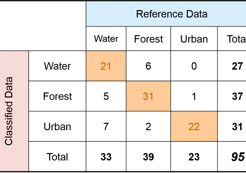
Spatial products such as maps of land cover, soil type, wildfire, glaciers, and surface water have become increasingly available and used in science and policy decisions.  These maps are not without error, and it is critical that a description of quality accompany each product.  In the case of a thematic map, one aspect of quality is obtained by conducting a spatially explicit accuracy assessment in which the map class and reference class are compared on a per spatial unit basis (e.g., per 30m x 30m pixel).  The outcome of an accuracy assessment is a description of quality of the end-product map, in contrast to conducting an evaluation of map quality as part of the map production process.  The accuracy results can be used to decide if the map is of adequate quality for an intended application, as input to uncertainty analyses, and as information to improve future map products.

Pages