Knowledge Economy

Knowledge Economy is the portion of the Body of Knowledge focused on the elements of GIScience central to the growth of the field, particularly in areas related to the professional realm. This knowledge area emphasizes the education and training of personnel, labor and management issues, professional standards (like certification and ethics), industry economics and impacts, and overarching professional community issues.

Topics in this Knowledge Area are listed thematically below. Existing topics are in regular font and linked directly to their original entries (published in 2006; these contain only Learning Objectives). Entries that have been updated and expanded are in bold. Forthcoming, future topics are italicized

GIS&T Workforce GIS Operations
GIS&T Workforce Development Systems Modeling for Effective GIS Management
Competence in GIS&T Knowledge Work Funding
GIS&T Positions and Qualifications Organizational Models for GIS Management
GIS&T Education and Training  
Professional Certification Design & Implementation of GIS&T
  The Process of GIS&T Design
Coordinating Organizations Strategic Planning for GIS Design
Value of Geospatial Professional Organizations GIS&T Project Planning and Management
Regional GIS Coordination & Collaboration Managing GIS&T Operations & Infrastructure
Multi-Organizaional GIS Coordination Measuring GIS Return on Investment
Publications Measuring GIS Costs
The Geospatial Community  
The Geospatial Industry  
KE-32 - Competence in GIS&T Knowledge Work

“Competence” is a word that rolls off the tongues of instructional designers, education administrators, and HR people. Others find it hard to swallow. For some GIS&T educators, competence connotes an emphasis on vocational instruction that’s unworthy of the academy. This entry challenges skeptical educators to rethink competence not just as readiness for an occupation, but first and foremost as the readiness to live life to the fullest, and to contribute to a sustainable future. The entry considers the OECD’s “Key Competencies for a Successful Life and Well-Functioning Society,” as well as the specialized GIS&T competencies specified in the U.S. Department of Labor’s Geospatial Technology Competency Model. It presents findings of a survey in which 226 self-selected members of Esri’s Young Professionals Network observe that competencies related to the GTCM’s Software and App Development Segment were under-developed in their university studies. Looking ahead, in the context of an uncertain future in which, some say, many workers are at risk of “technological unemployment,” the entry considers which GIS&T competencies are likely to be of lasting value.

KE-18 - Data sharing among public and private agencies, organizations, and individuals
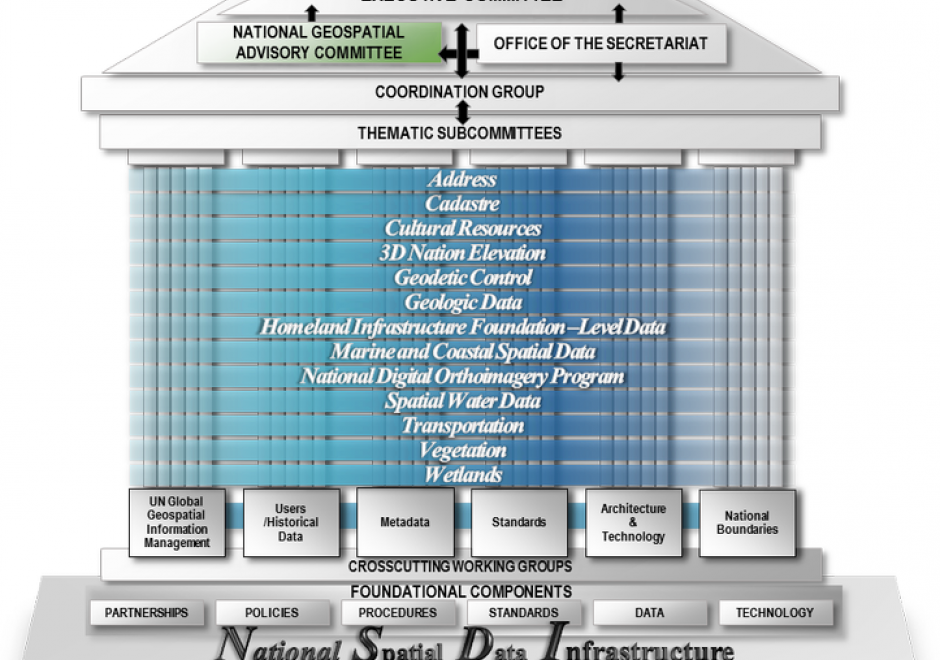
  • Describe formal and informal arrangements that promote geospatial data sharing (e.g., FGDC, ESDI, memoranda of agreements, informal access arrangements, targeted funding support)
  • Describe a situation in which politics interferes with data sharing and exchange
KE-11 - Funding
  • Identify potential sources of funding (internal and external) for a project or enterprise GIS
  • Create proposals and presentations to secure funding
  • Analyze previous attempts at funding to identify successful and unsuccessful techniques
KE-25 - GIS&T Education and Training

GIS education and training have their roots both in formal educational settings and in professional development.  Methods and approaches for teaching and learning about and with geospatial technologies have evolved in tight connection with the advances in the internet and personal computers.  The adoption and integration of GIS and related geospatial technologies into dozens of academic disciplines has led to a high demand for instruction that is targeted and timely, a combination that is challenging to meet consistently with diverse audiences and in diverse settings. Academic degrees, concentrations, minors, certificates, and numerous other programs abound within formal and informal education.

KE-24 - GIS&T Positions and Qualifications

Workforce needs tied to geospatial data continue to evolve.  Along with expansion in the absolute number of geospatial workers employed in the public and private sectors is greater diversity in the fields where their work has become important.  Together, these trends generate demand for new types of educational and professional development programs and opportunities. Colleges and universities have responded by offering structured academic programs ranging from minors and academic certificates to full GIS&T degrees.  Recent efforts also target experienced GIS&T professionals through technical certifications involving software applications and more comprehensive professional certifications designed to recognize knowledge, experience, and expertise.

KE-12 - GIS&T Project Planning and Management

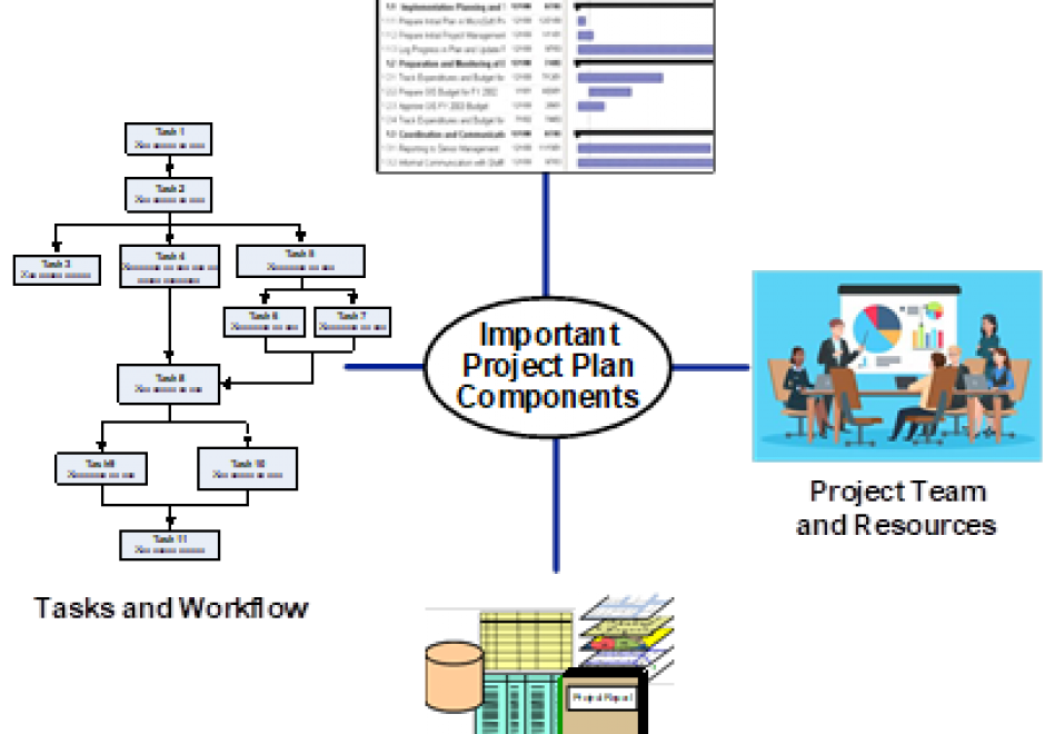
GIS&T project planning and management falls under the broader category of project management (PM) in general and information technology (IT) PM in particular, providing a rich background and guidelines that are stewarded by associations and their certifications. The lifecycle of a project or its component phases involves a number of process groups involving a series of actions leading to a result that are sequenced in the following manner: initiating, planning, executing and controlling, and closing. Effective project planning and management requires understanding of its knowledge areas in the project management body of knowledge (PM BoK), which include integration, scope, time, cost, quality, human resource, communications, risk, procurement, and stakeholder management. Numerous tools and techniques are available to assist the project manager in planning, executing, and controlling these efforts, some of which are specific to GIS&T projects. The distinctiveness of GIS&T project planning and management lies in an understanding of the uniqueness, overlap and connections that exist between the PM BoK and the GIS&T BoK, both of which have achieved new levels of maturity in recent decades. 

KE-23 - GIS&T workforce development
  • Describe issues that may hinder implementation and continued successful operation of a GIS if effective methods of staff development are not included in the process
  • Outline methods (programs or processes) that provide effective staff development opportunities for GIS&T
KE-19 - Managing GIS&T Operations and Infrastructure

This article discusses the key role of effective management practices to derive expected benefits from the infrastructure and operations of enterprise GIS, including needs assessment, data evaluation and management, and stakeholder involvement. It outlines management factors related to an emerging application of enterprise GIS.  How to configure GIS infrastructure and operations to support enterprise business needs is the focus. When appropriate, additional information is provided for programs, projects, and activities specifically relevant for equity and social justice.

KE-17 - Measuring costs
  • Explain how the saying “developing data is the largest single cost of implementing GIS” could be true for an organization that is already collecting data as part of its regular operations
  • Describe some non-fiduciary barriers to GIS implementation
  • Summarize what the literature suggests as means for overcoming some of the non-fiduciary barriers to GIS implementation
  • Outline sources of additional costs associated with development of an enterprise GIS
  • Outline the categories of costs that an organization should anticipate as it plans to design and implement a GIS
KE-34 - Multi-Organizational GIS Coordination

For many years, collaboration has been a key cornerstone in the success of efforts achieved by the geospatial community.  When paired with governance, collaborative efforts often lead to sustainability and have the effect of broadening the benefits that can be achieved.  The following text shares how the geospatial community uses collaboration and governance as tools to achieve benefits across the community.  Case studies are provided to illustrate the process and the outcomes achieved. 

Pages