Relationships

DM-28 - Topological relationships
  • Define various terms used to describe topological relationships, such as disjoint, overlap, within, and intersect
  • List the possible topological relationships between entities in space (e.g., 9-intersection) and time
  • Use methods that analyze topological relationships
  • Recognize the contributions of topology (the branch of mathematics) to the study of geographic relationships
  • Describe geographic phenomena in terms of their topological relationships in space and time to other phenomena
CP-21 - Social Networks
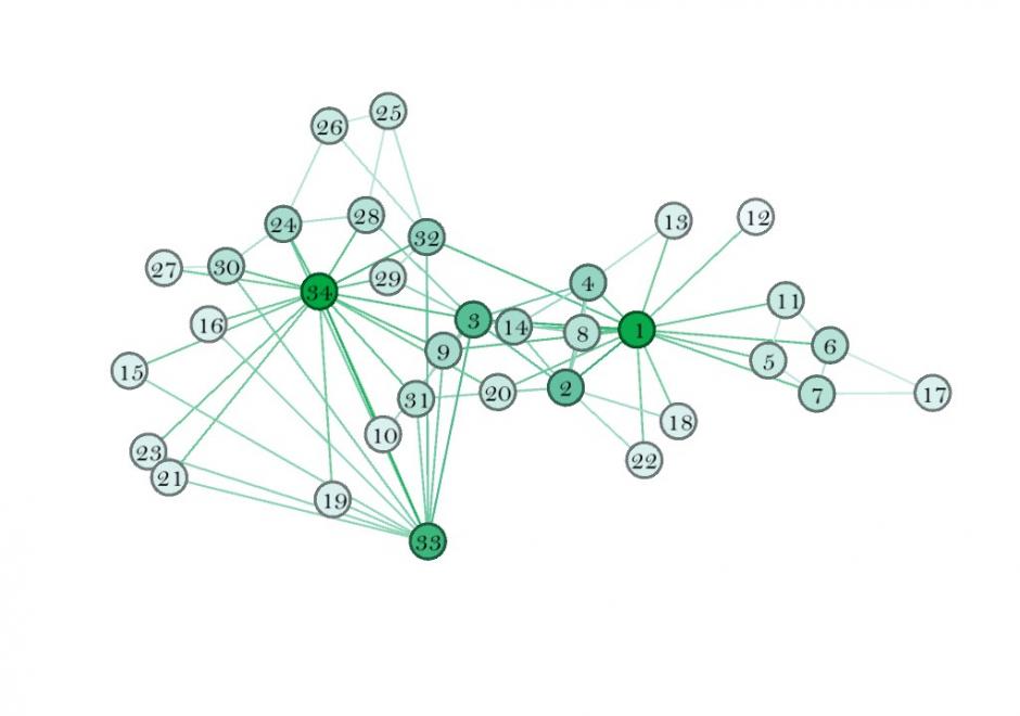
This entry introduces the concept of a social network (SN), its components, and how to weight those components. It also describes some spatial properties of SNs, and how to embed SNs into GIS. SNs are graph structures that consists of nodes and edges that traditionally exist in Sociology and are newer to GIScience. Nodes typically represent individual entities such as people or institutions, and edges represent interpersonal relationships, connections or ties. Many different mathematical metrics exist to characterize nodes, edges and the larger network. When geolocated, SNs are part of a class of spatial networks, more specifically, geographic networks (i.e. road networks, hydrological networks), that require special treatment because edges are non-planar, that is, they do not follow infrastructure or form a vector on the earth’s surface. Future research in this area is likely to take advantage of 21st Century datasets sourced from social media, GPS, wireless signals, and online interactions that each evidence geolocated personal relationships.

DM-28 - Topological relationships
  • Define various terms used to describe topological relationships, such as disjoint, overlap, within, and intersect
  • List the possible topological relationships between entities in space (e.g., 9-intersection) and time
  • Use methods that analyze topological relationships
  • Recognize the contributions of topology (the branch of mathematics) to the study of geographic relationships
  • Describe geographic phenomena in terms of their topological relationships in space and time to other phenomena
DM-26 - Mereology: structural relationships
  • Describe particular geographic phenomena in terms of their place in mereonomic hierarchies (parts and composites)
  • Explain the contributions of formal mathematical methods such as graph theory to the study and application of geographic structures
  • Represent structural relationships in GIS data
  • Explain the effects of spatial or temporal scale on the perception of structure
  • Explain the modeling of structural relationships in standard GIS data models, such as stored topology
  • Identify phenomena that are best understood as networks
DM-25 - Categories
  • Explain the human tendency to simplify the world using categories
  • Identify specific examples of categories of entities (i.e., common nouns), properties (i.e., adjectives), space (i.e., regions), and time (i.e., eras)
  • Explain the role of categories in common-sense conceptual models, everyday language, and analytical procedures
  • Recognize and manage the potential problems associated with the use of categories (e.g., the ecological fallacy)
  • Construct taxonomies and dictionaries (also known as formal ontologies) to communicate systems of categories
  • Describe the contributions of category theory to understanding the internal structure of categories
  • Document the personal, social, and/or institutional meaning of categories used in GIS applications
  • Create or use GIS data structures to represent categories, including attribute columns, layers/themes, shapes, and legends
  • Use categorical information in analysis, cartography, and other GIS processes, avoiding common interpretation mistakes
  • Reconcile differing common-sense and official definitions of common geospatial categories of entities, attributes, space, and time

Pages