tables

FC-12 - Structured Query Language (SQL) and attribute queries

The structured query language (SQL) for database interrogation is presented and illustrated with a few examples using attribute tables one might find in a common GIS database.  A short background is presented on the history and goals that the creators of the SQL language hoped to achieve, followed by a review of SQL utility for data query, editing, and definition.  While the SQL language is rich in content and breadth, this article attempts to build on a simple SQL and then iteratively add additional complexity to highlight the power that SQL affords to the GIS professional who has limited programming capabilities.  The reader is asked to consider how minor modifications to SQL syntax can add complexity and even create more dynamic mathematical models with simple English-like command statements.  Finally, the reader is challenged to consider how terse SQL statements may be used to replace relatively long and laborious command sequences required by a GIS GUI approach.

DM-77 - Spatial Joins
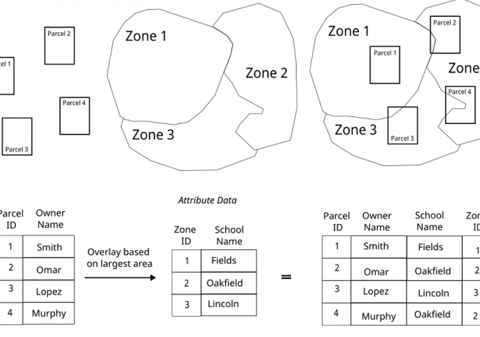
The measuring (or query) of the relationship between spatial features is of particular utility within a GIS. A spatial join combines represented geographic objects and their associated attributes based on a spatial relationship test (or predicate). The method of spatial join operation utilized depends on the relationship between the features represented and how those features are represented in the GIS.  Regardless of the software implementation, the spatial join operation results are predicated on a test condition such as adjacency, proximity, or topology comparison among represented geographic data. This topic discusses how spatial join operations can be utilized for different geographic problems.
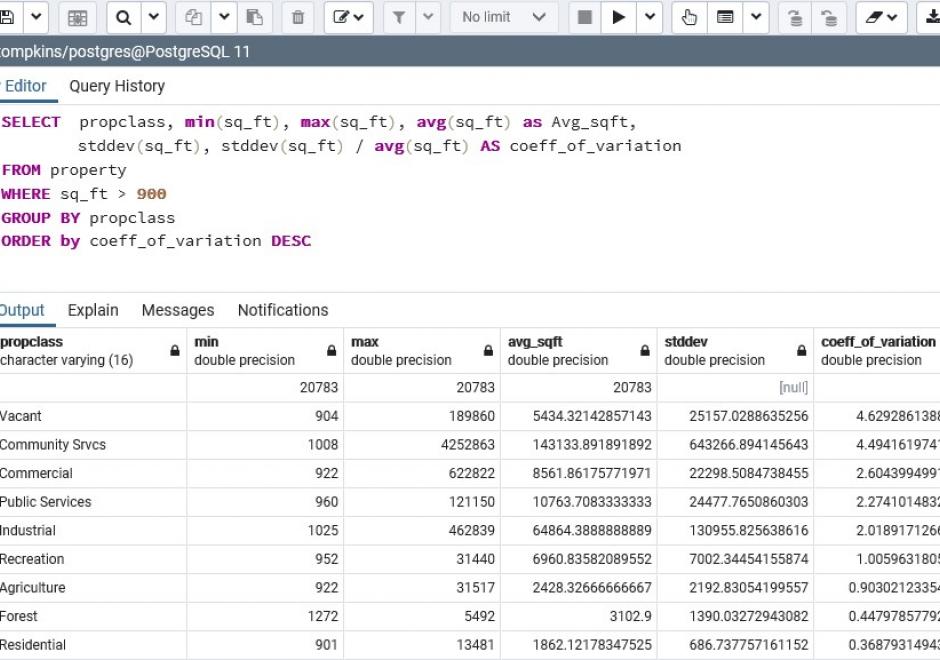

FC-12 - Structured Query Language (SQL) and attribute queries

The structured query language (SQL) for database interrogation is presented and illustrated with a few examples using attribute tables one might find in a common GIS database.  A short background is presented on the history and goals that the creators of the SQL language hoped to achieve, followed by a review of SQL utility for data query, editing, and definition.  While the SQL language is rich in content and breadth, this article attempts to build on a simple SQL and then iteratively add additional complexity to highlight the power that SQL affords to the GIS professional who has limited programming capabilities.  The reader is asked to consider how minor modifications to SQL syntax can add complexity and even create more dynamic mathematical models with simple English-like command statements.  Finally, the reader is challenged to consider how terse SQL statements may be used to replace relatively long and laborious command sequences required by a GIS GUI approach.

Pages