DC-24 - Unmanned Aerial Systems (UAS)
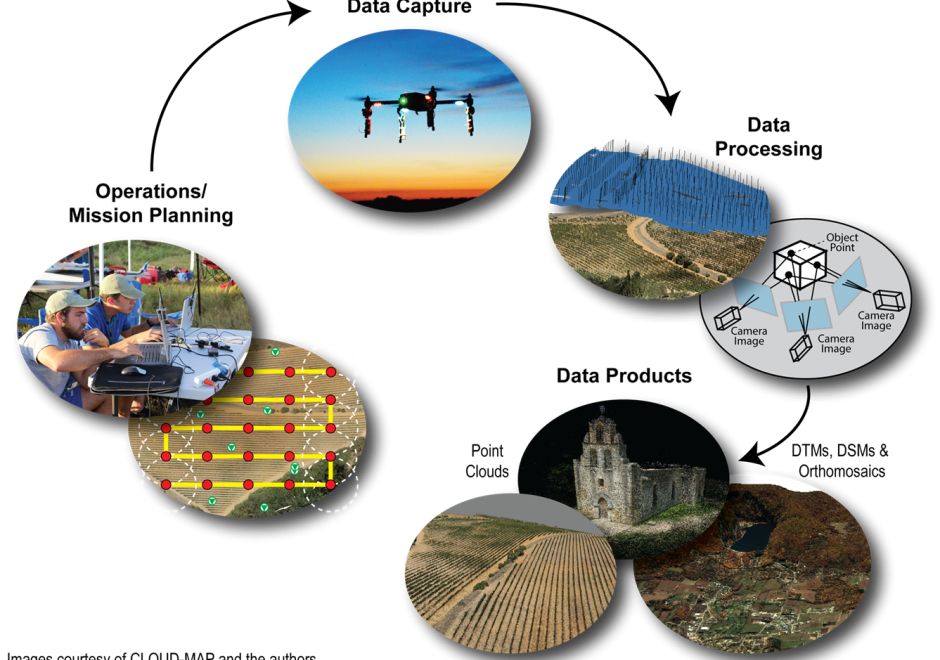
Unmanned Aerial Systems (UAS) are revolutionizing how GIS&T researchers and practitioners model and analyze our world. Compared to traditional remote sensing approaches, UAS provide a largely inexpensive, flexible, and relatively easy-to-use platform to capture high spatial and temporal resolution geospatial data. Developments in computer vision, specifically Structure from Motion (SfM), enable processing of UAS-captured aerial images to produce three-dimensional point clouds and orthophotos. However, many challenges persist, including restrictive legal environments for UAS flight, extensive data processing times, and the need for further basic research. Despite its transformative potential, UAS adoption still faces some societal hesitance due to privacy concerns and liability issues.

DC-26 - Remote Sensing Platforms
Remote sensing means acquiring and measuring information about an object or phenomenon via a device that is not in physical or direct contact with what is being studied (Colwell, 1983).To collect remotely sensed data, a platform – an instrument that carries a remote sensing sensor – is deployed. From the mid 1800’s to the early 1900’s, various platforms such as balloons, kites, and pigeons carried mounted cameras to collect visual data of the world below. Today, aircraft (both manned and unmanned) and satellites collect the majority of remotely sensed data. The sensors typically deployed on these platforms include film and digital cameras, light-detection and ranging (LiDAR) systems, synthetic aperture radar (SAR) systems, and multi-spectral and hyper-spectral scanners. Many of these instruments can be mounted on land-based platforms, such as vans, trucks, tractors, and tanks. In this chapter, we will explore the different types of platforms and their resulting remote sensing applications.