Analytics and Modeling

This knowledge area embodies a variety of data driven analytics, geocomputational methods, simulation and model driven approaches designed to study complex spatial-temporal problems, develop insights into characteristics of geospatial data sets, create and test geospatial process models, and construct knowledge of the behavior of geographically-explicit and dynamic processes and their patterns.

Topics in this Knowledge Area are listed thematically below. Existing topics are in regular font and linked directly to their original entries (published in 2006; these contain only Learning Objectives). Entries that have been updated and expanded are in bold. Forthcoming, future topics are italicized


Methodological Context Surface & Field Analyses Space-Time Analysis & Modeling
Geospatial Analysis & Model Building Modeling Surfaces Time Geography
Changing Context of GIScience Gridding, Interpolation, and Contouring Capturing Spatio-Temporal Dynamics in Computational Modeling 
Building Blocks Inverse Distance Weighting GIS-Based Computational Modeling
Overlay & Combination Operations Radial Basis & Spline Functions Computational Movement Analysis
Areal Interpolation Polynomial Functions Volumes and Space-Time Volumes
Aggregation of Spatial Entities Kriging Interpolation  
Classification & Clustering LiDAR Point Cloud Analysis Geocomputational Methods & Models
Boundaries & Zone Membership Intervisibility, Line-of-Sight, and Viewsheds Cellular Automata
Spatial Queries Digital Elevation Models & Terrain Metrics Agent-based Modeling
Buffers TIN-based Models and Terrain Metrics Simulation Modeling
Grid Operations & Map Algebra Watersheds & Drainage Networks Artificial Neural Networks
Data Exploration & Spatial Statistics 3D Parametric Surfaces Genetic Algorithms & Evolutionary Computing 
Spatial Statistics Network & Location Analysis Big Data & Geospatial Analysis
Spatial Sampling for Spatial Analysis Intro to Network & Location Analysis Problems of Large Spatial Databases
Exploratory Spatial Data Analysis (ESDA) Location & Service Area Problems Pattern Recognition & Matching
Point Pattern Analysis Network Route & Tour Problems Artificial Intelligence Approaches
Kernels & Density Estimation Modelling Accessibility Intro to Spatial Data Mining
Spatial Interaction Location-allocation Modeling Rule Learning for Spatial Data Mining
Cartographic Modeling The Classic Transportation Problem Machine Learning Approaches
Multi-criteria Evaluation   CyberGIS and Cyberinfrastructure
Grid-based Statistics and Metrics   Analysis of Errors & Uncertainty
Landscape Metrics   Error-based Uncertainty
Hot-spot and Cluster Analysis   Conceptual Models of Error & Uncertainty
Global Measures of Spatial Association   Spatial Data Uncertainty
Local Indicators of Spatial Autocorrelation   Problems of Scale & Zoning
Simple Regression & Trend Surface Analysis   Thematic Accuracy & Assessment
Geographically Weighted Regression   Stochastic Simulation & Monte Carlo Methods
Spatial Autoregressive Models   Mathematical Models of Uncertainty
Spatial Filtering Models   Fuzzy Aggregation Operators


AM-79 - Agent-based Modeling

Agent-based models are dynamic simulation models that provide insight into complex geographic systems. Individuals are represented as agents that are encoded with goal-seeking objectives and decision-making behaviors to facilitate their movement through or changes to their surrounding environment. The collection of localized interactions amongst agents and their environment over time leads to emergent system-level spatial patterns. In this sense, agent-based models belong to a class of bottom-up simulation models that focus on how processes unfold over time in ways that produce interesting, and at times surprising, patterns that we observe in the real world.

AM-97 - An Introduction to Spatial Data Mining
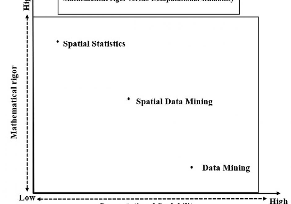
The goal of spatial data mining is to discover potentially useful, interesting, and non-trivial patterns from spatial data-sets (e.g., GPS trajectory of smartphones). Spatial data mining is societally important having applications in public health, public safety, climate science, etc. For example, in epidemiology, spatial data mining helps to nd areas with a high concentration of disease incidents to manage disease outbreaks. Computational methods are needed to discover spatial patterns since the volume and velocity of spatial data exceed the ability of human experts to analyze it. Spatial data has unique characteristics like spatial autocorrelation and spatial heterogeneity which violate the i.i.d (Independent and Identically Distributed) assumption of traditional statistic and data mining methods. Therefore, using traditional methods may miss patterns or may yield spurious patterns, which are costly in societal applications. Further, there are additional challenges such as MAUP (Modiable Areal Unit Problem) as illustrated by a recent court case debating gerrymandering in elections. In this article, we discuss tools and computational methods of spatial data mining, focusing on the primary spatial pattern families: hotspot detection, collocation detection, spatial prediction, and spatial outlier detection. Hotspot detection methods use domain information to accurately model more active and high-density areas. Collocation detection methods find objects whose instances are in proximity to each other in a location. Spatial prediction approaches explicitly model the neighborhood relationship of locations to predict target variables from input features. Finally, spatial outlier detection methods find data that differ from their neighbors. Lastly, we describe future research and trends in spatial data mining.

AM-40 - Areal Interpolation

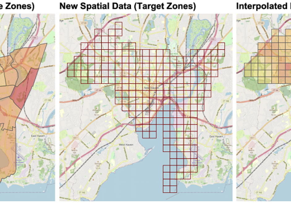
Areal interpolation is the process of transforming spatial data from source zones with known values or attributes to target zones with unknown attributes. It generates estimates of source zone attributes over target zone areas. It aligns areal spatial data attributes over a single spatial framework (target zones) to overcome differences in areal reporting units due to historical boundary changes of reporting areas, integrating data from domains with different reporting conventions or in situations when spatially detailed information is not available. Fundamentally, it requires assumptions about how the target zone attribute relates to the source zones. Areal interpolation approaches can be grouped into two broad categories: methods that link target and source zones by their spatial properties (area to point, pycnophylactic and areal weighed interpolation) and methods that use ancillary or auxiliary information to control, inform, guide, and constrain the interpolation process (dasymetric, statistical, streetweighted and point-based interpolation). Additionally, there are new opportunities to use novel data sources to inform areal interpolation arising from the many new forms of spatial data supported by ubiquitous web- and GPS-enabled technologies including social media, PoI check-ins, spatial data portals (e.g for crime, house sales, microblogging sites) and collaborative mapping activities (e.g. OpenStreetMap).

AM-93 - Artificial Intelligence Approaches

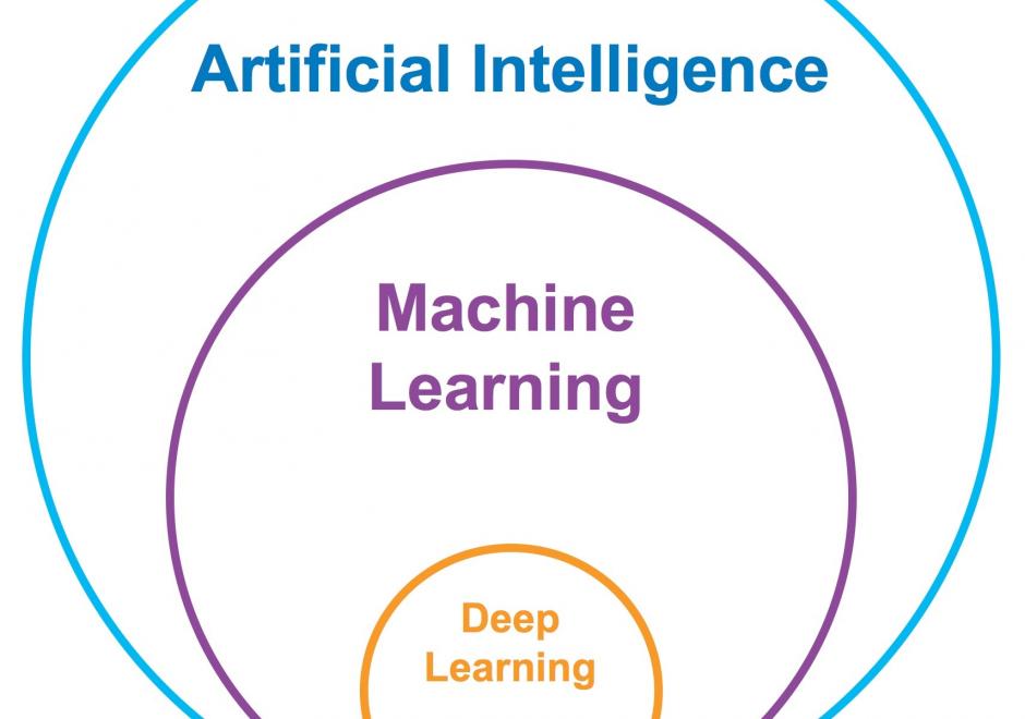
Artificial Intelligence (AI) has received tremendous attention from academia, industry, and the general public in recent years. The integration of geography and AI, or GeoAI, provides novel approaches for addressing a variety of problems in the natural environment and our human society. This entry briefly reviews the recent development of AI with a focus on machine learning and deep learning approaches. We discuss the integration of AI with geography and particularly geographic information science, and present a number of GeoAI applications and possible future directions.

AM-03 - Buffers

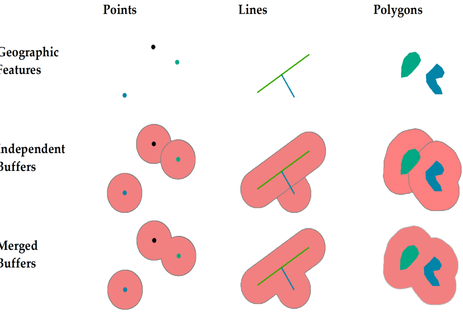
This short article introduces the definition of buffer and explains how buffers are created for single or multiple geographic features of different geometric types. It also discusses how buffers are generated differently in vector and raster data models and based on the concept of cost.

AM-64 - Calculating surface derivatives
  • List the likely sources of error in slope and aspect maps derived from digital elevation models (DEMs) and state the circumstances under which these can be very severe
  • Outline how higher order derivatives of height can be interpreted
  • Explain how slope and aspect can be represented as the vector field given by the first derivative of height
  • Explain why the properties of spatial continuity are characteristic of spatial surfaces
  • Explain why zero slopes are indicative of surface specific points such as peaks, pits, and passes, and list the conditions necessary for each
  • Design an algorithm that calculates slope and aspect from a triangulated irregular network (TIN) model
  • Outline a number of different methods for calculating slope from a DEM
AM-80 - Capturing Spatiotemporal Dynamics in Computational Modeling

We live in a dynamic world that includes various types of changes at different locations over time in natural environments as well as in human societies. Modern sensing technology, location-aware technology and mobile technology have made it feasible to collect spatiotemporal tracking data at a high spatial and temporal granularity and at affordable costs. Coupled with powerful information and communication technologies, we now have much better data and computing platforms to pursue computational modeling of spatiotemporal dynamics. Researchers have attempted to better understand various kinds of spatiotemporal dynamics in order to predict, or even control, future changes of certain phenomena. A simple approach to representing spatiotemporal dynamics is by adding time (t) to the spatial dimensions (x,y,z) of each feature. However, spatiotemporal dynamics in the real world are more complex than a simple representation of (x,y,z,t) that describes the location of a feature at a given time. This article presents selected concepts, computational modeling approaches, and sample applications that provide a foundation to computational modeling of spatiotemporal dynamics. We also indicate why the research of spatiotemporal dynamics is important to geographic information systems (GIS) and geographic information science (GIScience), especially from a temporal GIS perspective.

AM-12 - Cartographic Modeling

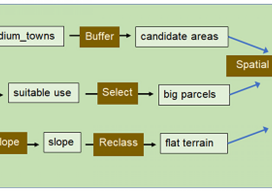
Cartographic modeling is an integrated sequence of data processing tasks that organize, combine, analyze and display information to answer a question. Cartographic modeling is effective in GIS environments because they rely heavily upon visualization, making it easy to show input and output layers in map form. In many GIS platforms, the sequence of tasks can be created and modified graphically as well. The modeling is visual, intuitive, and requires some knowledge of GIS commands and data preparation, along with curiosity to answer a particular question about the environment. It does not require programming skill. Cartographic modeling has been used in applications to delineate habitats, to solve network routing problems, to assess risk of storm runoff across digital terrain, and to conserve fragile landscapes. Historical roots emphasize manual and later automated map overlay. Cartographic models can take three forms (descriptive, prescriptive and normative). Stages in cartographic modeling identify criteria that meet an overarching goal; collect data describing each criterion in map form; design a flowchart showing data, GIS operations and parameters; implement the model; and evaluate the solution. A scenario to find a suitable site for biogas energy production walks through each stage in a simple demonstration of mechanics.

AM-69 - Cellular Automata

Cellular automata (CA) are simple models that can simulate complex processes in both space and time. A CA consists of six defining components: a framework, cells, a neighborhood, rules, initial conditions, and an update sequence. CA models are simple, nominally deterministic yet capable of showing phase changes and emergence, map easily onto the data structures used in geographic information systems, and are easy to implement and understand. This has contributed to their popularity for applications such as measuring land use changes and monitoring disease spread, among many others.

AM-09 - Classification and Clustering

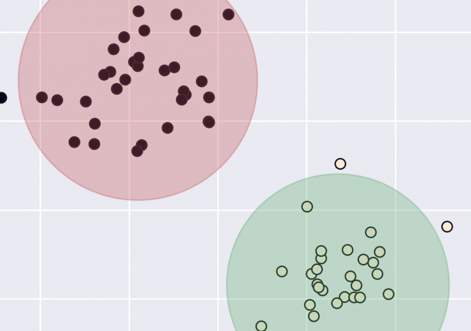
Classification and clustering are often confused with each other, or used interchangeably. Clustering and classification are distinguished by whether the number and type of classes are known beforehand (classification), or if they are learned from the data (clustering). The overarching goal of classification and clustering is to place observations into groups that share similar characteristics while maximizing the separation of the groups that are dissimilar to each other. Clusters are found in environmental and social applications, and classification is a common way of organizing information. Both are used in many areas of GIS including spatial cluster detection, remote sensing classification, cartography, and spatial analysis. Cartographic classification methods present a simplified way to examine some classification and clustering methods, and these will be explored in more depth with example applications.

Pages