
CP-23 - Google Earth Engine

Google Earth Engine (GEE) is a cloud-based platform for planetary scale geospatial data analysis and communication. By placing more than 17 petabytes of earth science data and the tools needed to access, filter, perform, and export analyses in the same easy to use application, users are able to explore and scale up analyses in both space and time without any of the hassles traditionally encountered with big data analysis. Constant development and refinement have propelled GEE into one of the most advanced and accessible cloud-based geospatial analysis platforms available, and the near real time data ingestion and interface flexibility means users can go from observation to presentation in a single window.
")

")


DA-08 - GIS&T and Archaeology
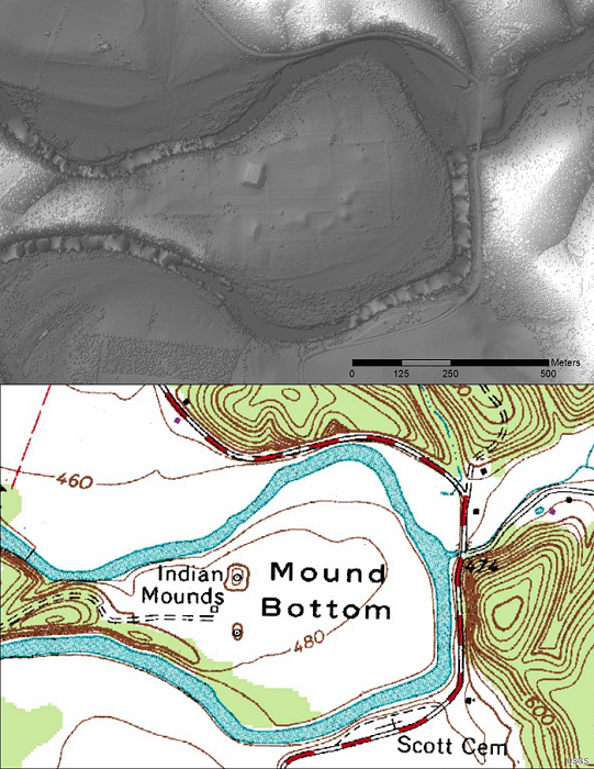
Figure 1. USGS topo map and bare earth (LiDAR) image of Tennessee’s Mound Bottom State Archaeological Area. Bare Earth DEM processed by Zada Law.
Archaeology provides a glimpse into the lives of past peoples and histories that may have otherwise been forgotten. Geographic Information Systems and Technology (GIS&T) has become an invaluable tool in this endeavor by advancing the identification, documentation, and study of archaeological resources. Large scale mapping techniques have increased the efficiency of site surveys even in challenging environments. GIS&T refers to such things as remote sensing, spatial analysis, and mapping tools. The use of GIS&T for archaeology is a truly interdisciplinary field as it borrows principles from geology, oceanography, botany, meteorology and more in order to further the science. This chapter discusses some of the primary GIS&T tools and techniques used in archaeology and the primary ways in which they are applied.