All Topics

A B C D E F G H I J K L M N O P R S T U V W
KE-27 - Value of Professional Geospatial Organizations

There are a great many professional associations in the geospatial sector.  They provide a great deal of value to the geospatial community and professionals working in that community.  The value can be described in terms of professional development, technological and organizational advancement, advocacy, governance, and leadership.  The following text explains the various ways in which professional associations provide value to the community.

CV-03 - Vector Formats and Sources
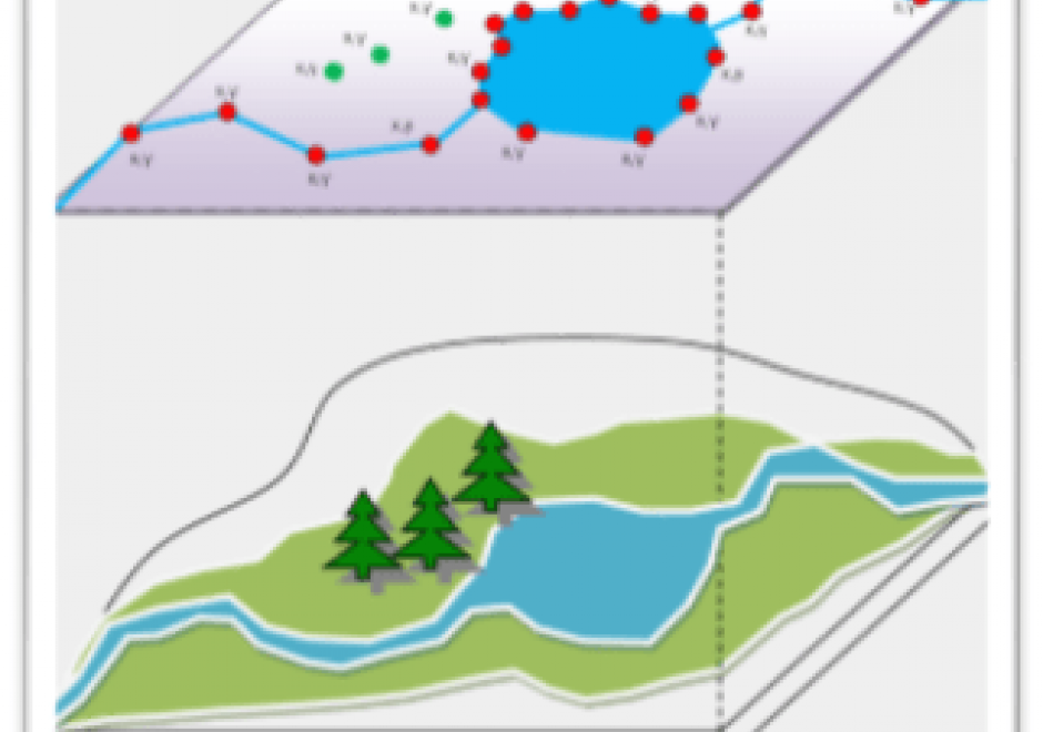
In the last ten years, the rise of efficient computing devices with significant processing power and storage has caused a surge in digital data collection and publication. As more software programs and hardware devices are released, we are not only seeing an increase in available data, but also an increase in available data formats. Cartographers today have access to a wide range of interesting datasets, and online portals for downloading geospatial data now frequently offer that data in several different formats. This chapter provides information useful to modern cartographers working with vector data, including an overview of common vector data formats (e.g. shapefile, GeoJSON, file geodatabase); their relative benefits, idiosyncrasies, and limitations; and a list of popular sources for geospatial vector data (e.g. United States Census Bureau, university data warehouses).

DM-51 - Vertical (Geopotential) Datums

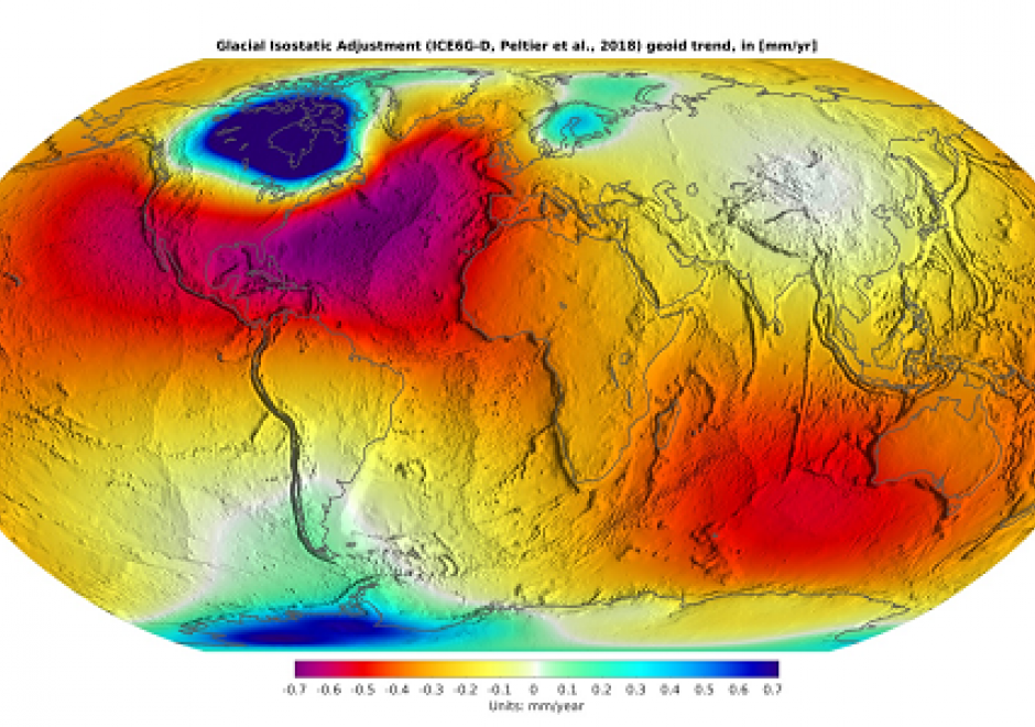
The elevation of a point requires a reference surface defining zero elevation. In geodesy, this zero-reference surface has historically been mean sea level (MSL) – a vertical datum. However, the geoid, which is a particular equipotential surface of Earth’s gravity field that would coincide with mean sea level were mean sea level altogether unperturbed and placid, is the ideal datum for physical heights, meaning height associated with the flow of water, like elevations. Tidal, gravimetric, and ellipsoidal are common vertical datums that use different approaches to define the reference surface. Tidal datums average water heights over a period of approximately 19 years, gravimetric datums record gravity across Earth’s surface, and ellipsoidal datums use specific reference ellipsoids to report ellipsoid heights. Increasingly, gravity measurements, positional data from GNSS (Global Navigation Satellite System), and other sophisticated measurement technologies GRACE-FO (Gravity Recovery and Climate Experiment – Follow On) are sourced to accurately model the geoid and its geopotential surface advancing the idea of a geopotential datum. Stemming from these advancements, a new geopotential datum for the United States will be developed: North American-Pacific Geopotential Datum 2022 (NAPGD2022).

CV-16 - Virtual and Immersive Environments

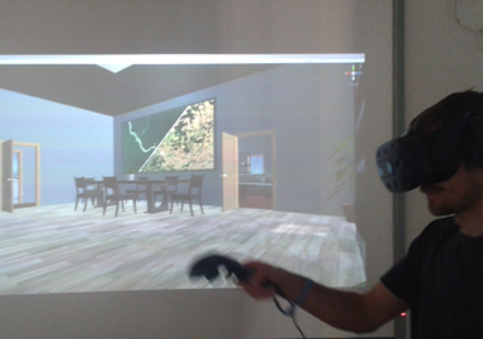
A virtual environment (VE) is a 3D computer-based simulation of a real or imagined environment in which users can navigate and interactive with virtual objects. VEs have found popular use in communicating geographic information for a variety of domain applications. This entry begins with a brief history of virtual and immersive environments and an introduction to a common framework used to describe characteristics of VEs. Four design considerations for VEs then are reviewed: cognitive, methodological, social, and technological. The cognitive dimension involves generating a strong sense of presence for users in a VE, enabling users to perceive and study represented data in both virtual and real environments. The methodological dimension covers methods in collecting, processing, and visualizing data for VEs. The technological dimension surveys different VE hardware devices (input, computing, and output devices) and software tools (desktop and web technologies). Finally, the social dimension captures existing use cases for VEs in geo-related fields, such as geography education, spatial decision support, and crisis management.

PD-28 - Visual Programming for GIS Applications

Visual programming languages (VPLs) in GIS applications are used to design the automatic processing of spatial data in an easy visual form. The resulted visual workflow is useful when the same processing steps need to be repeated on different spatial data (e.g. other areas, another period). In the case of visual programming languages, simple graphical symbols represent spatial operations implemented in GIS software (tools, geoalgorithms). Users can create a sequence of operation in a simple visual form, like a chain of graphical symbols. Visual programs can be stored and reused. The graphical form is useful to non-programmers who are not familiar with a textual programming language, as is the case with many professionals such as urban planners, facility managers, ecologists and other users of GIS. VPLs are implemented not only in GIS applications but also in remote sensing (RS) applications. Sometimes both types of applications are bundled together in one geospatial application that offers geoalgorithms in a shared VPL environment. Visual programming languages are an integral part of software engineering (SE). Data flow and workflow diagrams are one of the oldest graphical representations in informatics.

DC-29 - Volunteered Geographic Information

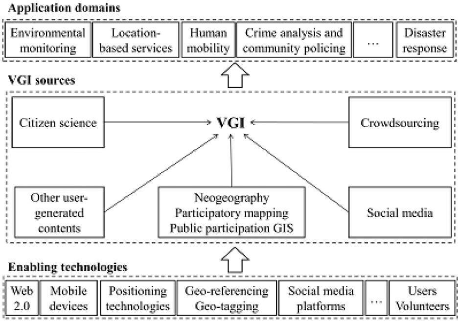
Volunteered geographic information (VGI) refers to geo-referenced data created by citizen volunteers. VGI has proliferated in recent years due to the advancement of technologies that enable the public to contribute geographic data. VGI is not only an innovative mechanism for geographic data production and sharing, but also may greatly influence GIScience and geography and its relationship to society. Despite the advantages of VGI, VGI data quality is under constant scrutiny as quality assessment is the basis for users to evaluate its fitness for using it in applications. Several general approaches have been proposed to assure VGI data quality but only a few methods have been developed to tackle VGI biases. Analytical methods that can accommodate the imperfect representativeness and biases in VGI are much needed for inferential use where the underlying phenomena of interest are inferred from a sample of VGI observations. VGI use for inference and modeling adds much value to VGI. Therefore, addressing the issue of representativeness and VGI biases is important to fulfill VGI’s potential. Privacy and security are also important issues. Although VGI has been used in many domains, more research is desirable to address the fundamental intellectual and scholarly needs that persist in the field.