All Topics

A B C D E F G H I J K L M N O P R S T U V W
AM-38 - Pattern Recognition and Matching

People recognize and characterize patterns to understand the world. Spatial data exhibit distinctive characteristics that render most aspatial recognition and matching methods unsuitable or inefficient. In past decades, a plethora of methods have been developed for spatial pattern recognition and matching to account for these spatial characteristics. This entry first focuses on the methods of spatial pattern recognition, including an overview of the basic concepts and common  types. Methods for spatial pattern matching are then introduced. An example scenario of the distribution of tree species in the Arbuckle Mountains of south-central Oklahoma illustrates covered concepts. The entry concludes with brief remarks on continuing challenges and future directions in spatial pattern recognition and matching in the Big Data and artificial intelligence era.

FC-04 - Perception and Cognitive Processing of Geographic Phenomena: a Choropleth Map Case Study

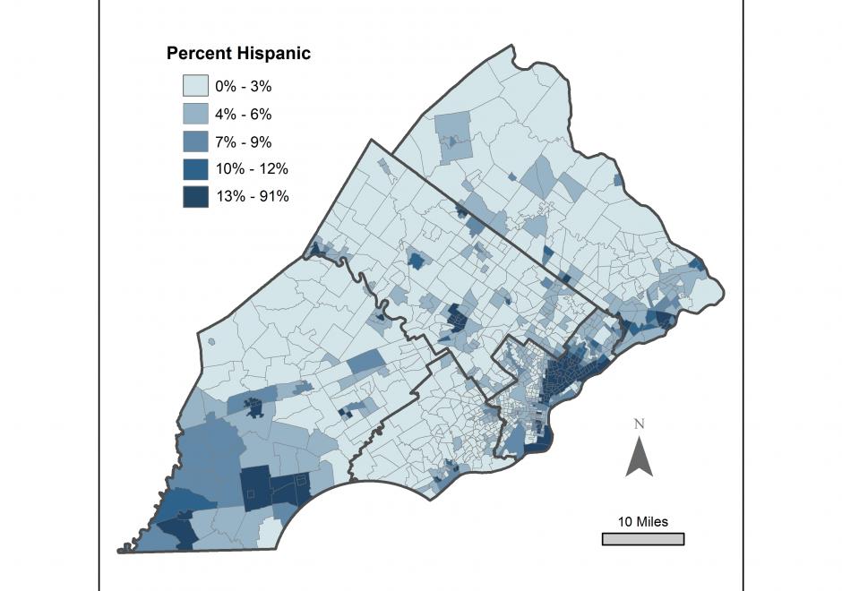
The near ubiquity of maps has created a population the is well adept at reading and understanding maps.  But, while maps are familiar, understanding how the human brain processes that information is less known.  Discussing the processing of geographic phenomena could take different avenues: specific geospatial thinking skills, general perception and cognition processes, or even different parts of the human brain that are invoked when thinking geographically.  This entry focuses on tracing the processing of geographic phenomena using a choropleth map case study, beginning from perception — the moment the phenomena enter the human brain via our senses, to cognition — how meaning and understanding are generated. 

FC-03 - Philosophical Perspectives

This entry follows in the footsteps of Anselin’s famous 1989 NCGIA working paper entitled “What is special about spatial?” (a report that is very timely again in an age when non-spatial data scientists are ignorant of the special characteristics of spatial data), where he outlines three unrelated but fundamental characteristics of spatial data. In a similar vein, I am going to discuss some philosophical perspectives that are internally unrelated to each other and could warrant individual entries in this Body of Knowledge. The first one is the notions of space and time and how they have evolved in philosophical discourse over the past three millennia. Related to these are aspects of absolute versus relative conceptions of these two fundamental constructs. The second is a brief introduction to key philosophical approaches and how they impact geospatial science and technology use today. The third is a discussion of which of the promises of the Quantitative Revolution in Geography and neighboring disciplines have been fulfilled by GIScience (and what is still missing). The fourth and final one is an introduction to the role that GIScience may play in what has recently been formalized as theory-guided data science.

DM-36 - Physical Data Models

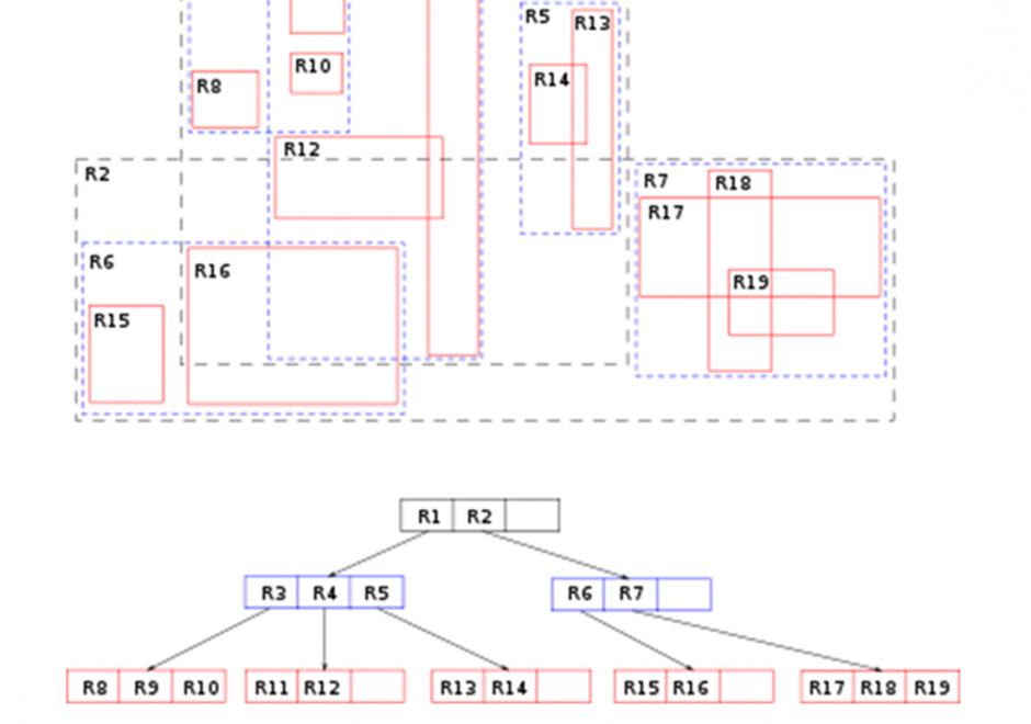
Constructs within a particular implementation of database management software guide the development of a physical data model, which is a product of a physical database design process. A physical data model documents how data are to be stored and accessed on storage media of computer hardware.  A physical data model is dependent on specific data types and indexing mechanisms used within database management system software.  Data types such as integers, reals, character strings, plus many others can lead to different storage structures. Indexing mechanisms such as region-trees and hash functions and others lead to differences in access performance.  Physical data modeling choices about data types and indexing mechanisms related to storage structures refine details of a physical database design. Data types associated with field, record and file storage structures together with the access mechanisms to those structures foster (constrain) performance of a database design. Since all software runs using an operating system, field, record, and file storage structures must be translated into operating system constructs to be implemented.  As such, all storage structures are contingent on the operating system and particular hardware that host data management software. 

AM-07 - Point Pattern Analysis

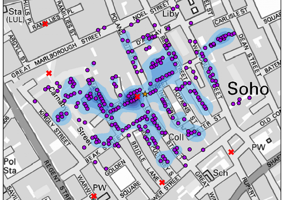
Point pattern analysis (PPA) focuses on the analysis, modeling, visualization, and interpretation of point data. With the increasing availability of big geo-data, such as mobile phone records and social media check-ins, more and more individual-level point data are generated daily. PPA provides an effective approach to analyzing the distribution of such data. This entry provides an overview of commonly used methods in PPA, as well as demonstrates the utility of these methods for scientific investigation based on a classic case study: the 1854 cholera outbreaks in London.

DM-85 - Point, Line, and Area Generalization

Generalization is an important and unavoidable part of making maps because geographic features cannot be represented on a map without undergoing transformation. Maps abstract and portray features using vector (i.e. points, lines and polygons) and raster (i.e pixels) spatial primitives which are usually labeled. These spatial primitives are subjected to further generalization when map scale is changed. Generalization is a contradictory process. On one hand, it alters the look and feel of a map to improve overall user experience especially regarding map reading and interpretive analysis. On the other hand, generalization has documented quality implications and can sacrifice feature detail, dimensions, positions or topological relationships. A variety of techniques are used in generalization and these include selection, simplification, displacement, exaggeration and classification. The techniques are automated through computer algorithms such as Douglas-Peucker and Visvalingam-Whyatt in order to enhance their operational efficiency and create consistent generalization results. As maps are now created easily and quickly, and used widely by both experts and non-experts owing to major advances in IT, it is increasingly important for virtually everyone to appreciate the circumstances, techniques and outcomes of generalizing maps. This is critical to promoting better map design and production as well as socially appropriate uses.

FC-26 - Problems of Scale and Zoning

Spatial data are often encoded within a set of spatial units that exhaustively partition a region, where individual level data are aggregated, or continuous data are summarized, over a set of spatial units. Such is the case with census data aggregated to enumeration units for public dissemination. Partitioning schemes can vary by scale, where one partitioning scheme spatially nests within another, or by zoning, where two partitioning schemes have the same number of units but the unit shapes and boundaries differ. The Modifiable Areal Unit Problem (MAUP) refers to the fact the nature of spatial partitioning can affect the interpretation and results of visualization and statistical analysis. Generally, coarser scales of data aggregation tend to have stronger observed statistical associations among variables. The ecological fallacy refers to the assumption that an individual has the same attributes as the aggregate group to which it belongs. Combining spatial data with different partitioning schemes to facilitate analysis is often problematic. Areal interpolation may be used to estimate data over small areas or ecological inference may be used to infer individual behaviors from aggregate data. Researchers may also perform analyses at multiple scales as a point of comparison.

GS-11 - Professional and Practical Ethics of GIS&T

Geospatial technologies are often and rightly described as “powerful.” With power comes the ability to cause harm – intentionally or unintentionally - as well as to do good. In the context of GIS&T, Practical Ethics is the set of knowledge, skills and abilities needed to make reasoned decisions in light of the risks posed by geospatial technologies and methods in a wide variety of use cases. Ethics have been considered from different viewpoints in the GIS&T field. A practitioner's perspective may be based on a combination of "ordinary morality," institutional ethics policies, and professional ethics codes. By contrast, an academic scholar's perspective may be grounded in social or critical theory. What these perspectives have in common is reliance on reason to respond with integrity to ethical challenges. This entry focuses on the special obligations of GIS professionals, and on a method that educators can use to help students develop moral reasoning skills that GIS professionals need. The important related issues of Critical GIS and Spatial Law and Policy are to be considered elsewhere.  

KE-31 - Professional Certification

Professional Certification has been a part of the GIS enterprise for over two decades. There are several different certification programs and related activities now in operation within GIS, though there has been much debate over its merits, how it should be done and by whom. 

DC-01 - Professional Land Surveying

Professional Land Surveyors are the only profession that create the legal description of land parcels, which are then officially recorded to show ownership and rights pertaining to each and every land parcel within a jurisdiction. The Surveyor is skilled at undertaking the physical measurements that are needed to locate accurately land parcels on the ground and to write the unambiguous legal description of the land to create legal title in real estate. These land ownership records are critical for the transfer of ownership in the real estate market. The legal land description provided by Surveyors forms the foundation, and the real estate market provides the mechanism, for real estate to become the largest store of tangible wealth in any free market economy.

Pages