AM-78 - Genetic Algorithms and Evolutionary Computing
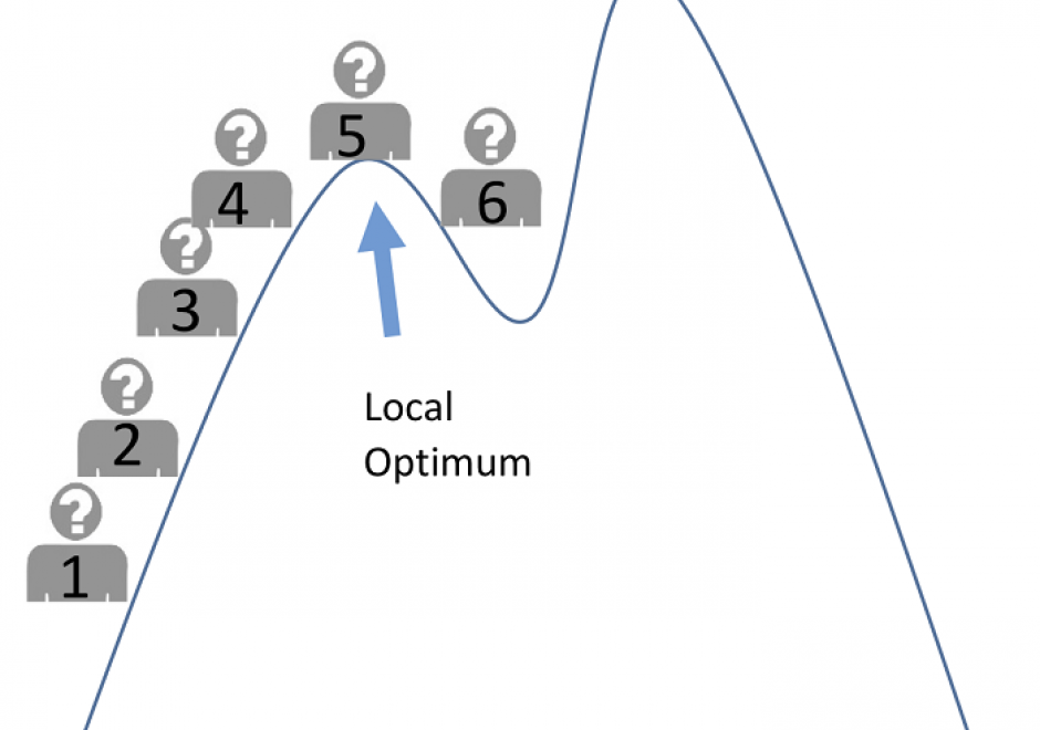
Genetic algorithms (GAs) are a family of search methods that have been shown to be effective in finding optimal or near-optimal solutions to a wide range of optimization problems. A GA maintains a population of solutions to the problem being solved and uses crossover, mutation, and selection operations to iteratively modify them. As the population evolves across generations, better solutions are created and inferior ones are selectively discarded. GAs usually run for a fixed number of iterations (generations) or until further improvements do not obtain. This contribution discusses the fundamental principles of genetic algorithms and uses Python code to illustrate how GAs can be developed for both numerical and spatial optimization problems. Computational experiments are used to demonstrate the effectiveness of GAs and to illustrate some nuances in GA design.




PD-33 - GDAL/OGR and Geospatial Data IO Libraries
Manipulating (e.g., reading, writing, and processing) geospatial data, the first step in geospatial analysis tasks, is a complicated step, especially given the diverse types and formats of geospatial data combined with diverse spatial reference systems. Geospatial data Input/Output (IO) libraries help facilitate this step by handling some technical details of the IO process. GDAL/OGR is the most widely-used, broadly-supported, and constantly-updated free library among existing geospatial data IO libraries. GDAL/OGR provides a single raster abstract data model and a single vector abstract data model for processing and analyzing raster and vector geospatial data, respectively, and it supports most, if not all, commonly-used geospatial data formats. GDAL/OGR can also perform both cartographic projections on large scales and coordinate transformation for most of the spatial reference systems used in practice. This entry provides an overview of GDAL/OGR, including why we need such a geospatial data IO library and how it can be applied to various formats of geospatial data to support geospatial analysis tasks. Alternative geospatial data IO libraries are also introduced briefly. Future directions of development for GDAL/OGR and other geospatial data IO libraries in the age of big data and cloud computing are discussed as an epilogue to this entry.