All Topics

A B C D E F G H I J K L M N O P R S T U V W
FC-31 - Academic Developments of GIS&T in English-speaking Countries: a Partial History

The constellation of science and technology that is now considered a unit (Geographic Information Science and Technology – GIS&T) has emerged from many source disciplines through many divergent and convergent pasts in different times and places. This narrative limits itself to the perspective of the English-speaking community, leaving other regions for a separate chapter As in the case of many technical developments in the second half of the twentieth century, academic institutions played a key (though far from exclusive) role in innovation and risk-taking. In a number of locations, academic innovators tried out new technology for handling geographic information, beginning as early as the 1960s. Three institutions (University of Washington, Laboratory for Computer Graphics – Harvard University, and Experimental Cartography Unit – Royal College of Art (UK)) deserve particular treatment as examples of the early innovation process. Their innovations may look crude by current standards, but they laid some groundwork for later developments. Academic institutions played a key role in innovation over the past decades, but the positioning of that role has shifted as first government, then commercial sectors have taken the lead in certain aspects of GIS&T. Current pressures on the academic sector may act to reduce this role.

DC-10 - Aerial Photography: History and Georeferencing

In 1903, Julius Neubranner, a photography enthusiast, designed and patented a breast-mounted aerial camera for carrier pigeons. Weighing only 70 grams, the camera took automatic exposures at 30-second intervals along the flight line flown by the bird. Although faster than balloons, they were not always reliable in following their flight paths. Today the pigeon corps has been replaced by unmanned aerial vehicles, but aerial photography continues to be an important source of data for use in a wide range of geospatial applications. Processing of the imagery to remove various types of distortion is a necessary step before the images can be georeferenced and used for mapping purposes. 

AM-79 - Agent-based Modeling

Agent-based models are dynamic simulation models that provide insight into complex geographic systems. Individuals are represented as agents that are encoded with goal-seeking objectives and decision-making behaviors to facilitate their movement through or changes to their surrounding environment. The collection of localized interactions amongst agents and their environment over time leads to emergent system-level spatial patterns. In this sense, agent-based models belong to a class of bottom-up simulation models that focus on how processes unfold over time in ways that produce interesting, and at times surprising, patterns that we observe in the real world.

GS-20 - Aggregation of Spatial Entities and Legislative Redistricting

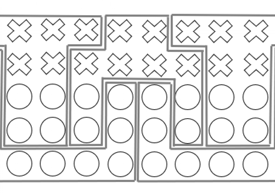
The partitioning of space is an essential consideration for the efficient allocation of resources. In the United States and many other countries, this parcelization of sub-regions for political and legislative purposes results in what is referred to as districts. A district is an aggregation of smaller, spatially bound units, along with their statistical properties, into larger spatially-bound units. When a district has the primary purpose of representation, individuals who reside within that district make up a constituency. Redistricting is often required as populations of constituents shift over time or resources that service areas change. Administrative challenges with creating districts have been greatly aided by increasing utilization of GIS. However, with these advances in geospatial methods, political disputes with the way in which districts increasingly snare the process in legal battles often centered on the topic of gerrymandering. This chapter focuses on the redistricting process within the United States and how the aggregation of representative spatial entities presents a mix of political, technical and legal challenges.

AM-97 - An Introduction to Spatial Data Mining

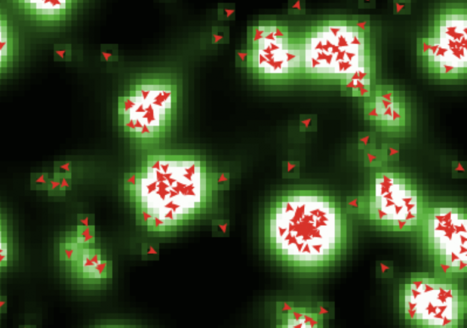
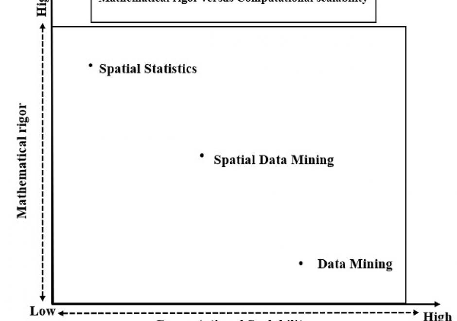
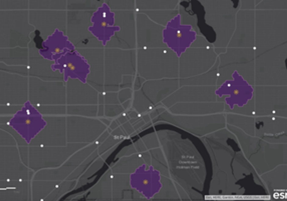
The goal of spatial data mining is to discover potentially useful, interesting, and non-trivial patterns from spatial data-sets (e.g., GPS trajectory of smartphones). Spatial data mining is societally important having applications in public health, public safety, climate science, etc. For example, in epidemiology, spatial data mining helps to nd areas with a high concentration of disease incidents to manage disease outbreaks. Computational methods are needed to discover spatial patterns since the volume and velocity of spatial data exceed the ability of human experts to analyze it. Spatial data has unique characteristics like spatial autocorrelation and spatial heterogeneity which violate the i.i.d (Independent and Identically Distributed) assumption of traditional statistic and data mining methods. Therefore, using traditional methods may miss patterns or may yield spurious patterns, which are costly in societal applications. Further, there are additional challenges such as MAUP (Modiable Areal Unit Problem) as illustrated by a recent court case debating gerrymandering in elections. In this article, we discuss tools and computational methods of spatial data mining, focusing on the primary spatial pattern families: hotspot detection, collocation detection, spatial prediction, and spatial outlier detection. Hotspot detection methods use domain information to accurately model more active and high-density areas. Collocation detection methods find objects whose instances are in proximity to each other in a location. Spatial prediction approaches explicitly model the neighborhood relationship of locations to predict target variables from input features. Finally, spatial outlier detection methods find data that differ from their neighbors. Lastly, we describe future research and trends in spatial data mining.

CP-24 - ArcGIS Online

ArcGIS Online is a hosted geographic information system (GIS) created and hosted by Environmental Systems Research Institute (Esri). In a few short years, it has eclipsed desktop software as the most popular tool for mapping and spatial analysis. ArcGIS Online is more than a traditional GIS software in that it also includes access to a wide range of authoritative datasets. ArcGIS fits into the Web 2.0 model where users of the platform are able to create and share maps.

AM-40 - Areal Interpolation

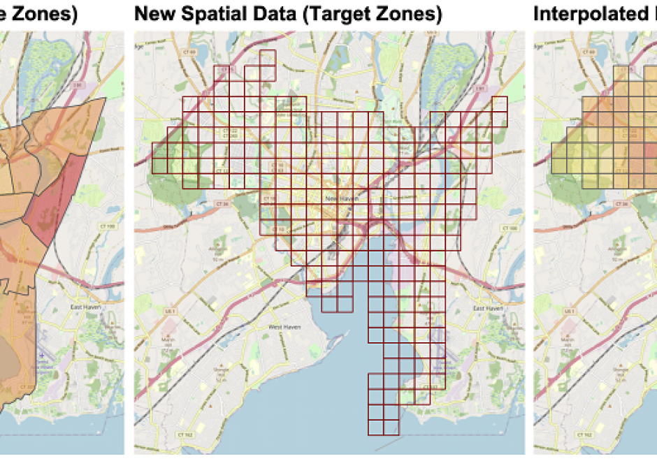
Areal interpolation is the process of transforming spatial data from source zones with known values or attributes to target zones with unknown attributes. It generates estimates of source zone attributes over target zone areas. It aligns areal spatial data attributes over a single spatial framework (target zones) to overcome differences in areal reporting units due to historical boundary changes of reporting areas, integrating data from domains with different reporting conventions or in situations when spatially detailed information is not available. Fundamentally, it requires assumptions about how the target zone attribute relates to the source zones. Areal interpolation approaches can be grouped into two broad categories: methods that link target and source zones by their spatial properties (area to point, pycnophylactic and areal weighed interpolation) and methods that use ancillary or auxiliary information to control, inform, guide, and constrain the interpolation process (dasymetric, statistical, streetweighted and point-based interpolation). Additionally, there are new opportunities to use novel data sources to inform areal interpolation arising from the many new forms of spatial data supported by ubiquitous web- and GPS-enabled technologies including social media, PoI check-ins, spatial data portals (e.g for crime, house sales, microblogging sites) and collaborative mapping activities (e.g. OpenStreetMap).

DM-81 - Array Databases

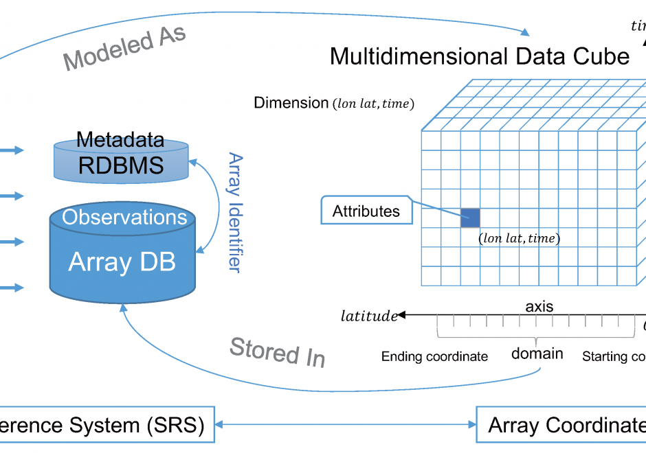
Array Databases are a class of No-SQL databases that store, manage, and analyze data whose natural structures are arrays. With the growth of large volumes of spatial data (i.e., satellite imagery) there is a pressing need to have new ways to store and manipulate array data. Currently, there are several databases and platforms that have extended their initial architectures to support for multidimensional arrays. However, extending a platform to support a multidimensional array comes at a performance cost, when compared to Array Databases who specialize in the storage, retrieval, and processing of n-dimensional data.

AM-93 - Artificial Intelligence Approaches

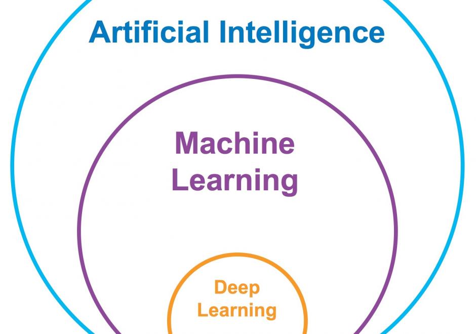
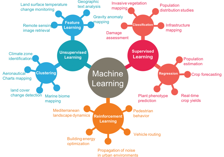
Artificial Intelligence (AI) has received tremendous attention from academia, industry, and the general public in recent years. The integration of geography and AI, or GeoAI, provides novel approaches for addressing a variety of problems in the natural environment and our human society. This entry briefly reviews the recent development of AI with a focus on machine learning and deep learning approaches. We discuss the integration of AI with geography and particularly geographic information science, and present a number of GeoAI applications and possible future directions.

CP-04 - Artificial Intelligence Tools and Platforms for GIS

Artificial intelligence is the study of intelligence agents as demonstrated by machines. It is an interdisciplinary field involving computer science as well as, various kinds of engineering and science, for example, robotics, bio-medical engineering, that accentuates automation of human acts and intelligence through machines. AI represents state-of-the-art use of machines to bring about algorithmic computation and understanding of tasks that include learning, problem solving, mapping, perception, and reasoning. Given the data and a description of its properties and relations between objects of interest, AI methods can perform the aforementioned tasks. Widely applied AI capabilities, e.g. learning, are now achievable at large scale through machine learning (ML), large volumes of data and specialized computational machines. ML encompasses learning without any kind of supervision (unsupervised learning) and learning with full supervision (supervised learning). Widely applied supervised learning techniques include deep learning and other machine learning methods that require less data than deep learning e.g. support vector machines, random forests. Unsupervised learning examples include dictionary learning, independent component analysis, and autoencoders. For application tasks with less labeled data, both supervised and unsupervised techniques can be adapted in a semi-supervised manner to produce accurate models and to increase the size of the labeled training data.